
Hydrography for any maritime nation is vital for a blue water economy and covers the needs for safe navigation for shipping, defense operations, offshore development for ports, communications, exploration for oil, gas & minerals and supports food security, development of marine sciences, maritime boundary delineation, marine environmental protection and onshore and offshore employment potential. The responsibility for national hydrography in the Kingdom of Saudi Arabia was allocated to the General Commission for Survey (GCS) through a Saudi Cabinet decision and formulation of a ten year national strategic and perspective plan (SPP) in 2011. The SPP objectives require hydrographic programs for the survey of the entire Saudi Marine Areas (SMAs) and the production of Marine Geospatial Products and Services (including the nautical charts under the IMO and IHO regulations). With reasonable funding provided, GCS hydrographic programs are progressing well to achieve the SPP objectives within a reasonably short period.
The GCS needed to accelerate hydrographic surveys due to the vintage source data found in the existing charts and the stringent international regulations for improving safety of shipping under current UN/IMO/IHO regulations. Barring some ports, surveys date back 30 to 62 years in most of the SMAs. The GCS’ SPP includes 100% insonified hydrographic surveys within the SMAs by 2020 with charting products published conforming to IHO charting standards S-4 and S-57/S-100. The nautical charting scheme will provide chart products at various scales to meet stakeholders need. GCS will also develop as an organization and undertake other activities necessary for a credible national hydrographic service to function and serve.
Hydrographic capacity building is one of the major strategic objectives in the SPP. Activities include a ‘Hydrographic Training Centre’ at Jeddah with its own training assets, ocean-going hydrographic survey vessel (HSV), coastal hydrographic survey launches (HSLs) and contemporary equipment/systems with associated software for data collection and post processing of hydrographic and related marine sciences data. The GCS has trained 24 Hydrographers and Nautical Cartographers in each specialization with recognition to Category “B” in accordance with the FIG/IHO/ICA International Board on Standards of Competence.
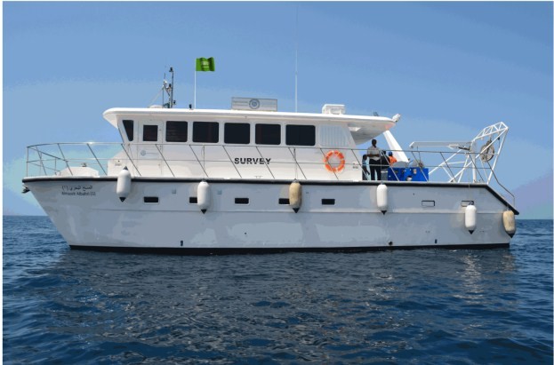
One 43.7 meter HSV (with two integral HSLs) (Figure 1) used for 3D surveying and one 16 meter HSL (Figure 2) used for training and coastal surveys within the SMAs, are already operational. Plans are under-way to construct one more HSV and 6 more HSLs to augment survey capacity in different coastal areas. A bathymetric and topographic-capable LiDAR system, along with an aerial camera, mounted on a suitable airborne platform is also being considered to further enhance survey capacity in coastal areas.

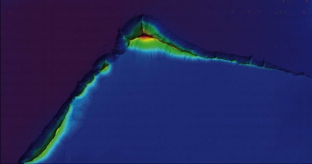
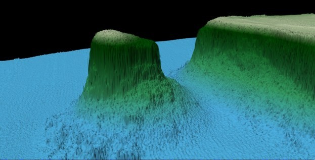
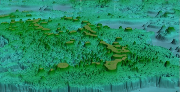
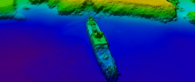
Survey activities in the Red Sea, the Gulf of Aqaba and the Gulf Region, SMAs include 100% seabed insonified hydrographic surveys, use of bathymetric and topographic LiDARs, hyper spectral imager, side scan sonar (SSS), multi-beam echo sounder (MBES), sub-bottom profiler, automatic tide gauges and acoustic doppler current profiler (both onshore and offshore) equipment. The surveys are being undertaken by outsourced agencies as well as GCS resources on a scale of 1:25,000 for coastal areas and at larger scales for ports and harbors. These hydrographic surveys have revealed considerable changes to the existing vintage chart depictions, in the form of changes in bathymetry/contours, location of wrecks/obstructions, coral reefs, stunning geomorphological features and changes to the ports and shore infrastructure information (Figures 3-6).
Based on the results of these surveys, chart compilation and maintenance tasks (ENCs and PNCs – 106 each) are being progressively done in-house by the Saudi marine cartographers under expert supervision. Over the past five years, 40% of the near coast SMAs have been surveyed and 35% of the planned charts have been produced (Figure 7). The establishment of the Marine Safety Information and nautical publications sections within the GCS, and the distribution of the verified chart products (ENCs and PNCs) through an established RENC under IHO regulations, are under active consideration for implementation in 2016.

Based on experience gained so far and the GCS organization structure being established, there will be a significant increase in the charting deliverables from 2016. It is hoped that the entire SMAs will be covered by 100% seabed insonified hydrographic surveys and associated nautical charts (ENC and paper) meeting IHO S-4, S-57/ S-100 standards by 2020, subject to continued annual funding by the Government of Saudi Arabia.
Another important product from the survey results is the development of the electronic coastal management zone charts (CZMCs – total 160) at a scale of 1:25,000 for non-navigational purposes for stakeholders within the Kingdom, through the use of additional layers. With this wealth of information, there is increasing interest in this spatial data and products by stakeholders. This scheme is planned to be augmented with additional layers for CZM, tourism, fisheries, defense, offshore cables, pipelines, environmentally sensitive marine areas, marine sciences, etc.
The hydrographic program comprises:
- Hydrographic survey projects (HSPs) undertaken by GCS hydrographic surveyors and outsourced agencies.
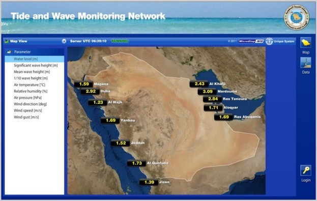
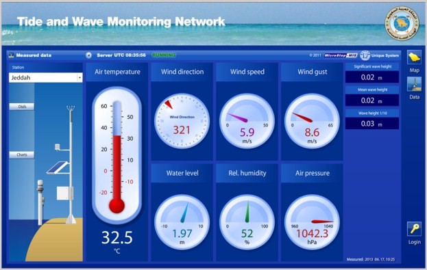
- The National Tide Gauge Network (NTGN 1) with 12 stations (Figure 8).
- Two Marine Sciences Data Buoys (MSDBs).
- Hydrographic Data Management System for the vast amount of spatial data (more than 150 TB of raw data and more than 30 TB of processed data so far).
- Independent QC/QA of HSP results.
- A shore based GMDSS to meet IMO/IHO regulations on MSI.
- Extraction of Baselines for Maritime Boundary Delimitation, etc.
Expansion of the NTGN and MSDB projects, along with coastal HF radar stations and marine scientific research projects related to charting, are also included in the plan programs.
One of the other important projects underway is the “Delineation of Islands and Shoreline Project”. This project will accurately determine the numbers and areas of islands, together with relevant information published in an Atlas. This project will be undertaken in phases and will use the 100% insonified survey data from LiDAR Surveys, and include high resolution satellite imagery supported by ground truthing.
Whilst the outsourced HSPs cover the coastal belt up to the 1:50,000 scale charts, the GCS HSV is being used for deep water surveys to provide marine spatial data for the 1:150,000 and 1:500,000 series charts. This work is especially required since existing chart coverage in deep waters is scanty. These surveys are planned to be done within the SMAs limits, deploying GCS’s own trained hydrographers. In addition to being used as a training platform, the GCS HSL will be used for port surveys, investigations, etc.
Human resource development in hydrography has been a very exciting and challenging assignment. With empowerment of Saudis, and “Think Global, Act Local”, “survey once, use many times” as important objectives, qualified experts in different fields assist the Saudis to achieve the required levels of standards and professionalism. With the planned completion of the first set of surveys by 2020, the GCS will be in a position to undertake the resurvey requirements on their own with the required capabilities to operate as a National Hydrographic Office that meets the stakeholder needs and to establish itself as a competent regional hydrographic service (RHC).
International cooperation is receiving due attention since GCS became the official representative of the Kingdom of Saudi Arabia at the International Hydrographic Organization (IHO) in 2012. GCS has actively participated in a number of IHO work programs, including the “North Indian Ocean Hydrographic Commission” (NIOHC) and the ROPME Sea Area Hydrographic Commission” (RSAHC). Participation in these RHCs will help to achieve the desired objectives of providing international survey and charting products and services to enable safe navigation in the Saudi Marine Areas.