
Abstract
1 Introduction
Bathymetric surveys are time consuming and resource-intensive, potentially involving multiple platforms and inherent risks. The field surveyor must anticipate and manage operational challenges and envisage the solutions to timely complete a project survey. Hydrographic surveys for the production of navigational charts are critical, as mariners remain dependent on the data collected by the surveyor until subsequent surveys of the area are conducted. A trade-off between accuracy and risk is often unavoidable and achieving the set standards ensuring safety has been paramount for all the surveyors. A remote survey solution for nearshore treacherous areas with coral reefs and underwater rocks would be a sigh of relief, provided it meets the set standards of the International Hydrographic Organization (IHO). Existing systems for bathymetric measurements such as multibeam echo sounder (MBES), single beam echo sounder (SBES) and light detection and ranging (LiDAR), are accurate depth measurement sensors. The challenges in a survey are cost, time, access to remote areas and environmental constraints. Earth observation (EO) satellites monitor the earth round the clock and provide new datasets for every single pass over targeted areas. Some of these datasets can be processed to derive bathymetric data. Hence, satellite-derived bathymetry (SDB) is as derived data as compared to an in-situ measurement. SDB is increasingly viewed as a faster, cost-effective alternative to shallow water sounding. The paper aims at exploring SDB’s utilisation and comparing it with traditional methods.
Each of the data sets (images) which are collected in every pass of satellite is put through a rigorous processing applying multiple corrections. Multispectral imagery from satellites is used for depth estimation. Due to the turbidity and suspended particles present in water nearshore area, the area for study was selected in Agatti island of Lakshadweep in India which has clear and pristine waters. The SDB data utilised in the study were provided by EOMAP GmbH & Co. KG. The dataset was generated using Sentinel-2 (ESA, 2015, 2025) satellite at 10 m pixel resolution, which is equipped with multispectral sensors capable of capturing eight visible to near infrared bands. The sensors used by the satellites for SDB are CAVIS, Panchromatic, Multispectral and Shortwave Infrared (EOMAP, 2025).
The IHO’s Satellite-Derived Bathymetry Best Practice Guide (IHO, 2024) provides a comprehensive global framework for the classification, processing, and quality assessment of SDB data. It identifies major challenges such as the influence of turbidity, substrate variability, and spectral limitations on bathymetric retrieval, and categorizes commonly used models into empirical, physics-based, and machine learning methods. This study focuses on evaluating SDB performance around Agatti Island, integrating MBES/SBES data to quantify accuracy, and aligning results with IHO S-44 uncertainty thresholds (IHO, 2022) to assess its applicability for hydrographic charting. Updation of Nautical chart is a cyclic process which continues as a need for new chart is projected or done after a certain time frame depending on the relevance of the area. SDB is a tool in identifying critical shallow areas which require update. It can also be handy in mapping hazardous and ecologically sensitive areas (Gunathilaka et al., 2024). Areas such as Polar Regions (as the ice melts) or archipelagos with limited access by ships may also be mapped remotely. As many Hydrographic Offices (UKHO published BA 2066 in October 2015) have integrated SDB in their charts and ENCs, the data is being utilised for nautical charting. SDB data helps in reconnaissance of an area prior to commencement of survey and helps in prioritising the areas depending on the surf and breakers and approximate depth profile. A case study on use of SDB for tsunami modelling report is also relevant (EAHC, 2015).
2 Data source and methodology
The data for SDB was acquired by EOMAP GmbH & Co. KG on various dates from November 2022 to March 2024 under different turbidity, wave height and sunlight conditions. The data was derived using physics-based inversion approach based on the radiative transfer equation (RTE; IHO, 2024), which models the complete light pathway through the atmosphere, water surface, water column and seafloor. The RTE based approach enables sensor independent processing and reduces reliance on in-situ calibration data (Hartmann et al., 2023).
The data processing for SDB was carried out by EOMAP GmbH & Co. KG. They also compared the SDB data with satellite-lidar bathymetry for quality control and fine tuning. The data was compared with ICESat satellite lidar bathymetry and results were provided as metadata.
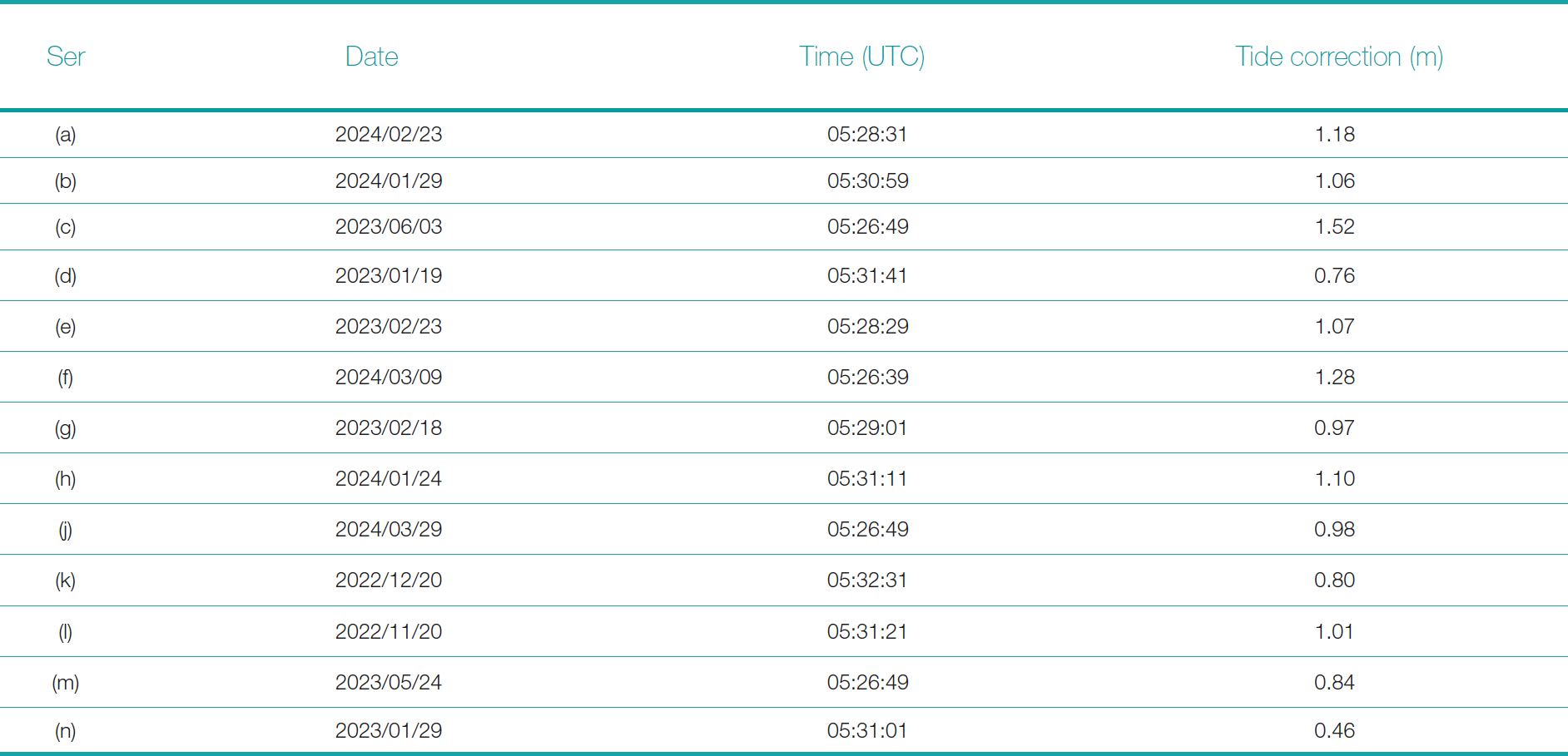
The SDB data is referenced to lowest astronomical tide (LAT) as each single image is referenced to LAT separately and combined to reduce the effects. Tides were modelled as per FES 2014 tidal model. Table 1 lists the tide values applied to each image.
The bathymetric data in field was collected by shallow water crafts for reef areas, survey motor boats for shallow depths and by ship for deeper areas. The data collected was referenced to LAT as tidal monitoring using tide pole was done simultaneously at Agatti jetty. The shallow water crafts used Deso 30 SBES, the survey motor boat a Seabeam 3180 MBES and the ship a Hydro Sweep DS MBES. The data acquired was processed in Teledyne CARIS HIPS and SIPS version 11.3. The SDB data was referenced and bathymetric surface of each line of data was compared in the processing software. The surface resolution of each line was kept the same as the SDB data to achieve an actual comparison.
3 Result and analysis
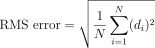
To assess the accuracy and reliability of SDB data, a structured quality control process was implemented. SDB depths were compared against in-situ measurements acquired from MBES and SBES surveys. Statistical analyses included the calculation of mean bias, standard deviation σ, and root mean square error (RMSE) across depth intervals of 0–3 m, 3–5 m, 5–10 m, and >10 m. For each depth interval, three survey lines were analyzed to increase the number of evaluation points. This stratification enabled a detailed examination of SDB performance relative to depth. Acceptance criteria were based on the IHO S-44 standards (IHO, 2022), where vertical uncertainty is expressed at the 95 % confidence level (LE95). Accordingly, compliance was judged by comparing 1.96 σ with the allowable total vertical uncertainty (TVU) for Order 1a, while mean bias and RMSE were reported as supplementary indicators of overall accuracy (Athmaram et al., 2017).
The accuracy of SDB against reference acoustic data was quantified using a combination of statistical measures. RMSE was initially computed as a descriptive metric since it accounts for both systematic bias and random variability, providing a useful indication of the total magnitude of depth deviation. However, for compliance with IHO S-44 standards (IHO, 2022), which define TVU at the 95 % confidence level (LE95), the standard deviation σ of the residuals was scaled by 1.96 (i.e., LE95 = 1.96 σ). This approach is consistent with the IHO guidelines for the use of SDB in hydrography (IHO, 2024) and avoids conflating systematic offsets with random uncertainty. Thus, while RMSE was reported for completeness, the determination of compliance with IHO Order 1a limits was made strictly using LE95 = 1.96 σ.
 |
(1) |
where:
N: Total number of points
SDBi: Depth from satellite-derived bathymetry at point i
MBESi: Depth from multibeam or single beam echo sounder at point i
 |
(2) |
where:
di = SDBi – MBESi: difference at point i
 |
(3) |
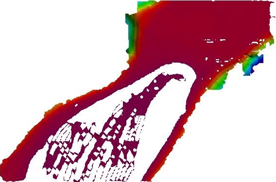
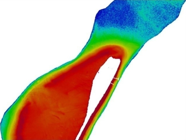
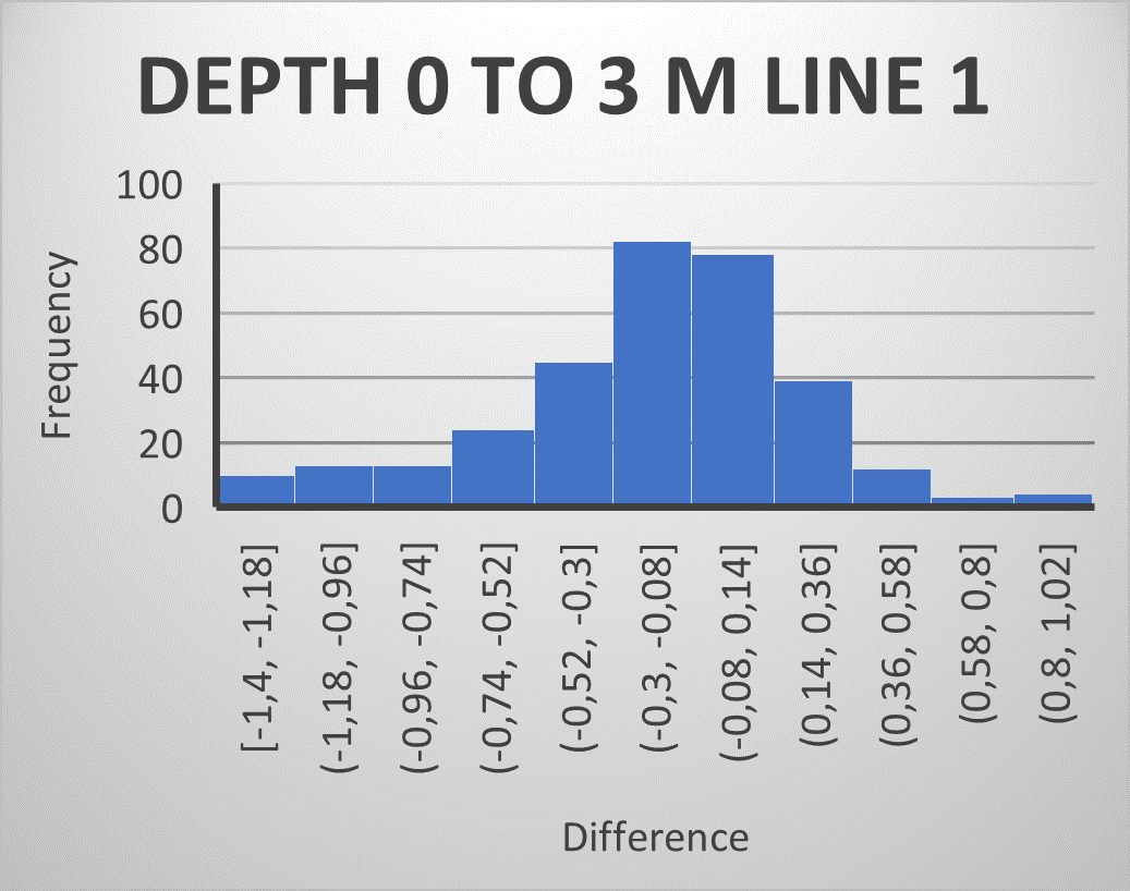
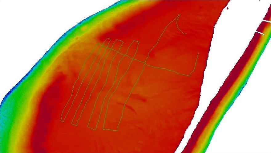
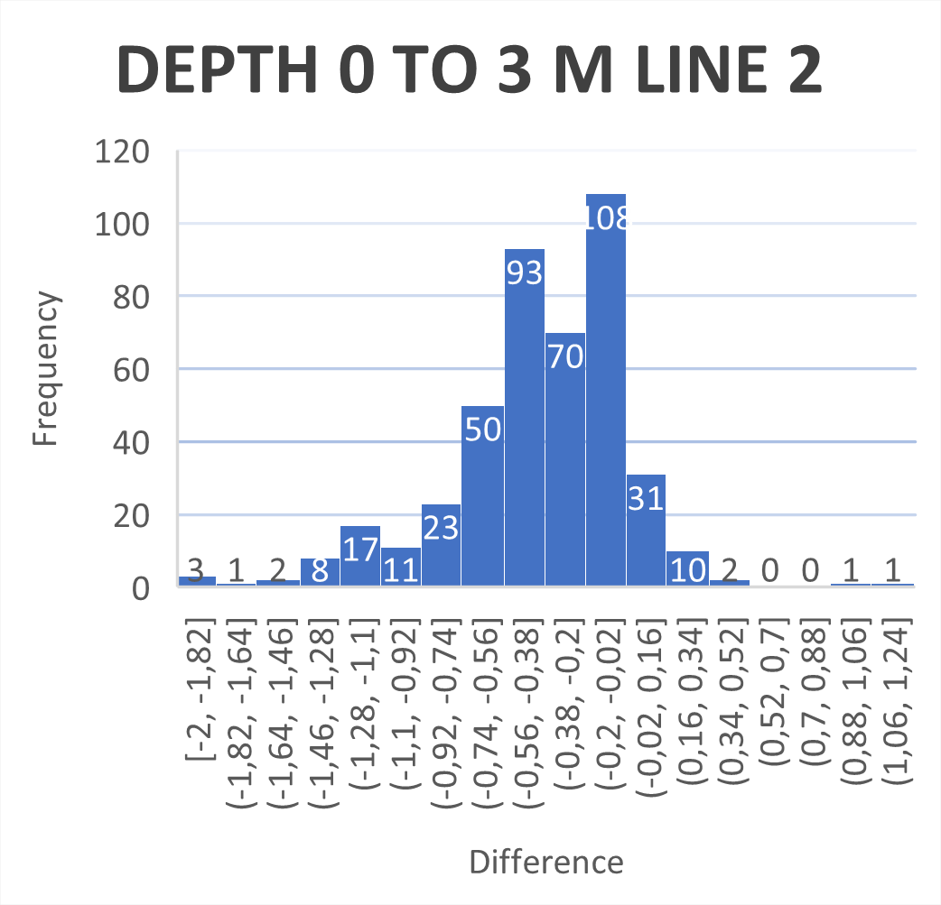
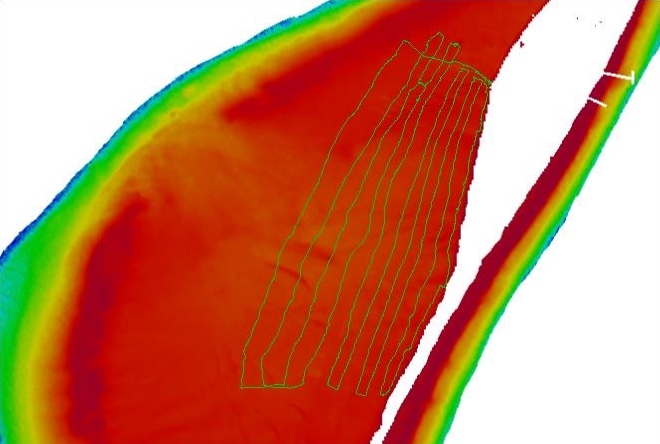
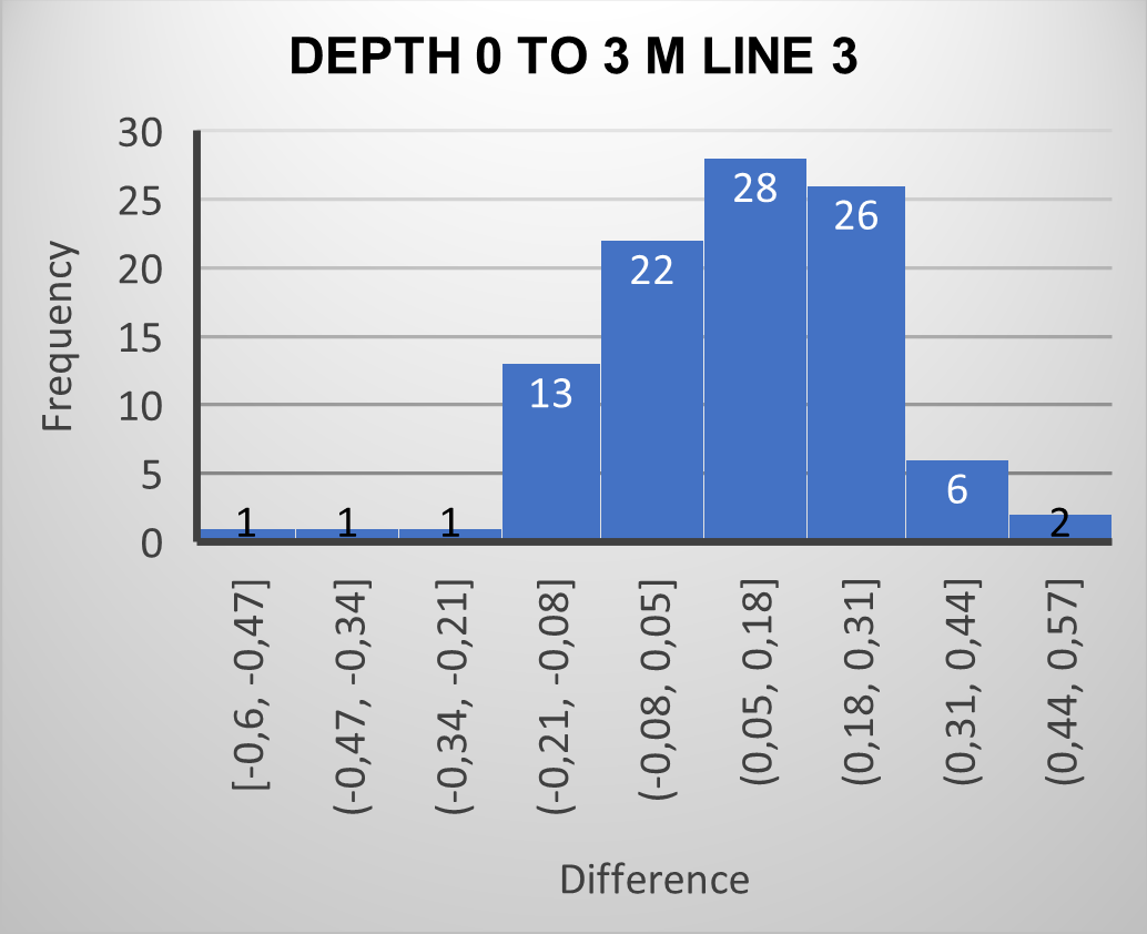
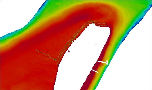
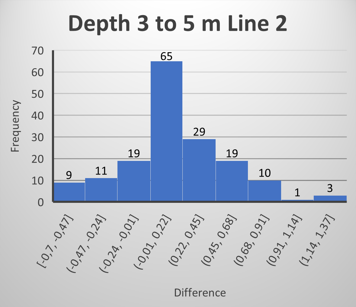
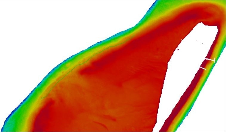
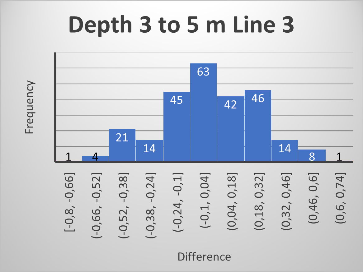
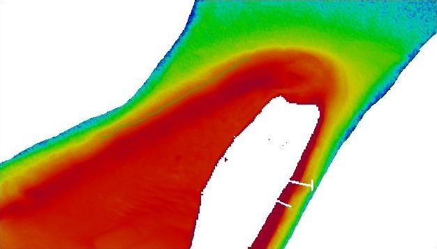
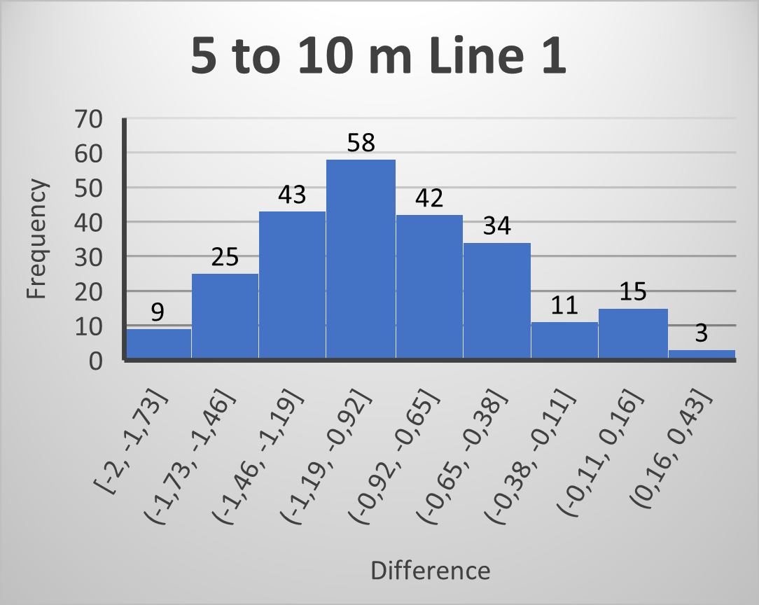
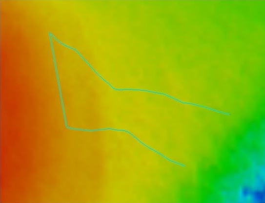
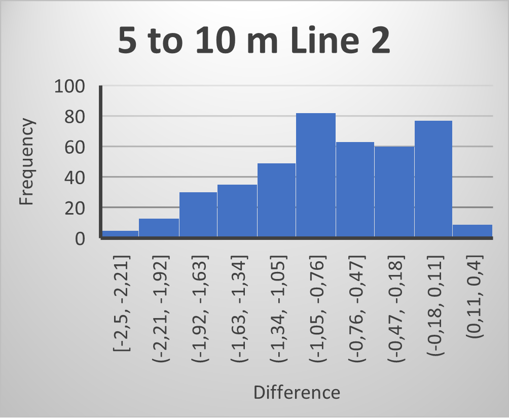
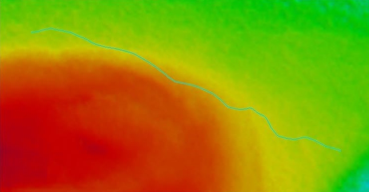
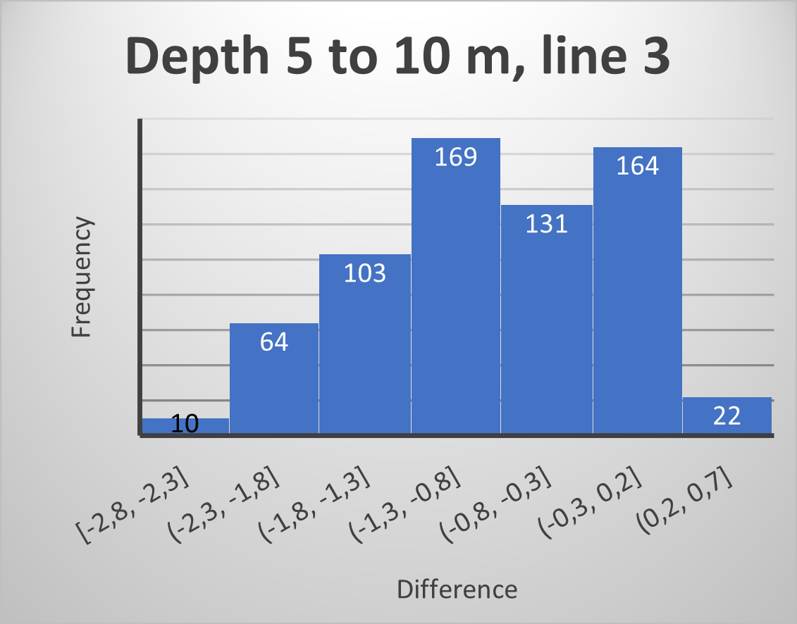
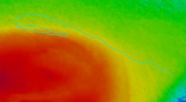
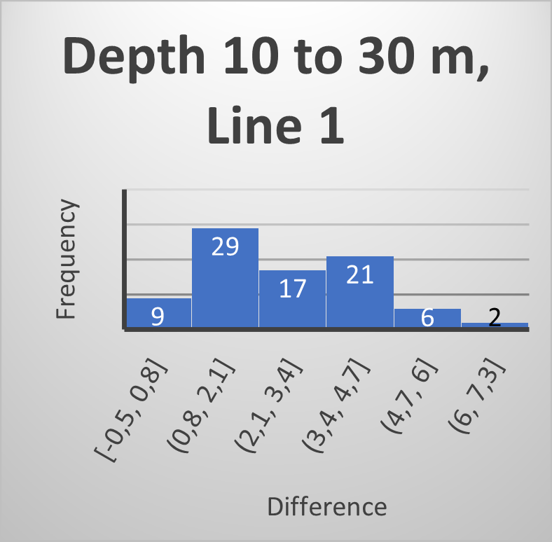
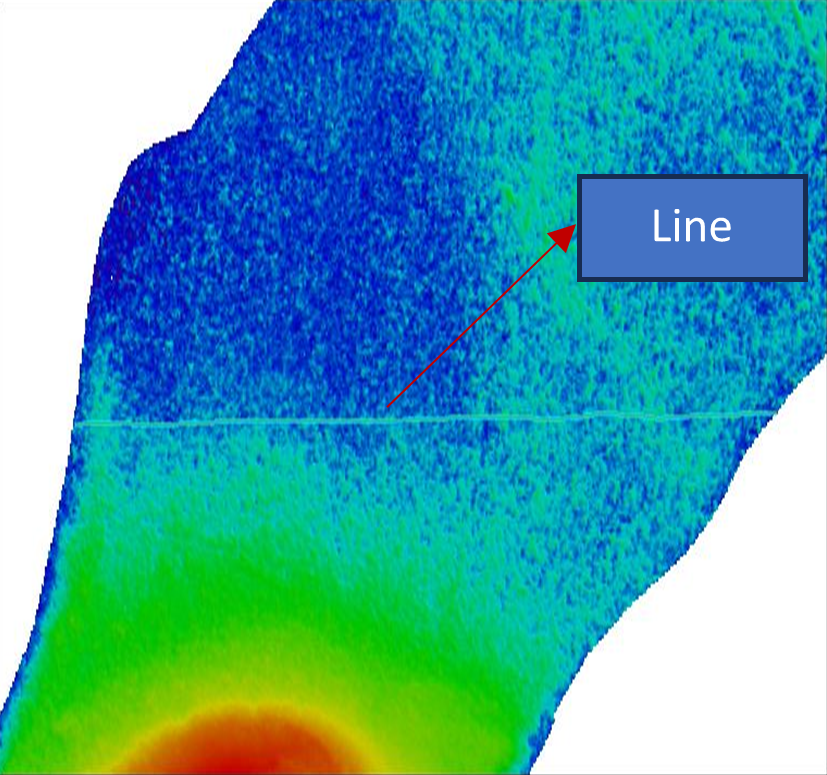
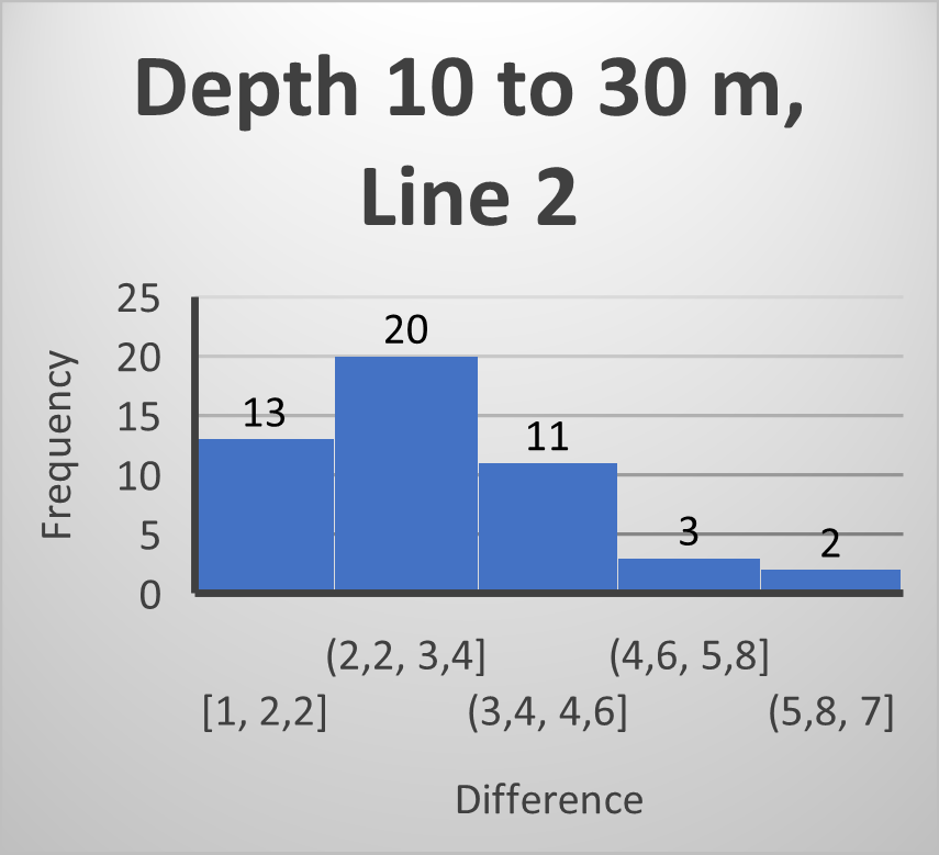
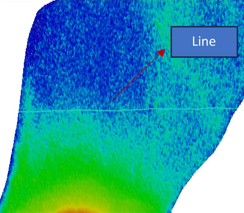
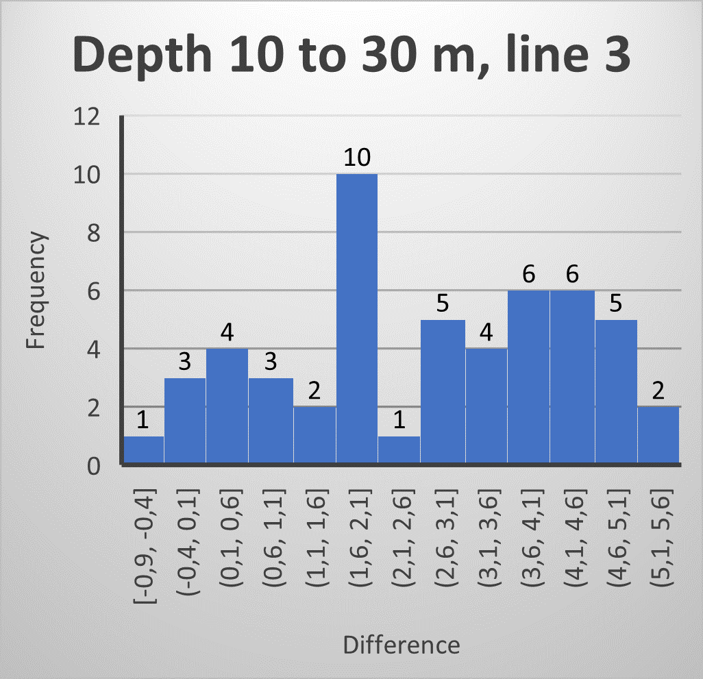
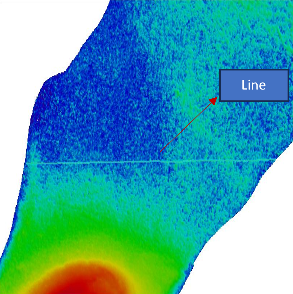
Figs. 2–13 showing the lines run on ground on top of SDB data (on the right) and an error histogram for each line in mentioned depth range (on left). Tables 2–13 displaying basic statistics of each line. All the errors and values in meter.












4 Discussion
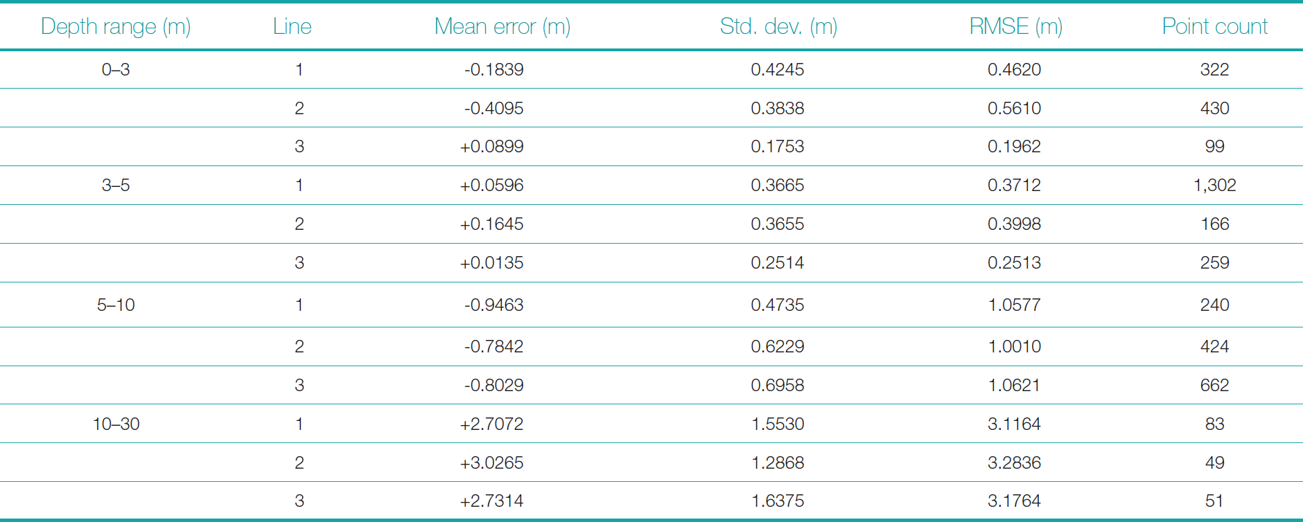
The summary of all the comparison is as follows. Table 14 below presents a detailed statistical comparison of SDB against ground-truth acoustic data (MBES/SBES) for each of the three survey lines within the defined depth intervals. The metrics include mean error, standard deviation, and RMSE for each line, along with the number of comparison points. The line-wise breakdown provides granularity to the performance assessment and underscores the need for selective application of SDB products based on local depth and optical conditions.
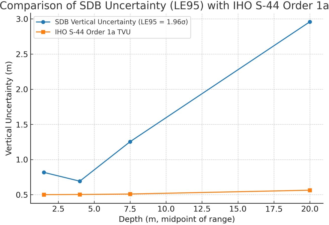
Fig. 14 presents the comparison of SDB vertical uncertainties, expressed as LE95 (1.96 σ), with IHO S-44 Order 1a TVU limits at the midpoints of each depth range. The results clearly show that while the LE95 values capture the general trend of increasing uncertainty with depth, they exceed the Order 1a limits across all bands, including the shallowest 0–3 m zone. This indicates that, although SDB reproduces the bathymetric pattern consistently, its uncertainties are above the stringent IHO thresholds when evaluated at the 95 % confidence level. These findings reinforce the suitability of SDB for reconnaissance-level mapping and coastal monitoring, while underscoring the importance of cautious interpretation when comparing to hydrographic survey standards.
In Table 15, in order to evaluate compliance with IHO S-44 standards (IHO, 2022), it is important to note that the TVU limits are expressed at the 95 % confidence level (LE95). Statistically, this corresponds to 1.96 times the standard deviation σ of normally distributed residuals. While RMS error values are often reported as a summary metric of accuracy, RMS includes both the random scatter (σ) and any systematic bias. Since TVU thresholds are intended to constrain random uncertainty rather than systematic offset, the appropriate measure for comparison is 1.96 σ, with bias reported separately. Accordingly, the compliance analysis presented here is based on 1.96 σ, ensuring consistency with the IHO S-44 LE95 definiton. The RMSE values computed in this study were compared against these limits under the assumption of a normal distribution of residuals. As per the results none of the depth criteria meet the requirements of order 1a.

5 Conclusions
This study assessed the applicability of physics-based SDB over the reef-fringed waters of Agatti Island using Sentinel-2 imagery processed by EOMAP GmbH & Co. KG. Validation against echo sounder data collected from shallow-water crafts (SBES) and survey vessels (MBES) demonstrated that while SDB provided reliable depth trends across all zones, the statistical comparison revealed limitations when benchmarked against IHO S-44 standards (IHO, 2022). Specifically, when residuals were assumed normally distributed and scaled to the 95 % confidence level (LE95 = 1.96 σ), SDB vertical uncertainties exceeded the Order 1a TVU limits across all depth bands. This indicates that, although the SDB performed within RMS magnitudes close to IHO thresholds in shallow waters, strict compliance was not achieved once LE95 criteria were applied.
Nevertheless, the results confirm the operational value of SDB as a reconnaissance tool, especially in logistically challenging or environmentally sensitive areas where conventional hydrographic surveys are constrained. The findings also highlight the importance of explicitly accounting for statistical definitions of uncertainty when comparing SDB results to hydrographic standards. With ongoing improvements in satellite sensor resolution, atmospheric correction, and water column modelling, SDB is expected to become an increasingly important complement to traditional surveys, particularly for coastal planning and monitoring in remote island regions.
While SDB alone cannot currently replace traditional surveys for safety-of-navigation charting in deeper waters, it holds considerable promise as a force multiplier – enabling prioritization, survey planning, and ecological monitoring in compliance with internationally accepted hydrographic standards. Future efforts may benefit from integrating optically active substance (OAS) data and machine learning enhancements, as explored in recent Indian studies (Ashphaq et al., 2025), to improve SDB depth retrieval in complex coastal waters.
Acknowledgement
The author expresses sincere gratitude to the Indian Naval Hydrographic Department (INHD) for the opportunity to undertake this study on an emerging and operationally relevant topic, and for the valuable guidance and support extended by senior officers and colleagues throughout the course of this work. Special thanks are also due to EOMAP GmbH & Co. KG for providing the SDB dataset, for the analysis presented in the paper. Special mention of Cdr Ashsish G Srinivasan (Ret.) for the valuable insights and guidance.
References
Ashphaq, M., Srivatsav, P. K. and Mitra, D. (2025). Optimizing satellite-derived bathymetry in coastal turbid waters through integration of optically active substances: Insights from the SATCORE project. Journal of Coastal Research, 86, 104208. https://doi.org/10.1016/j.rsma.2025.104208
Athmaram, J. and Srinivasan, A. G. (2017). Acquisition of satellite-derived bathymetry data for offshore engineering projects: Island case study. Abu Dhabi International Petroleum Exhibition & Conference, Abu Dhabi, UAE. doi: https://doi.org/10.2118/188714-MS
EAHC (2015). Report on International Workshop on Tsunami Inundation Mapping. East Asia Hydrographic Commission, Tokyo, Japan. http://home.eahc.asia/tsunami/(Final)_Full_Report_on_Tsunami_Workshop.pdf (last accessed 9 Otober 2025).
EOMAP (2025). Key insights from Earth Observation. EOMAP GmbH & Co. KG, Seelfeld, Germany. https://www.eomap.com (last accessed 1 April 2025).
ESA (2015) Sentinel-2 User Handbook (Issue 1, Rev. 2). European Space Agency, Paris, France. https://sentinels.copernicus.eu/documents/247904/685211/Sentinel-2_User_Handbook.pdf (last accessed 9 Otober 2025).
ESA (2025). Earth Online. European Space Agency, Paris, France.
Gunathilaka, M. D. E. K., Wishwajith, K. L. K. K. and Rathnayake, R. M. D. I. Satellite derived bathymetry for rapid investigation for possible navigational channel design for coastal wind farm installation: a case study at Silavathurai, Sri Lanka. Discov Appl Sci, 6(54). https://doi.org/10.1007/s42452-024-05689-5
Hartmann, K., Reithmeier, M., Knauer, K., Wenzel, J., Kleih, C., Heege, T. (2022). Satellite-derived bathymetry online. The International Hydrographic Review, 28, pp. 53–75. https://doi.org/10.58440/ihr-28-a14
IHO (2022). Standards for Hydrographic Surveys (ed. 6.1). IHO Special Publication S-44, International Hydrographic Organization, Monaco. https://iho.int/uploads/user/pubs/standards/s-44/S-44_Edition_6.1.0.pdf (last accessed 9 October 2025).
IHO (2024). Guidance to Satellite-derived Bathymetry (1st ed.). IHO Publication B-13, International Hydrographic Organization, Monaco. https://iho.int/uploads/user/pubs/bathy/B_13_Ed100_032024.pdf (last accessed 9 October 2025).