
Abstract
1 Chile and the naming of submarine features: An ongoing commitment to international hydrography
The seafloor remains one of the least explored and understood geographical domains, despite its scientific, environmental, and strategic significance. In recent decades, the development and refinement of bathymetric survey technologies – particularly multibeam echosounders – have enabled Chile to make significant progress in mapping its seabed. This has facilitated the identification and characterization of important submarine features.
In this context, SCUFN is the Sub-Committee on Undersea Feature Names (SCUFN) of the General Bathymetric Chart of the Oceans (GEBCO), within the framework of the International Hydrographic Organization (IHO) and the Intergovernmental Oceanographic Commission (IOC), responsible for reviewing, evaluating, and approving proposals for naming undersea features worldwide. Its mandate is to ensure consistency in toponymy and to ensure the standardized use of official names in maps, nautical charts, scientific research, and international publications.
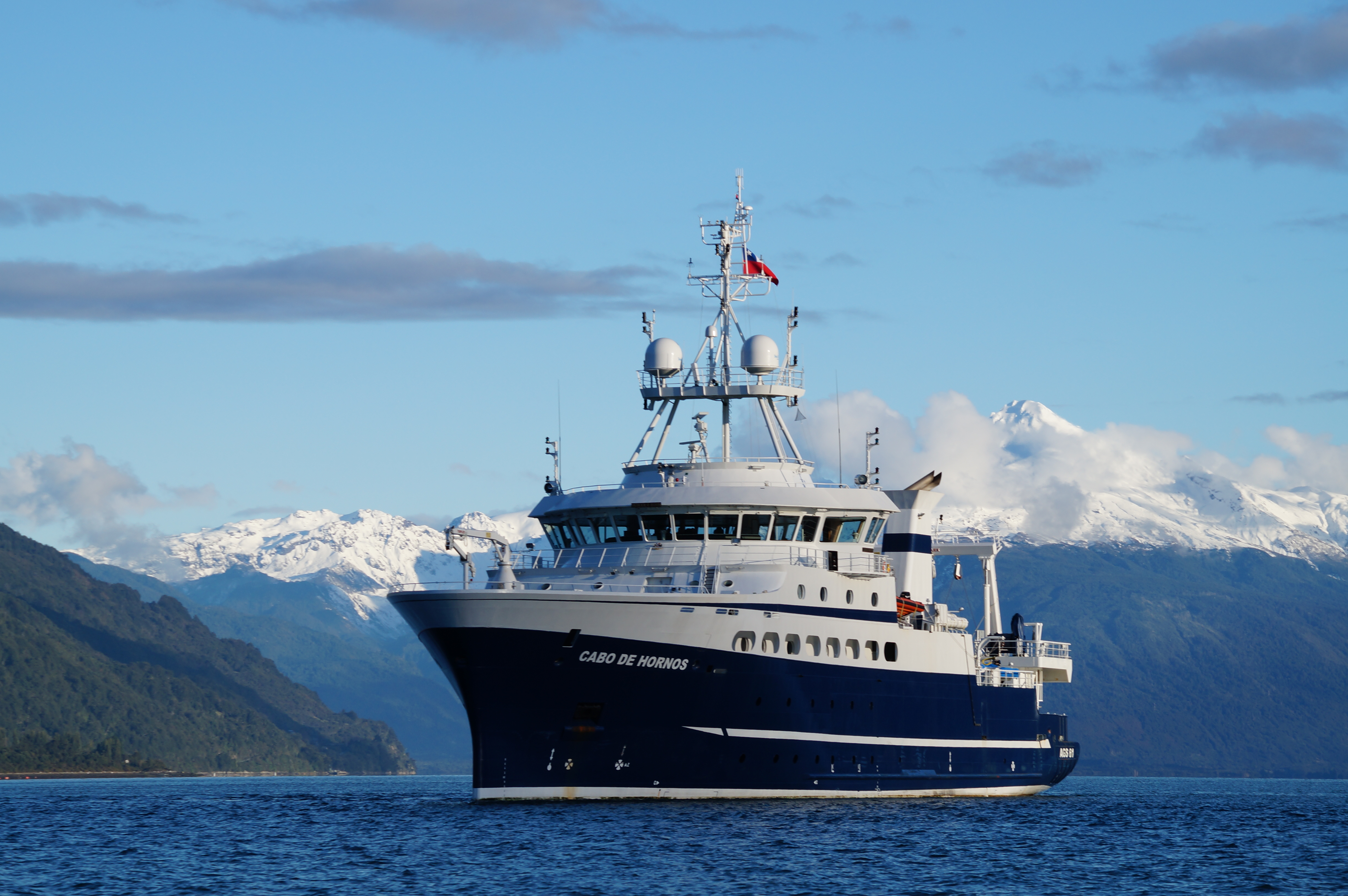
The Hydrographic and Oceanographic Service of the Chilean Navy (SHOA) is the State’s permanent technical agency responsible for hydrography, oceanography, and the unification of nautical toponymy, among other matters (SHOA, 2023). In this regard, it chairs and leads the National Committee on Antarctic Geographic Names, which brings together the country’s official cartographic institutions and seeks to achieve concordance and standardization of geographic names for use on charts and related publications. For this reason, the SHOA has also taken an active role in proposing and submitting names to the SCUFN through oceanographic cruises and hydrographic surveys, primarily conducted by the Chilean Navy’s research vessel AGS Cabo de Hornos (Fig. 1). These efforts seek to contribute to the international progress of toponymic standardization and provide high-resolution bathymetric data on the seafloor.
2 The importance of submarine toponymy
Submarine toponymy is a key tool in the advancement of scientific research, marine geospatial data management, and international hydrographic cooperation. The standardized naming of seafloor features enables precise identification of structures relevant to oceanography, marine geology, benthic biology, and ocean engineering, ensuring consistent reference across scientific and technical domains.
The assignment of geographic names to seafloor features contributes to the orderly and internationally recognized representation of underwater entities in oceanic spaces. This fosters data interoperability between nautical charts, databases, and marine monitoring platforms, which supports oceanographic research initiatives. In this regard, it is important to emphasize the availability of the bathymetric data from the proposals submitted to SCUFN, to contribute to GEBCO’s seafloor mapping.
This SCUFN-regulated methodology, highlights the technical commitment of States to generating high-resolution bathymetric data and to the systematic characterization of the ocean floor.
As multibeam hydrographic surveys expand, the need to update and increase undersea toponymy grows, in accordance with IHO principles and standards and those of the broader ocean science community. These efforts contribute to Seabed 2030 – a global initiative aimed at mapping the entire ocean floor by 2030 – and reinforce international collaboration for the UN Decade of Ocean Science for Sustainable Development (2021–2030). The Decade seeks to advance scientific research and knowledge of the oceans to promote their health and sustainable use.
To this end, proposals submitted to the SCUFN undergo an exhaustive review process by its members, who possess advanced knowledge in bathymetry, submarine geomorphology, among other topics, where, among other variables, they must verify the appropriateness of the proposed name, the morphometric characterization of the entity and its delimitation, also reviewing compliance in the proposals with the formats and indications established in IHO-IOC Publication B-6: Standardization of Undersea Feature Names.
The approved names were incorporated into the GEBCO Gazetteer of Undersea Feature Names1, which serves as the international reference database for submarine toponymy.
3 Chilean proposals approved (2021–2024)
Since 2021, Chile has contributed six undersea feature names. Their main characteristics are briefly outlined below.
3.1 Piloto Pardo Seamount (2021)
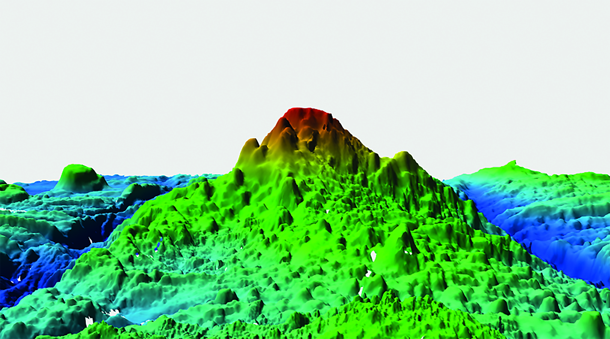
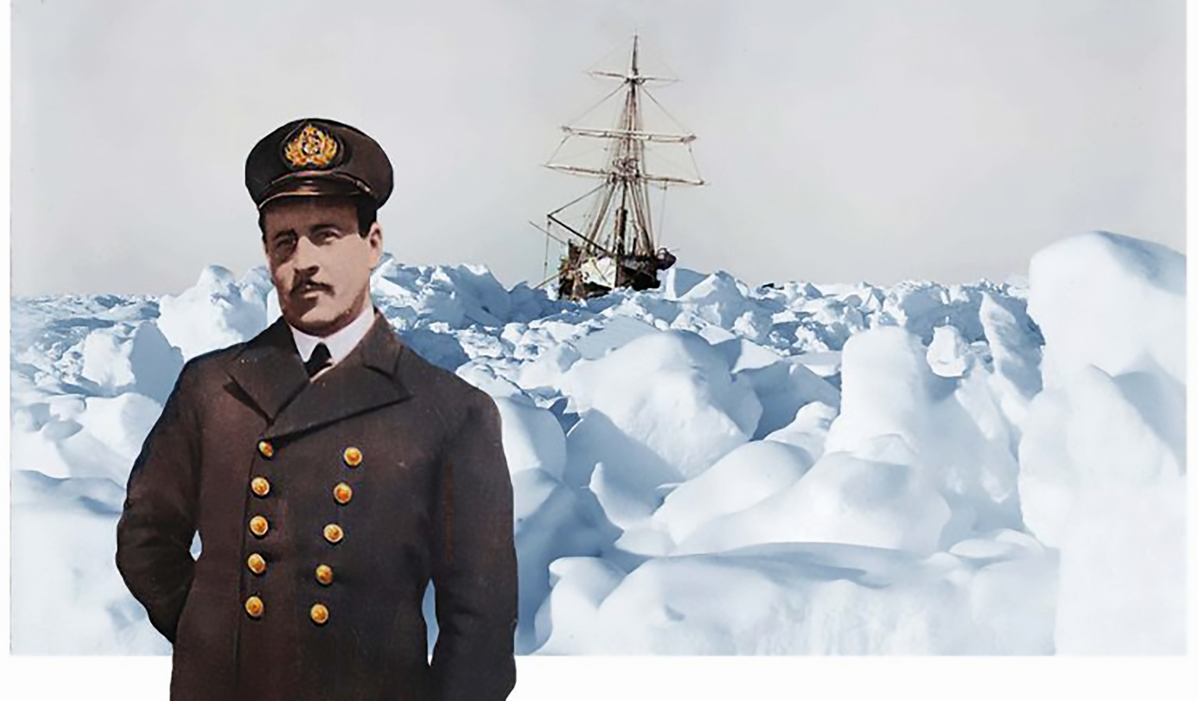
The Piloto Pardo Seamount is a prominent feature with a vertical relief of over 1,700 meters (Table 1), located on the seafloor of the Drake Passage. The name Piloto Pardo Seamount (Fig. 3) honors Second Pilot Luis Pardo Villalón (Fig. 2), a renowned officer of the Chilean Navy who, in 1916, led the schooner Yelcho during the heroic rescue of the crew of Ernest Shackleton’s ship Endurance on Elephant Island in Antarctica (Cárcamo, n.d.).
The name was officially accepted at SCUFN’s 34th meeting in 2021 and is now recognized for use in the international ocean science community and represented in charts and related publications.

3.2 O’Higgins Seamount and O’Higgins Guyot (2023)
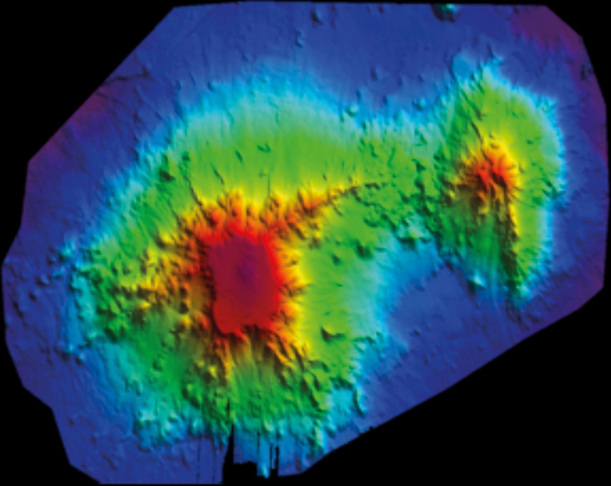
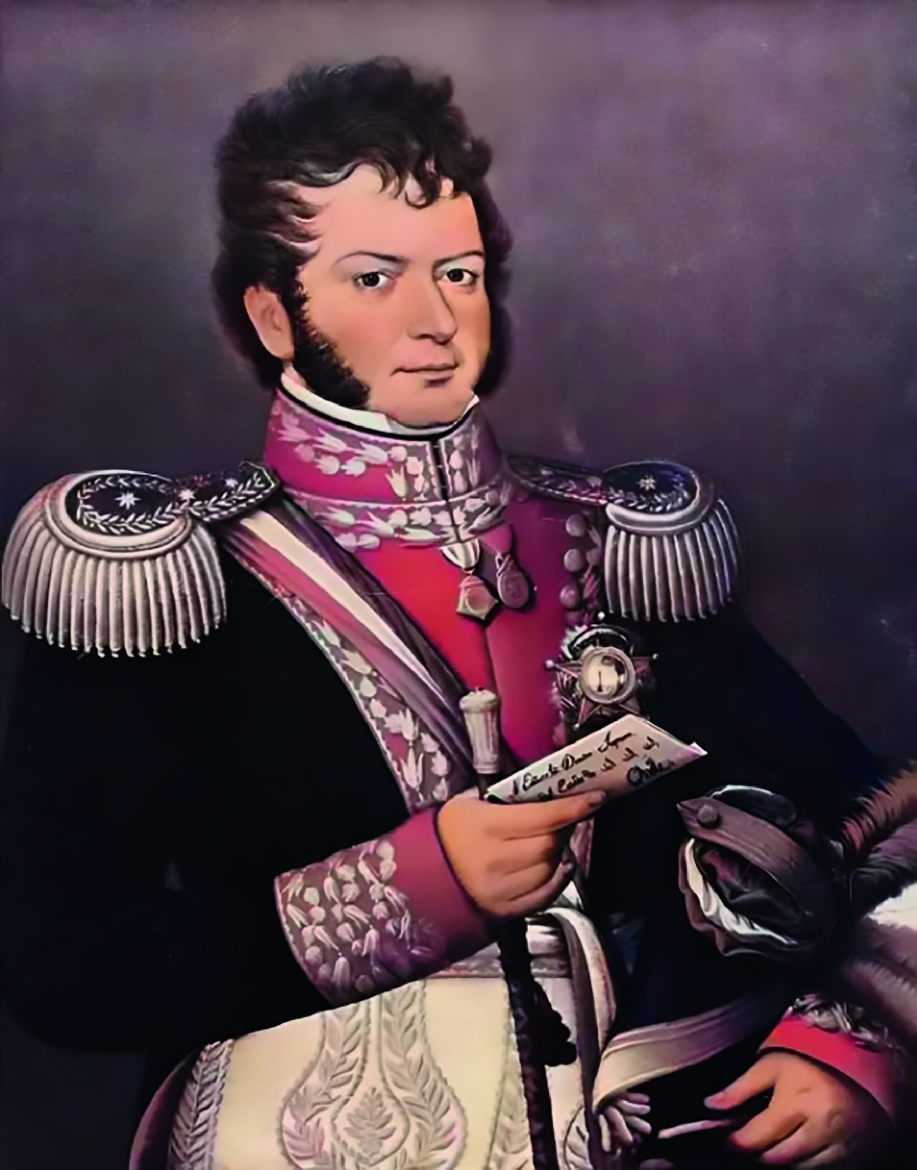
The O’Higgins Seamount and O’Higgins Guyot are large-scale submarine features located west of Valparaíso and east of the Juan Fernández Archipelago (Fig. 4; Valenzuela & Vergara, 1982). Classified based on their geomorphological characteristics, the guyot is the largest feature, with a relief exceeding 2,700 m. These features (Tables 2 and 3), named O’Higgins Seamount and O’Higgins Guyot, commemorate Chilean independence leader General Bernardo O’Higgins Riquelme (Fig. 5). These names had already been widely used informally in marine scientific literature prior to their official approval. These names were officially accepted at the 36th SCUFN meeting in 2023.


3.3 Atacama Deep (2024)
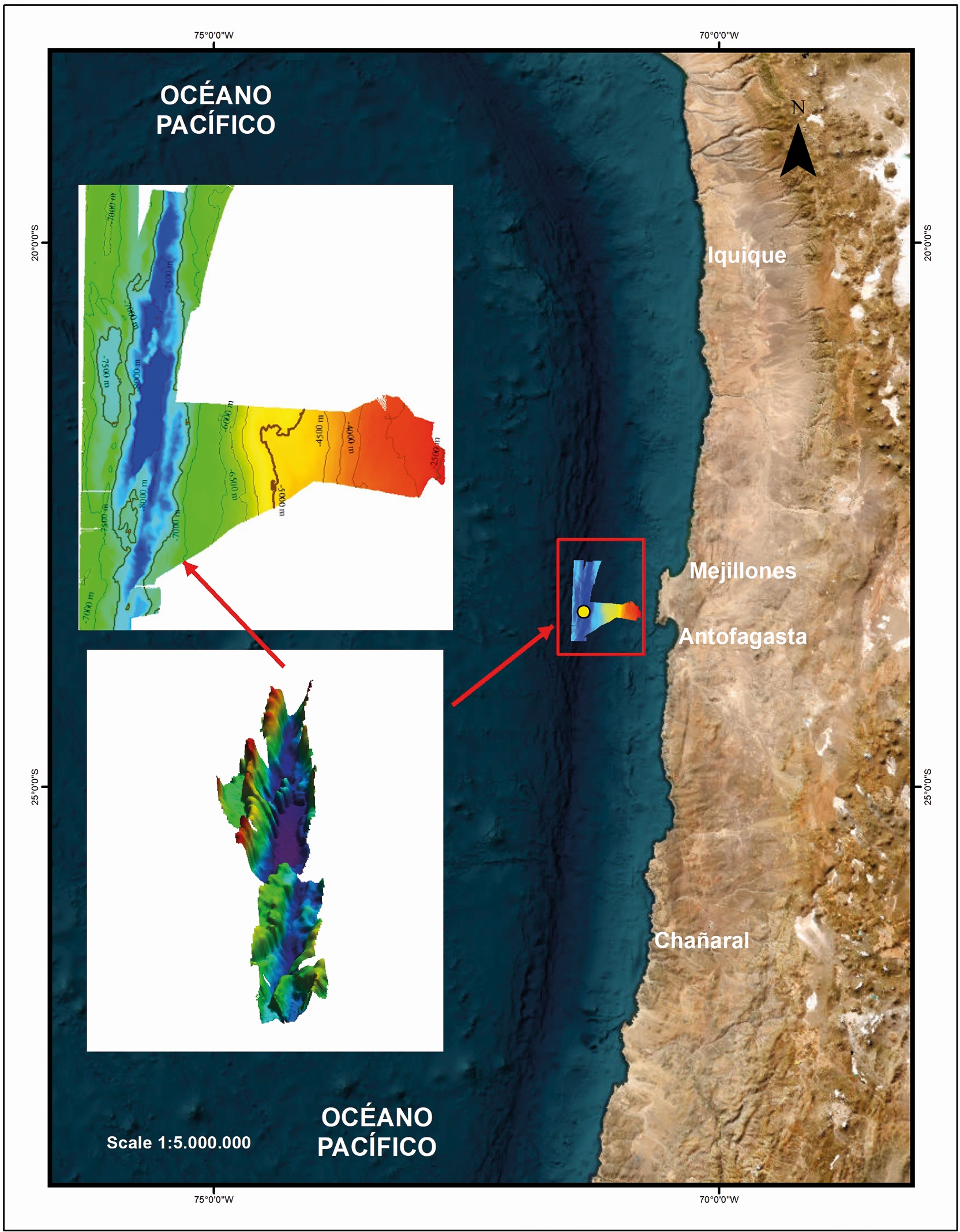
The Atacama Deep is a located west of the Mejillones Peninsula in northern Chile (Fig. 6), this is the deepest point (8,087 m) in the Peru-Chile Trench (Table 4). The name Atacama Deep references its proximity to the Atacama Desert, one of the driest regions on Earth. The area is of high interest to the international scientific community for studies of deep-sea ecosystems. The name was officially accepted at SCUFN’s 37th meeting in 2024.

3.4 Morales Seamount (2024)
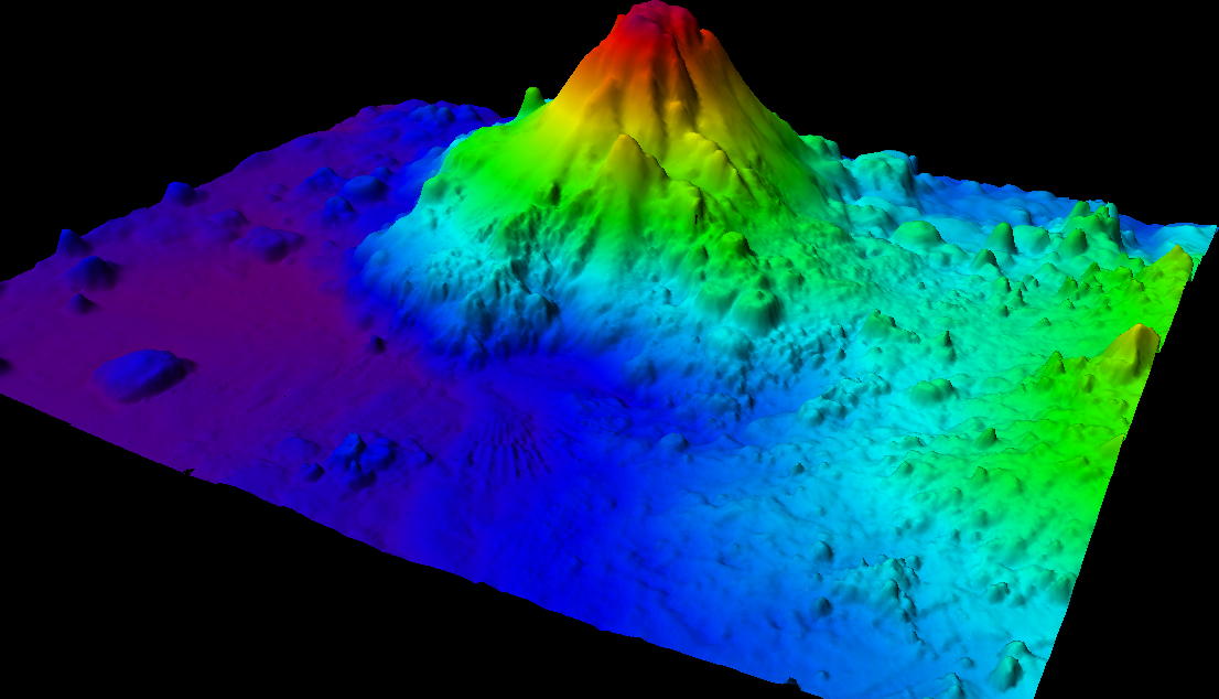
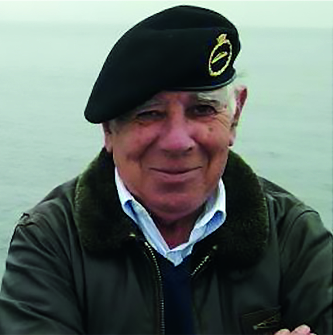
The Morales Seamount located east of Alejandro Selkirk Island in the Juan Fernández Archipelago (Table 5). This feature was submitted at SCUFN’s 37th meeting in 2024. Morales Seamount (Fig. 7) honors Chilean geographer Dr. Esteban G. Morales (Fig. 8), a pioneer in Chile’s scientific exploration of the seafloor (Morales, 2007).

3.5 Vidal Gormaz Seamount (2024)
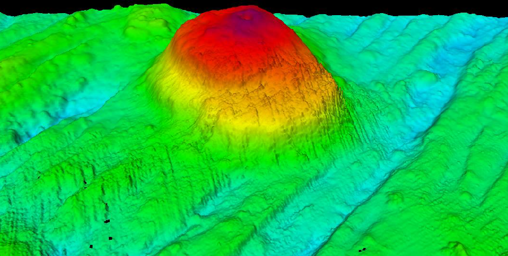
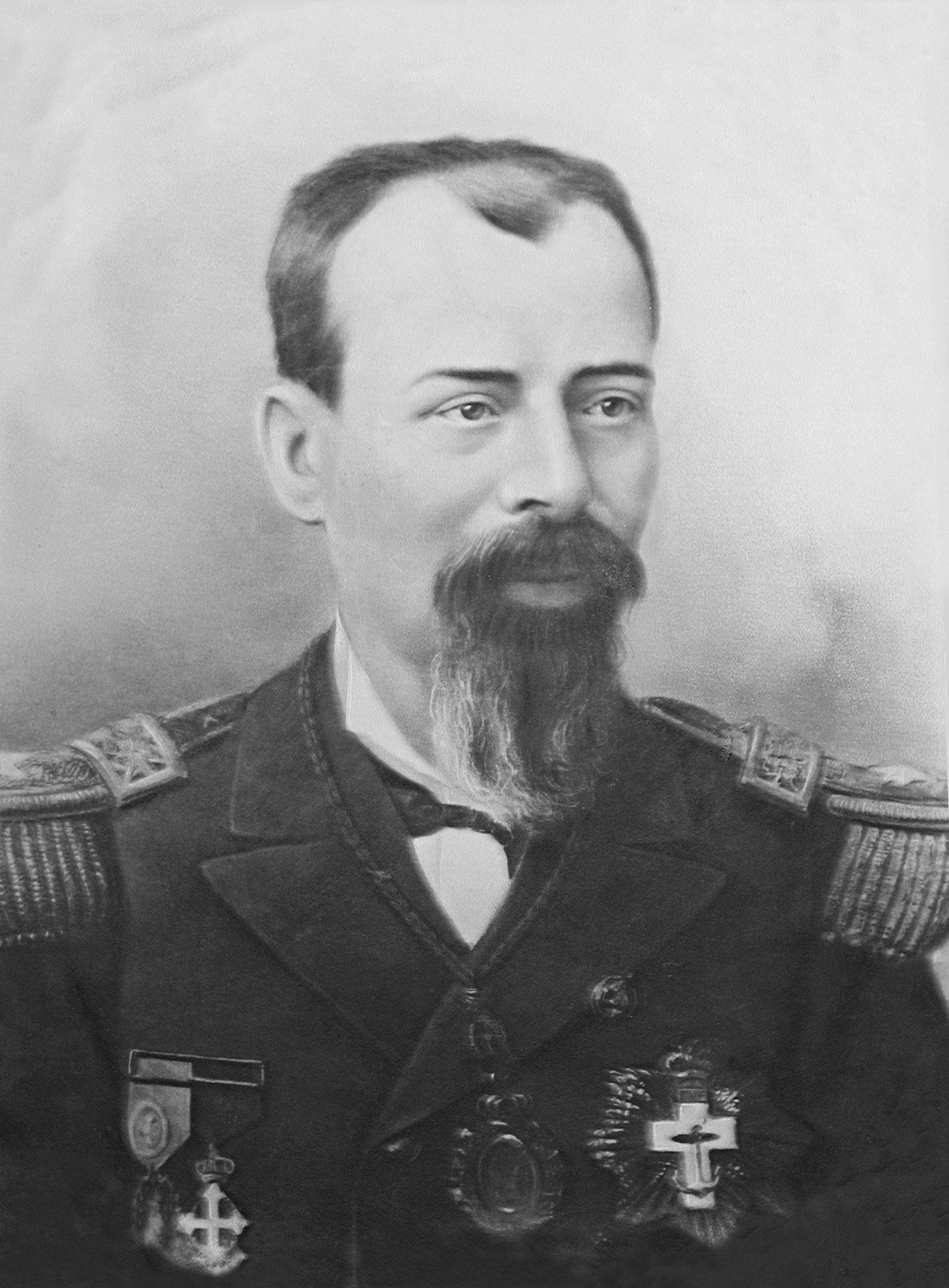
The Vidal Gormaz Seamount is a prominent seamount with over 1,200 meters of relief (Fig. 9), located in the Drake Passage, approximately 37 miles southwest of Piloto Pardo Seamount. The name Vidal Gormaz Seamount commemorates Captain Francisco Vidal Gormaz (Fig. 10; Maldonado, 2016), regarded as the Father of Hydrography in Chile and the first director of the Chilean Hydrographic Office. The name was officially accepted at SCUFN’s 37th meeting in 2024.

4 Conclusion
The approval of toponymic proposals by SCUFN marks a significant step forward in the global effort to enhance the knowledge and representation of undersea features. Chile’s contribution reflects its commitment to the marine scientific community by incorporating these names into the GEBCO Gazetteer and promoting the standardized use of submarine toponymy across cartographic products, geospatial databases, and scientific publications. Also important is the contribution of bathymetric data made available with these proposals, which directly benefits the effort to achieve complete coverage of the ocean floor.
The process of identifying, characterizing, and officially naming these features has been supported by high-resolution bathymetric surveys using multibeam technologies, conducted in accordance with IHO standards and methodologies. Therefore, we are grateful for the enormous contribution of SCUFN in receiving and reviewing the proposals to nominate underwater geoforms that contribute to the dissemination and knowledge of the seabed. The inclusion of these names strengthens the principle of interoperability in marine geospatial data and enhances the accuracy and consistency of international hydrographic information.
As bathymetric data becomes increasingly available and global interest in ocean floor exploration grows, this contribution aligns with the broader efforts in standardized seafloor cartography, international scientific cooperation, and reliable geospatial information to support ocean governance.
References
Cárcamo, V. E. (n.d.). La gran hazaña del Piloto Pardo y su tripulación en la escampavía Yelcho: Rescate de la expedición británica en la Antártica en 1916. Academia de Historia Naval y Marítima de Chile.
Morales, E. (2007). Historia de la exploración submarina. Ediciones Universitarias de Valparaíso, PUCV.
Maldonado, Z. S. (2016). Francisco Vidal Gormaz: Hidrógrafo olvidado del Chile decimonónico. Revista de Marina, 6, pp. 34–39. https://revistamarina.cl/revistas/2016/6/zsaldiviam.pdf (last accessed 30 September 2025).
SHOA (2023). Hydrographic Instructions No. 3: Geographic Naming Determination (3rd ed.). Publication No. 3103, Hydrographic and Oceanographic Service of the Chilean Navy, Valparaíso, Chile.
Valenzuela, E. and Vergara, H. (1982). Morfología submarina del Guyot O´Higgins, extremo oriental del cordón asísmico Juan Fernández. III Congreso Chileno de Geología, Concepción, Chile.