
1 Introduction
In an era of growing maritime significance and ever-increasing emphasis on sustainable use of ocean resources, Hydrography has emerged as a cornerstone of maritime safety, economic development, and environmental stewardship. For a nation like Bangladesh, with a vast maritime zone in the Bay of Bengal, hydrographic leadership is not only a strategic imperative but also a national responsibility. Under the leadership of the Bangladesh Navy, the country’s hydrographic journey has undergone a transformative evolution-marked by advanced capability development, international collaboration, and regional leadership.
The nomination of Bangladesh as Chair of the North Indian Ocean Hydrographic Commission (NIOHC) for the term of 2025–2027, marks a significant milestone in its maritime diplomacy and regional influence. This leadership position reflects the growing recognition of Bangladesh Navy’s technical expertise, operational readiness, and institutional vision in the field of Hydrography and Oceanography. Through initiatives like Electronic Navigational Chart (ENC) production, seabed mapping, capacity building, and collaboration with the International Hydrographic Organization (IHO), Bangladesh has positioned itself as a central actor in promoting safe navigation, regional data sharing, and sustainable Blue Economy activities. The participation by the Chairman of National Hydrographic Committee (NHC) in global hydrographic forums, such as the Capacity Building Sub-Committee (CBSC) and Inter-Regional Coordination Committee (IRCC) meetings held in Monaco, further underscores Bangladesh’s growing integration into the global hydrographic framework.
This paper aims to explore the vision of Bangladesh Navy’s leadership in Hydrography, the institutional and operational roles it plays through regional bodies and national committee, and the ways in which regional cooperation, capacity enhancement, and technological innovation are being prioritized. It delves into how the leadership of Bangladesh is bridging gaps between national and regional interests, aligning Hydrography with broader strategic goals, and positioning the country as a key contributor to regional maritime safety and sustainable development.
2 Aim
This paper aims to explore the leadership of Bangladesh in regional Hydrography through its active roles in the NIOHC and NHC. It will also highlight the Navy’s vision, capacity building efforts, and strategic integration to promote maritime safety, regional collaboration, and sustainable blue economy activities.
3 North Indian Ocean Hydrographic Commission
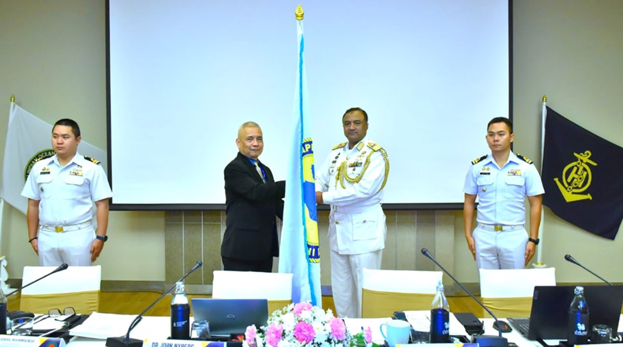
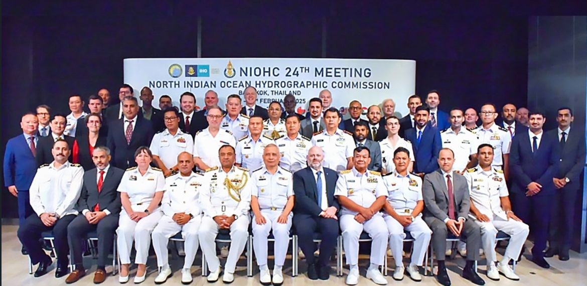
The NIOHC is a Regional Hydrographic Commission (RHC) under the IHO. It aims to promote regional cooperation in Hydrography, nautical charting, and marine geospatial data among member states bordering the North Indian Ocean (Fig. 1). The commission facilitates the exchange of technical expertise, capacity building, and implementation of international hydrographic standards such as S-100 (Universal Hydrographic Data Model) developed by the IHO as a framework for digital maritime data. By supporting safe navigation, maritime trade, and environmental protection, NIOHC plays a vital role in strengthening maritime governance in the region. Bangladesh Navy has taken over the chairmanship of NIOHC from Thailand for next two years (i.e. 2025–2027; Figs. 2 and 3; IHO, 2025).

4 Role of Bangladesh Navy as Chair of NIOHC with the vision
As the Chair of the NIOHC for the term of 2025–2027, Bangladesh holds a leadership position of strategic importance in advancing regional cooperation in Hydrography. With growing maritime activities in the North Indian Ocean, the need for accurate nautical information and coordinated hydrographic efforts has become increasingly critical. Bangladesh is committed to fostering collaborative frameworks among member states to enhance navigational safety, protect the marine environment, and ensure efficient maritime trade. As Chair, Bangladesh promotes a comprehensive and forward-looking agenda that strengthens the collective capacity of the region’s hydrographic services.
A key priority under Bangladesh’s chairmanship is capacity building across the NIOHC member states. By facilitating training programs, technical workshops, and knowledge exchanges, Bangladesh is working to uplift the technical competencies of hydrographic offices, especially among developing countries in the region. The focus includes strengthening national hydrographic capabilities, modernizing data collection techniques, and enhancing access to contemporary tools and technologies. These efforts are aligned with the broader goals of the IHO, ensuring that all members can effectively contribute to and benefit from a harmonized regional hydrographic infrastructure.
Moreover, Bangladesh is placing strong emphasis on the transition towards the S-100 framework, the next generation of hydrographic standards developed by the IHO. This transition is vital for supporting emerging needs such as e-navigation, marine spatial planning, disaster risk reduction, and blue economy initiatives. Through its leadership, Bangladesh is encouraging interoperability, standardization, and data-centric services across the region, facilitating the production of advanced hydrographic products and services. These initiatives not only strengthen maritime safety but also contribute to sustainable ocean governance and the long-term development goals of the NIOHC member states (IHO, 2023).
In light of the above, the Chairman’s vision extends to the sustainable development of the blue economy. Recognizing the critical role of modern Hydrography and maritime geospatial data in unlocking economic potential, the focus will be on establishing a robust data infrastructure that supports marine resource management, coastal planning, disaster preparedness, and climate resilience. Through strategic leadership, Bangladesh seeks to ensure that Hydrography not only serves the needs of the maritime industry but also becomes a catalyst for environmental stewardship and long-term economic growth throughout the North Indian Ocean region (Sarker & Islam, 2018).
5 Capacity building in the NIOHC region
Capacity building remains a cornerstone priority in the NIOHC region, particularly for enhancing the capabilities of developing member states. Many of these nations face significant limitations in resources, infrastructure, and trained personnel, which hinder their ability to contribute effectively to regional hydrographic initiatives. Under the dynamic leadership of Bangladesh and with continued support from the IHO, capacity development has been prioritized to bridge these gaps and promote equitable participation. These efforts aim to build a more capable and collaborative regional hydrographic community, capable of responding to the demands of modern maritime safety, coastal management, and economic development (Fig. 4; IHO, 2025).
To this end, a range of practical initiatives have been implemented, including the organization of technical workshops, seminars, and collaborative exercises focused on current and emerging hydrographic needs. Bangladesh Navy, through its Hydrographic School, has taken the initiative by offering specialized training such as Category ‘B’ Hydrography course, supporting the professional development of Hydrographers from across the region. These training programs are further complemented by initiatives such as equipment-sharing arrangements, survey planning support, and technical guidance on ENC production and S-57 implementation. These programs not only enhance operational readiness but also promote regional interoperability and adherence to IHO standards.
Through these sustained efforts, Bangladesh is playing a transformative role in advancing regional hydrographic capacity. By focusing on human resource development and technology transfer, Bangladesh Navy is enabling member states to produce their own navigational charts, conduct reliable hydrographic surveys, and support marine spatial data infrastructure. As the region moves toward a digital and data-centric future, capacity building also supports the broader goals of maritime safety, environmental stewardship, and blue economy growth. Ultimately, this vision reinforces sustainable ocean governance and ensures that all NIOHC nations, regardless of size or capacity, have a voice and a role in shaping the maritime future of the North Indian Ocean.

6 National Hydrographic Committee of Bangladesh
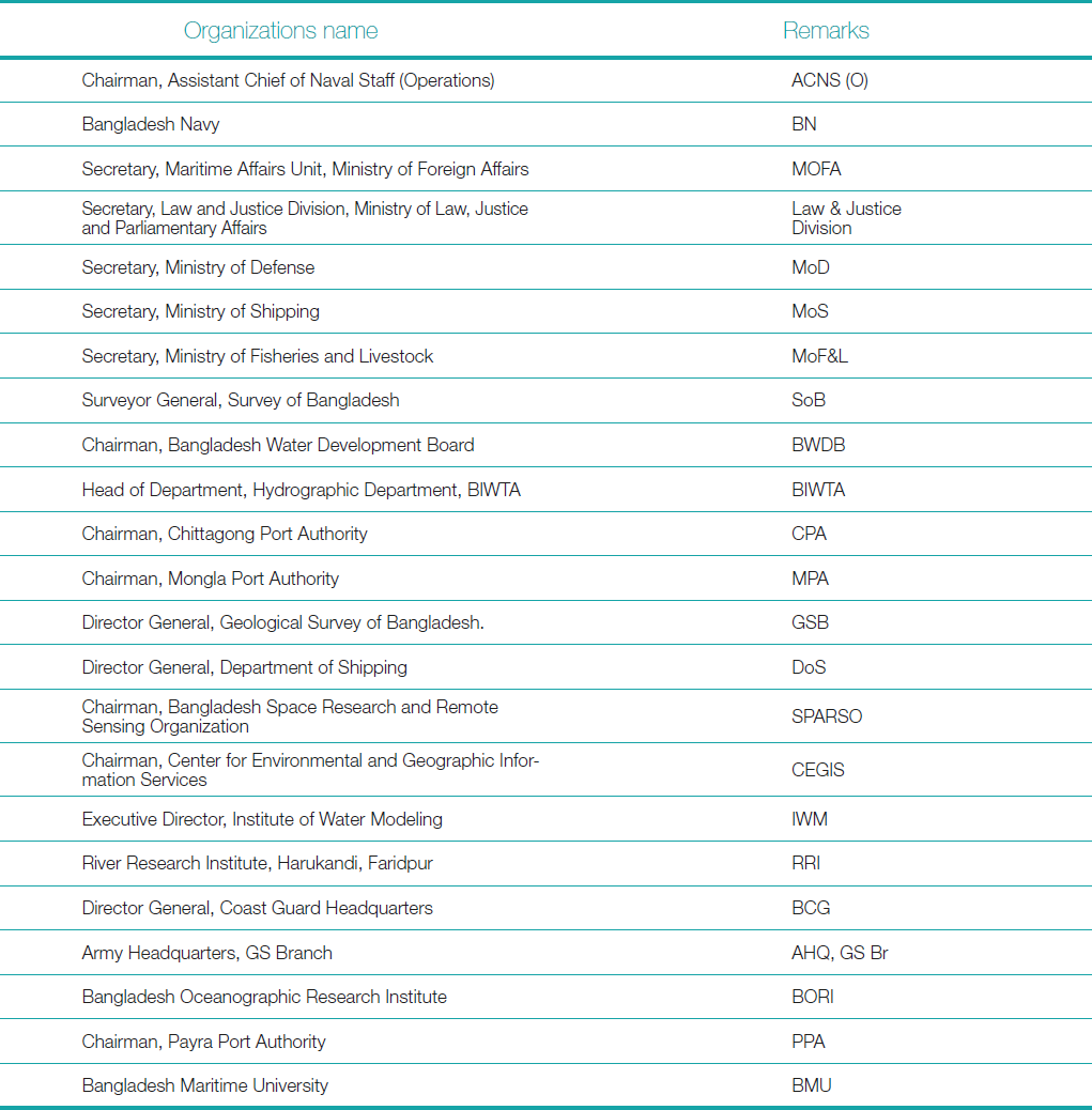
The NHC of Bangladesh serves as the apex body responsible for overseeing and coordinating hydrographic efforts across the nation. Established to foster a unified national approach to Hydrography, the NHC is chaired by Assistant Chief of Naval Staff (Operations) of the Bangladesh Navy and comprises representatives from major maritime and coastal stakeholders. These include government departments and agencies associated with ports, shipping, fisheries, energy, the environment, disaster management etc. (Table 1). The committee provides a structured platform for inter-agency collaboration and ensures that the hydrographic needs of various sectors are addressed coherently and effectively. The Chairman NHC is responsible to the Ministry of Defense (MOD) to the Government of Bangladesh.
A key mandate of the NHC is to align national hydrographic initiatives with the standards and strategic directions set by the IHO. This involves the promotion of modern hydrographic practices, adherence to international charting norms, and the integration of emerging technologies such as S-57 and S-100 based products. The committee also facilitates the sharing of hydrographic data among stakeholders to eliminate duplication of efforts and promote efficient resource utilization. Such coordination supports the development of critical infrastructure, improves navigational safety, and enhances national capabilities in marine spatial data management.
The NHC plays a pivotal role in capitalizing Hydrography for broader national interests such as the sustainable use of marine resources, coastal resilience, and the growth of the blue economy. By guiding hydrographic support for marine spatial planning, offshore energy exploration, port development, and environmental monitoring, the committee ensures that Hydrography remains central to Bangladesh’s maritime governance. It is strategic leadership and policy integration help for building national capacity, improve compliance with international obligations, and promote safer, smarter, and more sustainable maritime operations.
7 Resource sharing via NIOHC and NHC
Both the NIOHC and NHC function as key platforms for collaborative resource sharing among regional and national stakeholders. They facilitate the exchange of hydrographic assets such as survey equipment, data repositories, training materials, and skilled personnel. By pooling resources, these bodies enhance operational efficiency and build collective capacity, especially for developing nations with limited infrastructure or technical expertise.
For example, as an active member of NIOHC, BNHOC actively engages in regional resource sharing and collaboration, benefiting from access to modern survey equipment, hydrographic data, and specialized training from partner nations and organizations like the UKHO and IHO. At the national level, BNHOC shares hydrographic information and expertise with agencies such as the various port authorities, Department of Shipping, and BIWTA to ensure consistent and accurate charting. This cooperative approach enhances Bangladesh’s hydrographic capacity, reduces duplication of effort, and promotes standardized practices, ultimately strengthening maritime safety and supporting sustainable marine resource management in the region.
This shared approach to hydrographic development not only reduces redundancy but also promotes standardization and interoperability across national and regional initiatives. Through coordinated training programs, joint survey missions, and mutual access to hydrographic data, NIOHC and NHC help optimize the quality and reach of hydrographic services. Ultimately, such cooperation strengthens maritime safety, supports sustainable marine resource management, and advances the broader goals of integrated ocean governance.
8 Landward role of the NHC Chairman
Beyond traditional maritime responsibilities, the Chairman of the NHC plays a vital role in fostering inter-ministerial cooperation on projects that address the land-sea interface. These initiatives include coastal erosion mapping, port infrastructure development, shoreline management, and disaster risk reduction planning. By bridging the gap between maritime and terrestrial sectors, the NHC ensures that hydrographic data and expertise are effectively integrated into national development strategies.
This dual land-sea function highlights hydrography’s broader relevance beyond navigation, emphasizing its importance in environmental monitoring, climate resilience, and sustainable coastal development. Under the Chairman’s leadership, the NHC advocates for the inclusion of hydrographic considerations in national policy and planning processes, enabling better-informed decisions across ministries and agencies. This integrated approach strengthens the country’s ability to manage its coastal and marine zones holistically and sustainably.
For example, Bangladesh’s exposure to flooding, storm surges, and coastal inundation makes hydrographic planning essential for resilience and infrastructure protection. Chairman NHC, coordinates data-driven mapping of priority coastal areas such as the Sundarbans, Meghna estuary, Cox’s Bazar, Teknaf, and St Martin’s Islands etc. Collaboration with the NIOHC further strengthens data sharing and technical cooperation, enhancing national capacity to safeguard communities and critical assets.
9 Bangladesh Navy Hydrographic and Oceanographic Centre
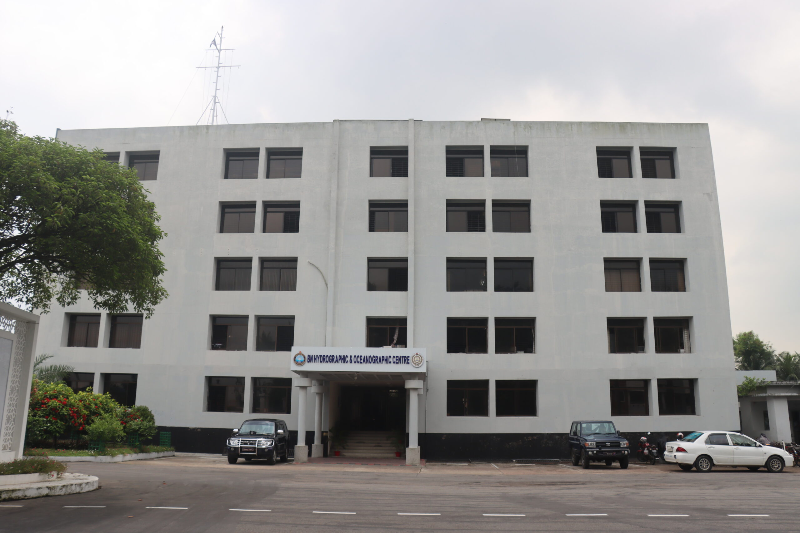
The Bangladesh Navy Hydrographic and Oceanographic Centre (BNHOC; BNHOC, 2024b) serves as the central hub for all hydrographic and oceanographic activities of the Bangladesh Navy. Its core responsibility lies in the production, procurement, and distribution of navigational charts and maritime publications to meet the operational requirements of Bangladesh Navy ships, submarines, and shore-based establishments under the supervision of BN Chief Hydrographer. These products are critical for ensuring navigational safety, supporting maritime patrols, and enabling precise route planning for both national and international waters.
Beyond the chart production, BNHOC plays an instrumental role in the maintenance, calibration, and management of a wide array of specialized equipment. This includes Hydrographic and oceanographic survey instruments, cartographic systems, meteorological tools, and advanced data processing units. The center ensures that all deployed systems are functioning optimally to support accurate data acquisition, which is essential for mission planning, maritime situational awareness, and environmental analysis. Regular servicing and upgrades of instruments ensure operational readiness and compliance with international standards.
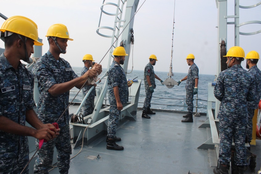
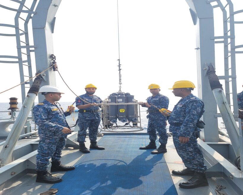
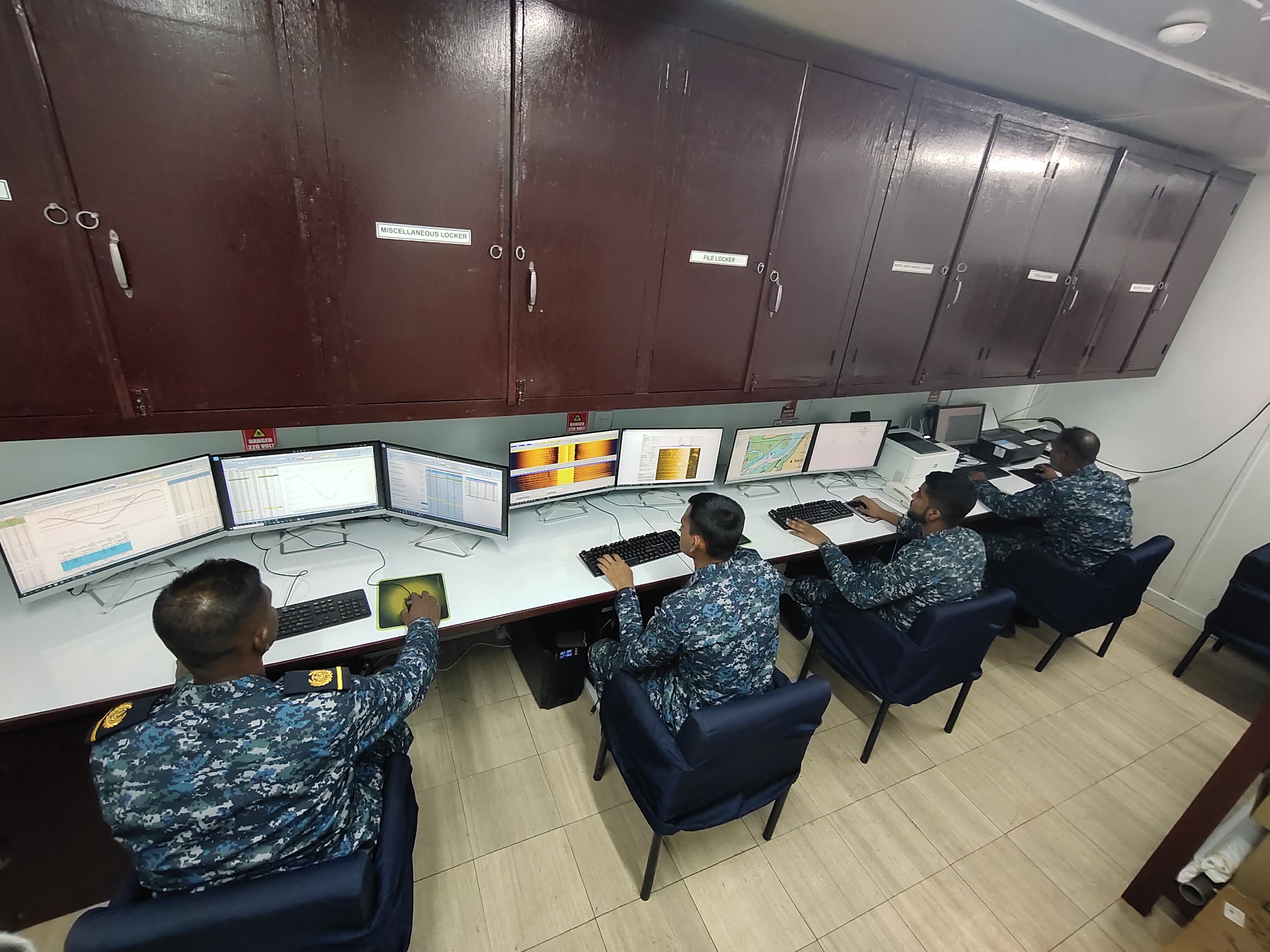
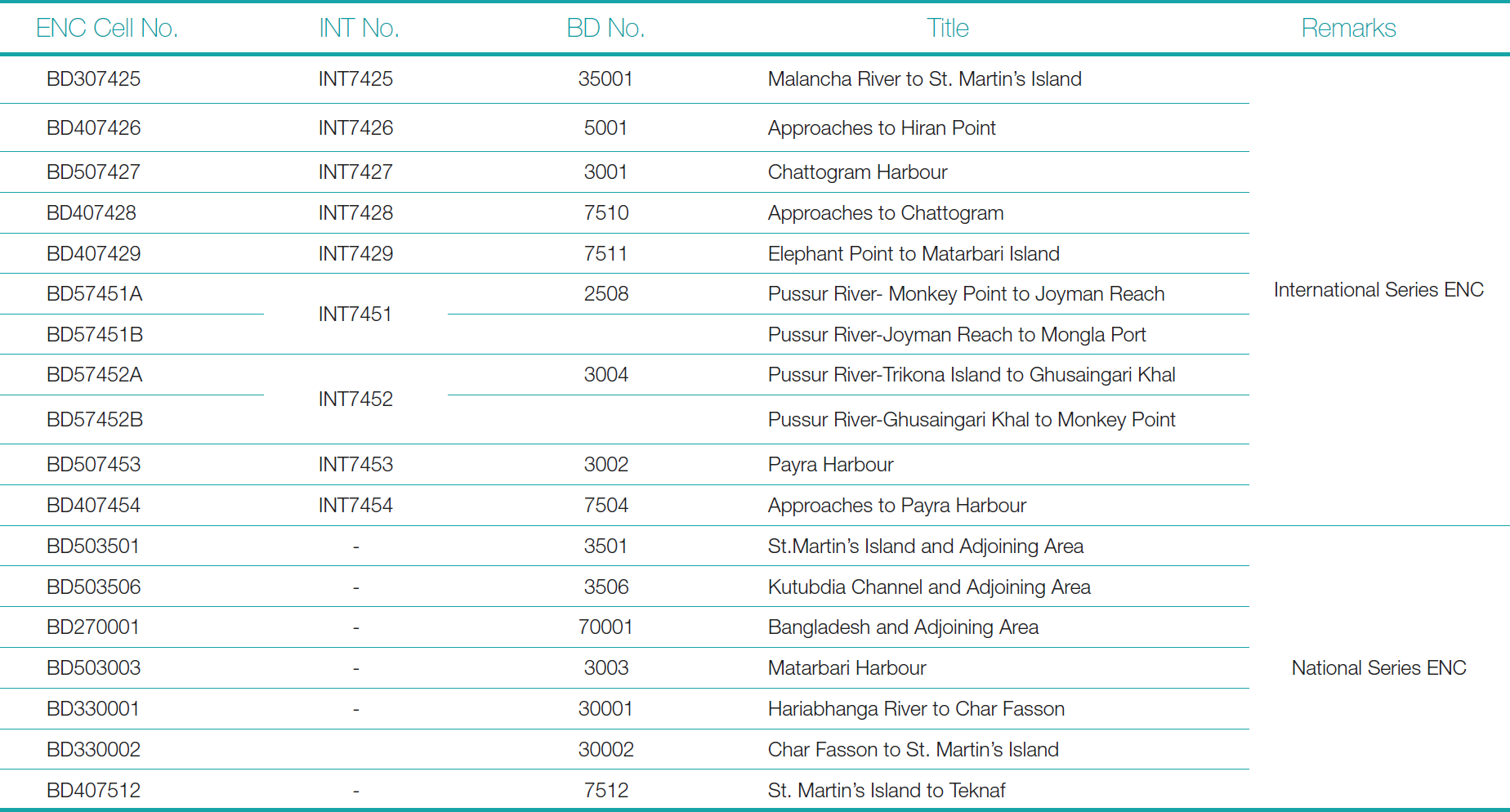
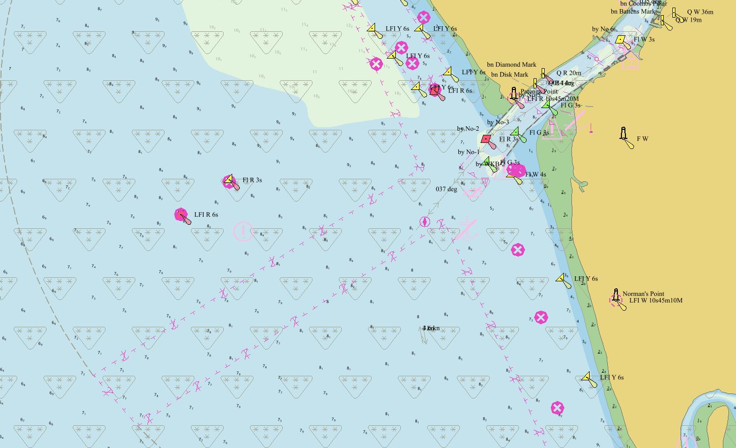
Furthermore, BNHOC contributes significantly to national and regional maritime knowledge through data management, technical support, processed hydrographic and oceanographic data aid in producing reliable nautical charts, ENCs (Tables 2 and 3), tide tables, and ocean current models (Fig. 5). These outputs not only support naval operations but also benefit civilian sectors such as port management, coastal development, disaster preparedness, and scientific research. By maintaining a high standard of technical capability, BNHOC upholds Bangladesh Navy’s commitment to safe navigation, marine resource management, and integrated maritime governance (BNHOC, 2024a)
10 BN’s capacity in producing paper charts and S-57 ENCs
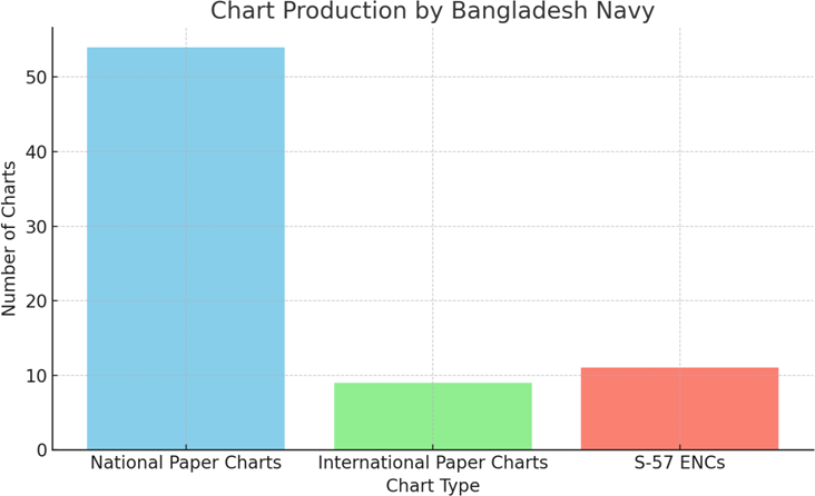
The Bangladesh Navy has demonstrated significant capability in modern hydrographic charting by producing 11 in number S-57 ENCs as shown in Fig 6, which are regularly supplied to the International Centre for ENCs (IC-ENC) and all BN ships. These charts meet international standards set by the IHO and are crucial for ensuring safe, digital navigation in Bangladesh’s waters. By contributing to the global ENC database, the Navy supports both national maritime safety and international shipping operations, reinforcing its role as a reliable chart producer in the region.
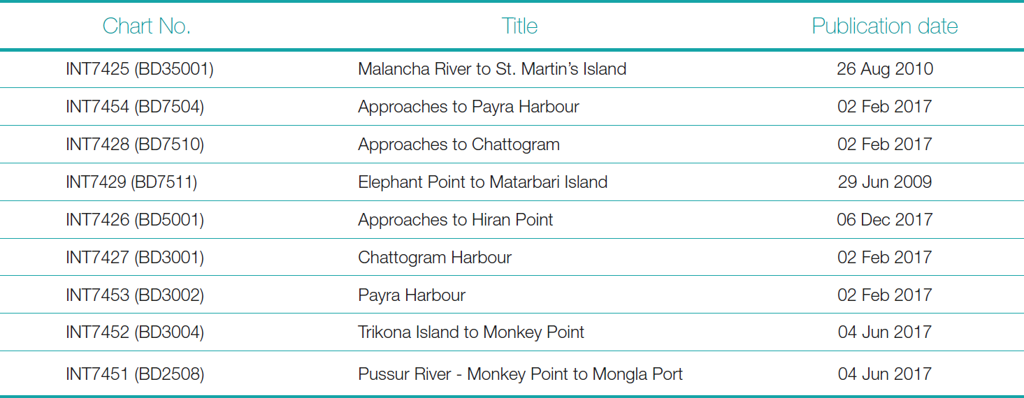
In addition to digital products, the Navy has produced 54 national series paper charts and 9 international series charts to date as shown in Fig 7. The national charts enhance coastal and inland waterway navigation, while the international charts align with global charting schemes to support safe passage through the Bay of Bengal. These efforts reflect the Bangladesh Navy’s growing technical expertise and its commitment to maintaining navigational safety, supporting maritime trade, and contributing to regional and global hydrographic initiatives.
11 Transition from paper chart to S-100 ENC (IHO directives)
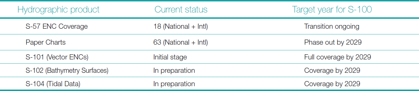
BN is at the forefront of the global transition from traditional paper charts to ENC usage, aligned with the IHO’s goal to discontinue paper charts on or after 2029 as shown in Table 4. The conversion from S-57 to S-100 standards is ongoing, ensuring compliance with next-generation hydrographic and maritime information models (IHO, 2023).
12 Actions to be taken for the transition from S-57 to S-100 standards
BN is undertaking the transition from the S-57 to the S-100 standard to align with the IHO future framework for marine data. This transition requires the formulation of a comprehensive national roadmap, coordinated through the NHC. The roadmap defines priorities, such as the development of S-101 (ENC), S-102 (bathymetry), and S-104 (tides) products, while ensuring policy alignment across national maritime stakeholders. A phased implementation plan with clear milestones will help manage the shift smoothly while maintaining existing services.
To support this transition, BN must enhance capacity through targeted training, workshops, and technical support. Personnel need to be trained in S-100 data models, production tools, and quality control techniques. Upgrading hydrographic software and equipment systems is also essential to ensure compatibility with new standards. Pilot projects on S-101 ENC production should be launched by BNHOC to test workflows and validate data handling. Close collaboration with regional partners under the NIOHC and engagement with IHO working groups will be vital for knowledge sharing and technical support.
Furthermore, BN must focus on building robust data governance and quality assurance frameworks to ensure reliable and standardized S-100 product outputs. At the same time, awareness programs for end users such as port authorities, pilots, and mariners which will help prepare stakeholders for the new products and interfaces. Through a coordinated approach involving policy, people, and technology, Bangladesh Navy can successfully lead the national implementation of S-100 standards and enhance its role in regional hydrography.
13 Bangladesh Navy Hydrographic School: A national platform for hydrography
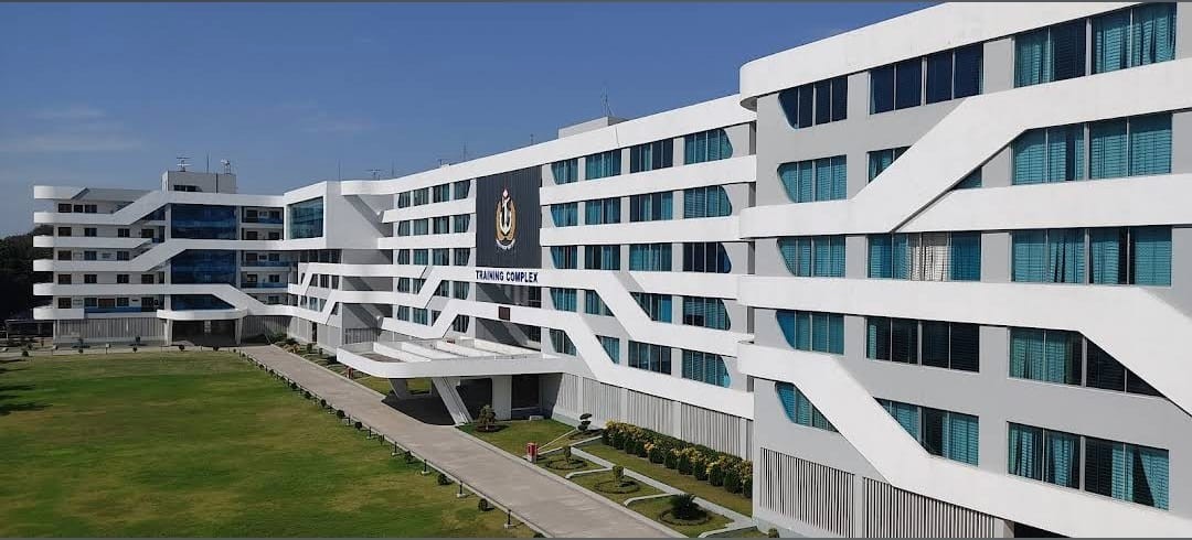
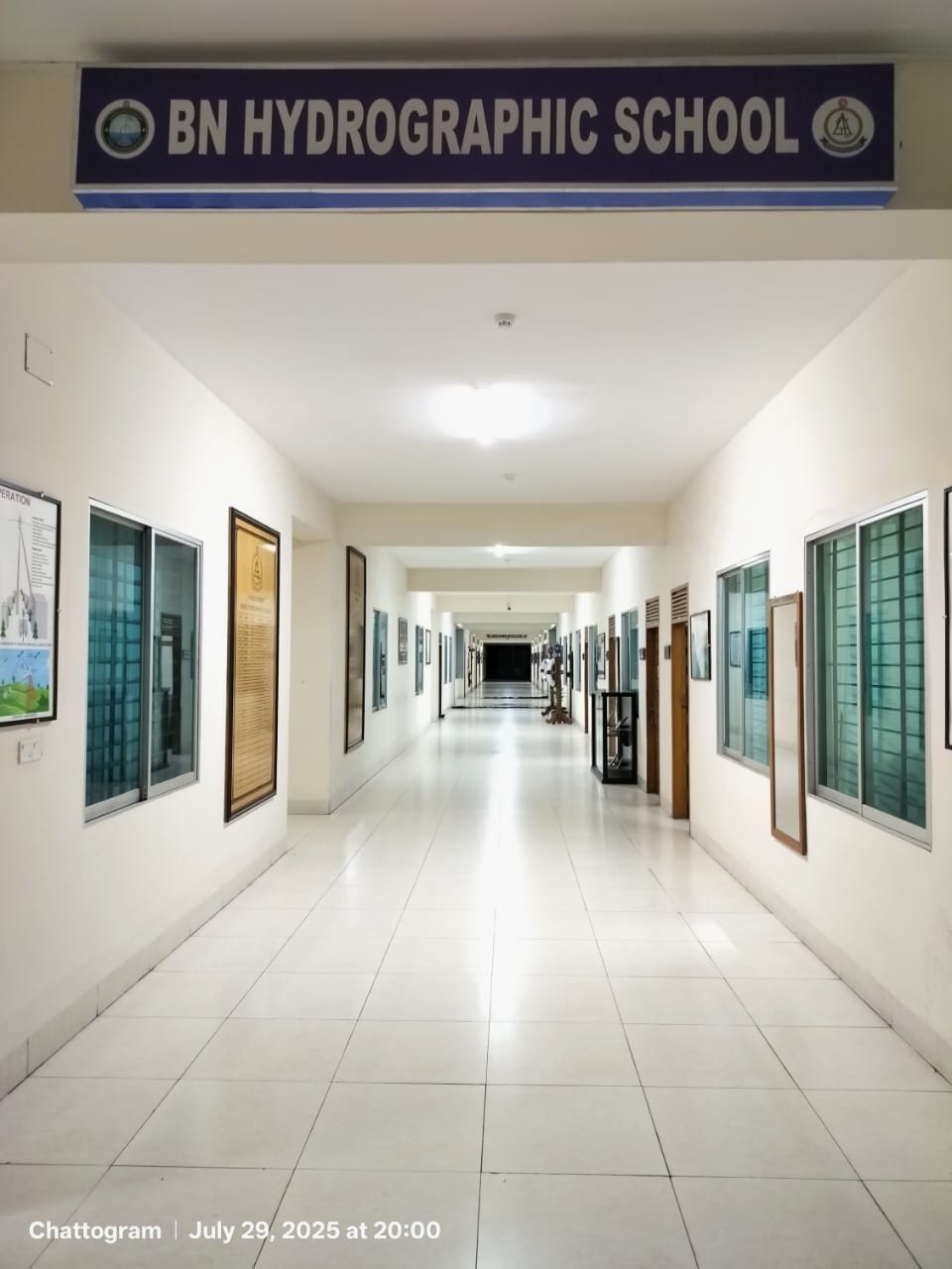
Bangladesh Navy Hydrographic School (BNHS; Fig 8), established in 1983, stands as a cornerstone institution in the maritime education and training infrastructure of Bangladesh. Dedicated to producing skilled Hydrographer capable of supporting national, regional, and international maritime initiatives, BNHS has consistently evolved to meet the growing demands of the hydrographic community under the supervision of BN Chief Hydrographer. In 2005, the school achieved a significant milestone when it was formally recognized by the International Board on Standards of Competence for Hydrographic Surveyors and Nautical Cartographers (IBSC), operating under the joint auspices of the International Federation of Surveyors (FIG), the IHO, and the International Cartographic Association (ICA), to deliver a Category ‘B’ basic hydrography course. It was again recognized in 2010, 2015 and 2020, as a Category B programme, reaffirming the institution’s compliance with international standards and its continued commitment to excellence in hydrographic education. This recognition is valid for the year 2025, and the renewal process for the period 2026 to 2030 is currently underway.
Over the past two decades, BNHS has conducted a total of 18 Category ‘B’ hydrography courses between 2005 and 2025. These training programs have successfully qualified 136 professionals, including 81 officers from the Bangladesh Navy, 27 personnel from Bangladesh Inland Water Transport Authority (BIWTA) and various port authorities, as well as 28 international participants from friendly foreign nations. This diverse participation reflects BNHS’s growing reputation as a regional hub for hydrographic training and its role in fostering international cooperation and capacity building in the maritime domain.
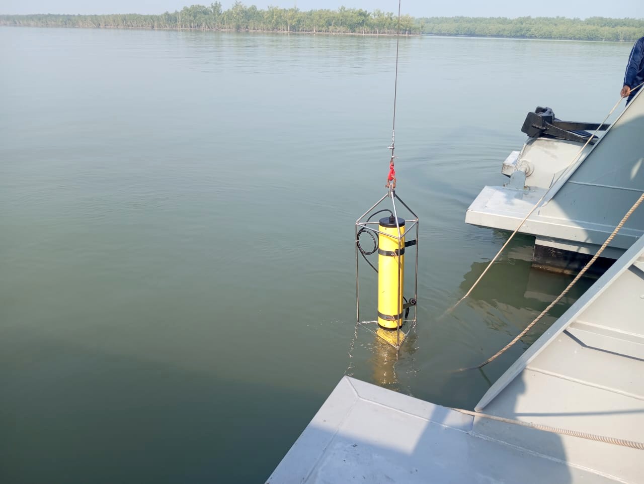
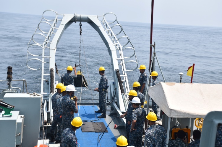
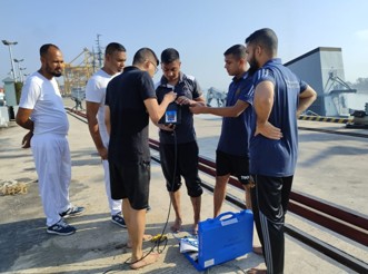
In addition to its success in delivering Category ‘B’ training, BNHS has also contributed significantly to the professional development of hydrographic experts (Fig 9). A total of 33 Bangladesh Navy officers, after obtaining their Category ‘B’ qualification from the school, have progressed further to successfully complete the more advanced Category ‘A’ Hydrography Course from internationally accredited institutions. This progression not only strengthens the Bangladesh Navy’s own hydrographic capabilities but also enhances its ability to lead and support complex hydrographic and oceanographic missions both at home and abroad.
Today, BNHS remains committed to advancing hydrographic education in line with emerging global standards, including the adoption of S-100-based training frameworks and integration of modern technologies such as GNSS positioning, LiDAR, Multibeam Echo Sounders, and Marine Spatial Data Infrastructure (MSDI). Through continuous professional development, international collaboration, and quality assurance, the school plays a pivotal role in supporting Bangladesh’s maritime ambitions, including the sustainable development of the blue economy and regional maritime safety and security.
As Bangladesh assumes greater leadership roles within the international hydrographic community including chairing the NIOHC, institutions like BNHS will be instrumental in shaping the future of hydrography in the region. Recently, BNHS has received confirmation that the Category ‘A’ long hydrography course has been recognized. BNHS will conduct the said course from 2026.
14 Integration of maritime stakeholders
Bangladesh is successfully integrating a wide range of maritime stakeholders including the BN, Bangladesh Coast Guard (BCG), Bangladesh Oceanographic Research Institute (BORI), port authorities, universities (i.e. Bangladesh Maritime University), fisheries, environment, energy, and disaster management sectors (Fig 10) under a unified hydrographic framework and supervision of the Chairman NHC. This strategic alignment enables coordinated planning, data sharing, and efficient use of resources, ensuring that hydrographic activities support the broader goals of maritime governance. By bringing together civil and military agencies, the NHC promotes a whole-of-government approach to managing marine and coastal affairs.
This integration fosters the development of a cohesive maritime policy framework that is essential for addressing key national priorities. It strengthens maritime security by improving situational awareness and navigation safety, supports economic growth through better port planning and marine infrastructure, and contributes to environmental protection and marine conservation by facilitating informed decision-making. Through this collaborative model, the NHC ensures that hydrography remains a foundational element in sustainable ocean governance and national development.

15 Challenges ahead
Despite its rapid advancement in Hydrography and charting capacity, Bangladesh continues to face several challenges that may affect the pace and scope of its progress in the coming years. These challenges are multidimensional and require coordinated efforts both at the national and regional levels.
15.1 Transition from S-57 to S-100 ENC
The transition from S-57 to S-100 Standards ENC poses several challenges. Firstly, it requires significant technical upgrades in chart production systems, software, and hardware to support the new standard. Capacity building is another key challenge, as specialized training and expertise are needed for Hydrographers and navigators to efficiently manage S-100 products. Financial constraints may also impact timely procurement of modern infrastructure and tools required for the transition. Additionally, ensuring data interoperability and integration with regional and global hydrographic systems demands strong coordination and compliance with IHO guidelines. For the Bangladesh Navy, the challenge extends to upgrading onboard navigation and combat management systems across its fleet to be fully compatible with S-100 ENCs, while maintaining operational readiness during the transition period.
15.2 Climate change and coastal dynamics
As one of the most climate-vulnerable countries in the world, Bangladesh’s dynamic coastline presents an ongoing hydrographic challenge. Rising sea levels, coastal erosion, siltation, and sediment deposition in riverine areas require frequent re-surveying and chart updates. The pace of environmental change in the Bay of Bengal demands adaptive survey techniques, predictive modeling, and near real-time data integration – all of which require technical readiness and adequate resources.
15.3 Technological and digital infrastructure gaps
Although Bangladesh Navy has made significant strides in digital Hydrography, the broader national infrastructure still faces gaps. Bandwidth limitations, cyber security vulnerabilities, and lack of seamless inter-agency data-sharing protocols pose risks to building an integrated MSDI. Additionally, real-time data transmission from remote survey platforms and offshore locations remains an area that needs technological reinforcement.
15.4 Skilled human resource development
BNHS has been providing the Basic Hydrography Category B course since 2005 whilst the demand for Hydrographers, oceanographers, and geospatial analysts continues to rise. Recently the same institution has gained Recognized by IBSC for its Category ‘A’ long Hydrography course. BN will conduct the Category ‘A’ course in the 2026. Retaining trained professionals, adapting to evolving standards like S-100, and providing continuing education opportunities are ongoing challenges, particularly as global hydrographic competencies are becoming more complex and data-driven.
15.5 Budgetary constraints
Hydrographic operations, especially in transitioning from traditional charting methods to digital platforms such as S-100, require significant financial investment. From acquiring survey vessels like the HMS Enterprise to procuring advanced equipment such as Multibeam Echo Sounders, Side Scan Sonar, AUVs etc., the cost burden on a developing nation like Bangladesh remains high. While support from development partners and international agencies partially offsets this burden, sustained investment from the national treasury is critical to meet long-term goals.
16 Future plans beyond 2025
Looking beyond the 2025–2027 chairmanship of NIOHC, Bangladesh envisions a broader and more strategic role in the global hydrographic community. The roadmap for the post-2027 period is guided by a commitment to innovation, regional leadership, and maritime sustainability.
16.1 Becoming a regional S-100 charting hub
By 2028, Bangladesh aims to position itself as a regional charting center for S-100 (Universal Hydrographic Data Model) data products, offering services not only to domestic stakeholders but also to NIOHC member states with limited ENC production capacity. This would include generating and maintaining S-101 ENCs, S-102 (Bathymetric Surfaces) and S-104 (Tidal Data Products) using high-resolution data from its upgraded fleet and hydrographic labs.
16.2 Establishment of a national marine data repository
Plans are underway to build a centralized marine geospatial data repository under the NHC framework. This repository will integrate data from hydrographic surveys, oceanographic research, port operations, and environmental studies. It will serve as the national backbone for Marine Spatial Planning (MSP), maritime research, disaster preparedness, and blue economy development.
16.3 Expansion of international collaboration
Beyond the Indian Ocean, Bangladesh seeks deeper engagement with global hydrographic communities such as the East Asia Hydrographic Commission (EAHC) and the Intergovernmental Oceanographic Commission (IOC). Participation in international research expeditions, co-hosting of workshops, and staff exchanges are part of this forward-looking agenda.
16.4 Full ENC coverage and S-100 integration by 2029
In alignment with the IHO’s global initiative, Bangladesh is targeting complete national ENC coverage under the S-101 standard by 2029, in preparation for the global phase-out of paper charts. This will involve automated chart update systems, improved metadata services, and direct integration with navigational systems onboard domestic and foreign vessels.
16.5 Creating a blue economy Decision Support System
Hydrography will play a central role in the development of a blue economy Decision Support System (DSS), a GIS-based platform that integrates economic, environmental, and navigational data to support decision-making by government agencies, investors, and planners. It is envisioned as a live dashboard powered by real-time hydrographic and oceanographic feeds.
16.6 Upgrade to National Hydrographer
The role of the BN Chief Hydrographer has expanded well beyond Naval boundaries, supporting national maritime governance and international obligations. With Bangladesh’s vision to become a regional S-100 charting hub, establish a National Marine Data Repository, and achieve full ENC coverage by 2029, Hydrography has become central to the nation’s maritime strategy. To reflect this elevated scope and ensure effective coordination with ministries, port authorities, research institutions, and global bodies, it is planned to upgrade the position from BN Chief Hydrographer to the National Hydrographer to the Government of Bangladesh. This up gradation would align the country with international best practices and strengthen Bangladesh’s leadership in the global hydrographic community.
17 Recommendations
Foster regional cooperation: Strengthen collaboration with all the members of NIOHC to enhance data sharing, joint surveys, and technical assistance.
Advance S-100 implementation: Develop a national and regional roadmap for a smooth transition to S-100 based products and services.
Expand capacity building efforts: Enhance training programs (Cat A and Cat B), and seminar through BN Hydrographic School and conduct regional workshops.
Integrate national stakeholders: Strengthen the National Hydrographic Committee (NHC) to coordinate hydrographic efforts across agencies and sectors.
Support the blue economy and MSDI: Utilize hydrographic data for sustainable marine development and accelerate the establishment of MSDI.
Upgrade to National Hydrographer: Upgrade the BN Chief Hydrographer to National Hydrographer under the Government of Bangladesh to effectively address expanded national and international hydrographic responsibilities.
18 Conclusion
Bangladesh Navy’s leadership in regional Hydrography, through the chairmanship of the NIOHC and proactive role in the NHC, marks a significant milestone in the maritime journey of the country. This leadership reflects Bangladesh’s strategic commitment to enhancing maritime safety, economic development, and regional cooperation. As the custodian of national hydrographic responsibilities, the Navy has not only advanced domestic charting and survey capabilities but also emerged as a key contributor to the international hydrographic region.
The vision articulated by the current NIOHC Chair, aligned with IHO’s strategic goals, emphasizes innovation, capacity building, and data integration, particularly in transitioning towards S-100 standards. Bangladesh Navy’s focus on multilateral partnerships, technology driven solutions, and sustainable use of marine resources reflects a broader regional vision where Hydrography becomes a cornerstone of safe navigation, climate resilience, and blue economy initiatives. Through collaboration with regional stakeholders and technical bodies, Bangladesh is fostering an inclusive approach that supports both national priorities and international hydrographic development.
Looking ahead, the Bangladesh Navy is well-positioned to lead the hydrographic domain through emerging challenges and opportunities. Also, the NIOHC has given an opportunity to lead the hydrographic field. With strengthened institutional mechanisms, increasing technical competence, and a clear strategic direction, the Navy is advancing not only its own capabilities but also contributing to collective regional resilience. The path forward involves deepening integration, addressing digital and environmental challenges, and preparing for future roles such as becoming a regional S-100 data service hub and thereby ensuring Bangladesh retains a lead role in shaping the hydrographic future of the Indian Ocean region.
References
BNHOC (2024a). CHARTS. Bangladesh Navy, New Mooring, Chattogram-4218, Bangladesh. http://bnhoc.navy.mil.bd/charts (last accessed 19 July 2025).
BNHOC (2024b). Hydrographic & Oceanographic Center (BNHOC). Bangladesh Navy, New Mooring, Chattogram-4218, Bangladesh. http://bnhoc.navy.mil.bd/: http://bnhoc.navy.mil.bd/ (last accessed 22 August 2025).
IHO (2020). Strategic Plan for 2021–2026. International Hydrographic Organization, Monaco. https://iho.int/uploads/user/About%20IHO/Strategic%20Plan/IHOSP2021_2026_
final.pdf (last accessed 31 October 2025).
IHO (2023). Report of the IHO Hydrographic Services and Standards Committee to the 7th Meeting of the IHO Council. International Hydrographic Organization, Monaco. https://iho.int/uploads/user/About%20IHO/Council/council7/C7_2023_04.1A_EN_
HSSC_Report_to_C7_ver1.0.pdf (last accessed 31 October 2025).
IHO (2025). North Indian Ocean HC. International Hydrographic Organization, Monaco. https://iho.int/en/north-indian-ocean-hc (last accessed 27 June 2025).
ISPR (2025). Bangladesh Navy Taken Over the Chairmanship Of North Indian Ocean Hydrographic Commission (NIOHC). Inter Services Public Relation Directorate (ISPR), Dhaka, Republic of Bangladesh. https://ispr.gov.bd/en/bangladesh-navy-taken-over-the-chairmanship-of-north-indian-ocean-hydrographic-commission-niohc/ (last accessed 2 November 2025).
Sarker, S. and Islam, M. A. (2018). From science to action: Exploring the potentials of Blue Economy for enhancing economic sustainability in Bangladesh. Ocean & Coastal Management, 157, 180–192. https://doi.org/10.1016/j.ocecoaman.2018.03.001