


Abstract
1. INTRODUCTION
While public agencies can conduct business as usual on their own, agencies that are interacting with their stakeholders and the public can excel in their services and be more readily accepted by the public. Congress directed NOAA to form an advisory panel to ensure regular communications and enrich the interactions with stakeholders from industry, academia, scientific institutes, organizations as well as the public. The advice from this panel supports NOAA’s strategic objective to improve the nation’s marine transportation system, marine commerce and the Blue Economy with world-class products and services that will help ensure safe, efficient and environmentally sound marine transportation. Experts in the field serve as members of the Federal Advisory Committee and provide thoughtful comments on the foundational navigation, positioning, and observations data, products, and services needed for climate change and coastal resilience.
2. NOAA’S COMMITMENT TO STAKEHOLDER INVOLVEMENT AND FEEDBACK
NOAA’s commitment to its diverse stakeholders which include but are not limited to other federal agencies, defense and national security, local and state government, academia, and the private community is paramount to the successful implementation of its policies. Over the years, issue papers authored by members of HSRP helped the NOAA administration to focus on issues and recommendations that matter the most. The most recent example on HSRP involvement along these issues is the review and the recommendations that HSRP sent to NOAA’s Administrator regarding the implementation plan for the National Strategy for Mapping, Exploring, and Characterizing the United States Exclusive Economic Zone (NOMEC) and Alaska Coastal Mapping Strategy (ACMS). In those recommendations, the HSRP recommended an increased emphasis should be placed on public/private partnerships with mechanisms established to allow early, open and full engagement in planning and implementation.
3. HSRP HISTORY
In October 2003, then Secretary of Commerce, Mr. Don Evans established the Hydrographic Services Review Panel as directed by the Hydrographic Services Improvement Act of 2002, Public Law 107-372.
Over time the Panel has provided over 307 recommendations to the NOAA Administrator and served as a reminder and catalyst for change for dozens of issues and topics. The HSRP is closely linked to the goals for the U.S. Marine Transportation System (MTS) in support of commercial and recreational mariners, and also to benefit NOAA’s stewardship of the nation’s coastal and ocean resources, and includes the data required for coastal resilience goals to respond to climate change. Early on, the HSRP developed two detailed reports documents in 2007 and 2010 “Most Wanted Hydrographic Service Improvements Federal Advisory Committee Update Report,” highlighting the key hydrographic services and the panel’s best advice to the NOAA, the Administration, and Congress regarding near term priorities and direction. A link to the report is below. The HSRP developed white papers and issue papers with a deeper dive on topics of interest such as the six noted below.
- OCS’s unmanned systems with the “HSRP Comments OCS Autonomous Strategy, Sept 2017”. https://www.nauticalcharts.noaa.gov/hsrp/recommendations/2016/HSRP-comment-NCMS-final-22Aug2016.docx
- “HSRP Recommendations to the National Coastal Mapping Strategy”. https://www.nauticalcharts.noaa.gov/hsrp/recommendations/2016/HSRP-comment-NCMS-final-22Aug2016.docx
- “A Report from HSRP Emerging Arctic Priorities working group Sept 2015”. https://www.nauticalcharts.noaa.gov/hsrp/workinggroups/HSRP-ltr-and-Report-Arctic-WG-Group-Sep2015.pdf
- A series of 14 short issue papers and other NOAA requests.
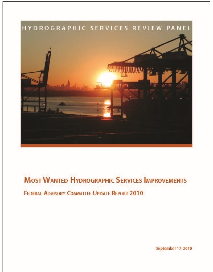
- MOST WANTED HYDROGRAPHIC SERVICES IMPROVEMENTS FEDERAL ADVISORY COMMITTEE UPDATE REPORT2010 https://www.nauticalcharts.noaa.gov/hsrp/2010_Most_Wanted_%20Hydrographic_Services_Improvements.pdf
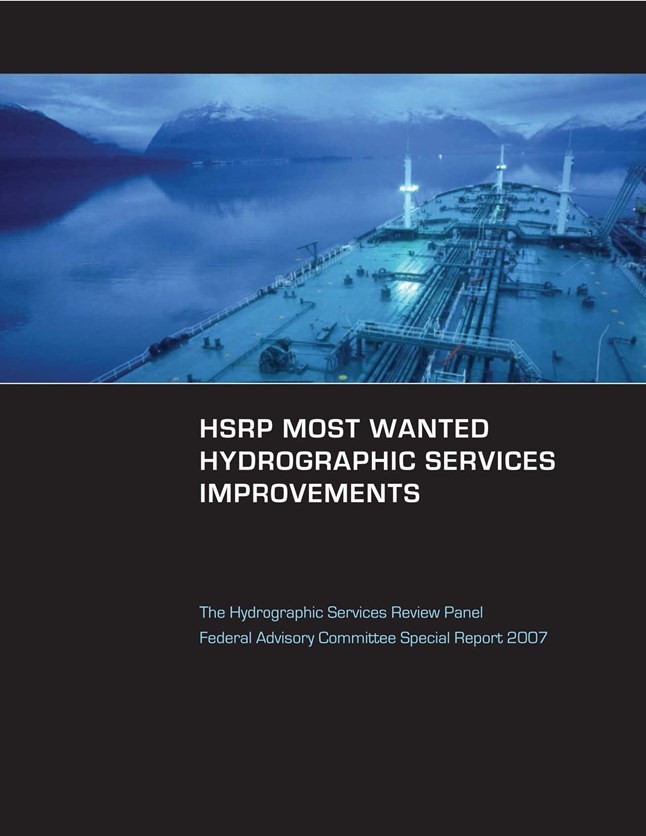
- MOST WANTED HYDROGRAPHIC SERVICES IMPROVEMENTS, The Hydrographic Services Review Panel Federal Advisory Committee Special Report 2007 https://www.nauticalcharts.noaa.gov/hsrp/archive/general/HSRPspecrpt2007.pdf
4. HSRP TERMS OF REFERENCE /ROLES/ OBJECTIVES
The HSRP is a federal advisory committee that provides NOAA with independent advice on improving the quality, efficiency, and usefulness of NOAA’s navigation-related products, data, and services. The HSRP advises the NOAA Administrator about its navigation (i.e. nautical charts and ENCs), physical oceanographic (i.e. tides & water levels), geospatial, positioning, and coastal and shoreline programs, products, and services. There are two public meetings each year, often in different port regions at which public comments from stakeholders and partners are sought. Most of the meetings include a webinar capability for those not in the area.
The HSRP public meetings focus on topics related to the navigation, positioning and observations portfolio of the National Ocean Service. The meetings often include the following: updates from the three HSRP working groups (WG); the Planning and Engagement WG, Technology WG, and Arctic Priorities WG; development, discussion and finalization of issue papers and recommendations to NOAA; comments and suggestions regarding white papers, regional, state and national priorities; and review and discussion of proposed priorities for the HSRP. Link to the three working groups: https://www.nauticalcharts.noaa.gov/hsrp/workinggroups.html
The HSRP mainly provides recommendations for three National Ocean Service offices and one partner – the National Geodetic Survey (NGS), the Center for Operational Oceanographic Products and Services (CO-OPS), the Office of Coast Survey (OCS), as well as the NOAA-University of New Hampshire’s (UNH) Joint Hydrographic Center (JHC). The HSRP occasionally meets or partners with other NOAA Federal Advisory Committees such as the NOAA Science Advisory Board and the Integrated Ocean Observing System (IOOS) Advisory Committee.
Link to the latest version of the HSRP charter, legal statutes, and by-laws:
https://www.nauticalcharts.noaa.gov/hsrp/charter-bylaws-hsia-statute.html
HSRP Charter:
https://www.nauticalcharts.noaa.gov/hsrp/charter/hsrp-charter-signed-8-28-19.pdf
5. MEMBERSHIP
There are 15 voting members who serve in their capacity as subject matter experts along with four non-voting members composed of the two Directors from NOAA’s CO-OPS and NGS and the two co-directors of the NOAA-UNH JHC. The voting members are considered super stakeholders and serve in their personal capacity and not as a representative of a sector. The Panel is composed of a diverse field of experts in hydrographic surveying, vessel pilotage, port administration, tides and currents, coastal zone management, geodesy, GIS and geospatial, recreational boating, marine transportation, institutes and academia, and related fields.
The role of the members is primarily to advise the NOAA Administrator. They participate, they discuss in public meetings, bring their cumulative experience and knowledge to the discussions and analysis, and ultimately decide/conclude on which topics and initiatives should be forwarded to the NOAA Administrator for consideration and action. The recommendations are forwarded as letters, issue papers, and position papers. This process has proven to be productive and extremely informative. The opinions and advocacy of the members have proven to be both diverse and passionate. The members track ongoing interests and three working groups meet to allow for deeper discussion. A link to the member biographies: https://www.nauticalcharts.noaa.gov/hsrp/panel.html.
6. RECENT AND CURRENT ISSUES
The HSRP addresses a diverse and broad spectrum of critical and priority issues. The HSRP especially directs its discussion and recommendations to three offices at NOS – the Office of Coast Survey, National Geodetic Survey and the Center for Operational Oceanographic Products and Services. There are a series of short one page issues papers with recommendations as well as longer position papers.
Recent issues papers and recommendations topics: sea level rise; Precision Marine Navigation; charting and maritime Arctic priorities; NOAA hydrographic fleet modernization; and Artificial Intelligence. There are long term and ongoing issues advocated by the HSRP.
Among the recent discussion topics are the following:
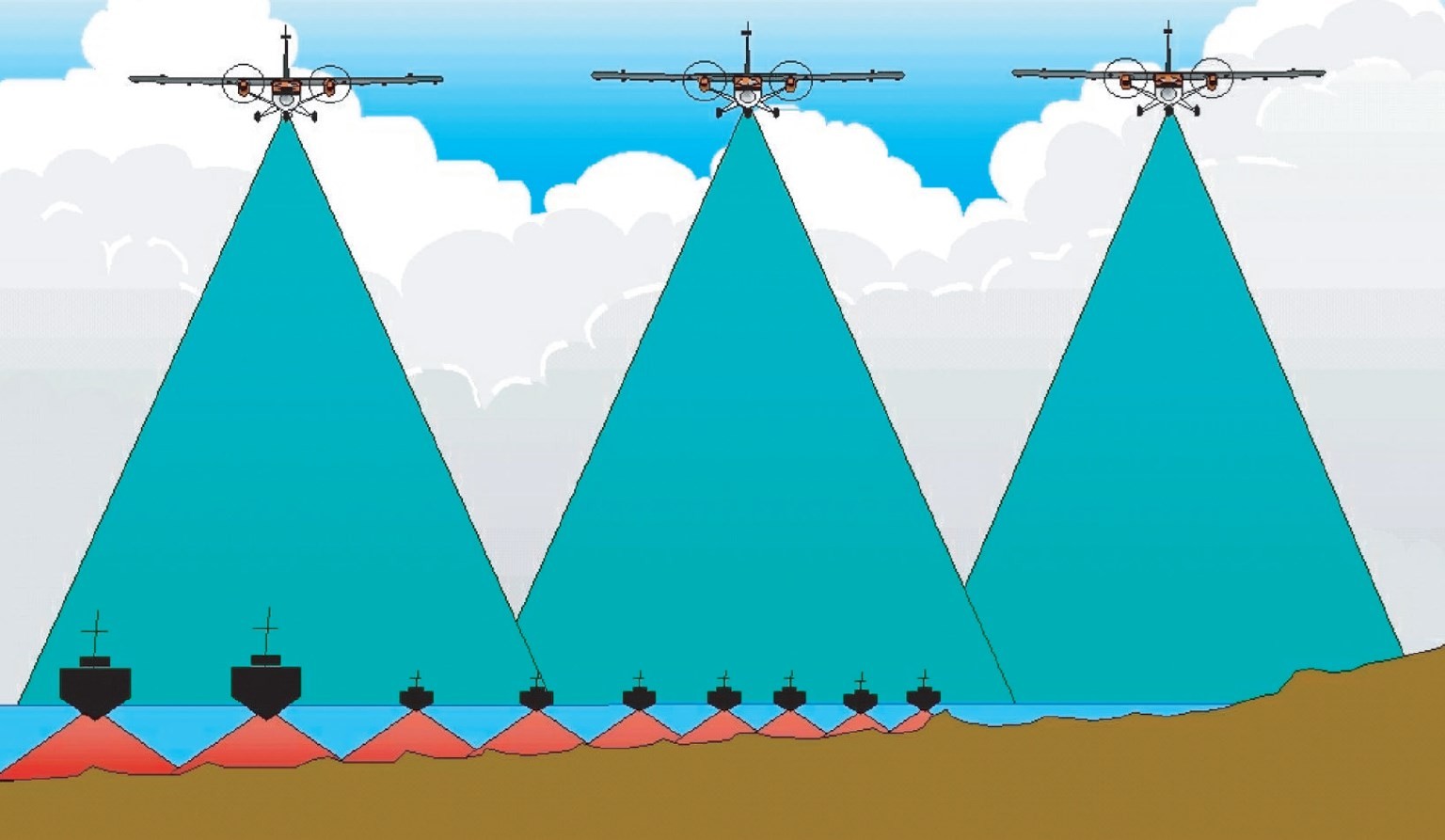
- Ocean mapping protocols and standardization. This includes the additional need for high resolution data and focus on the nearshore component in less than 40 meters.
- Continue operations and expansion of water level data, including focus on challenges in remote areas where access is limited.
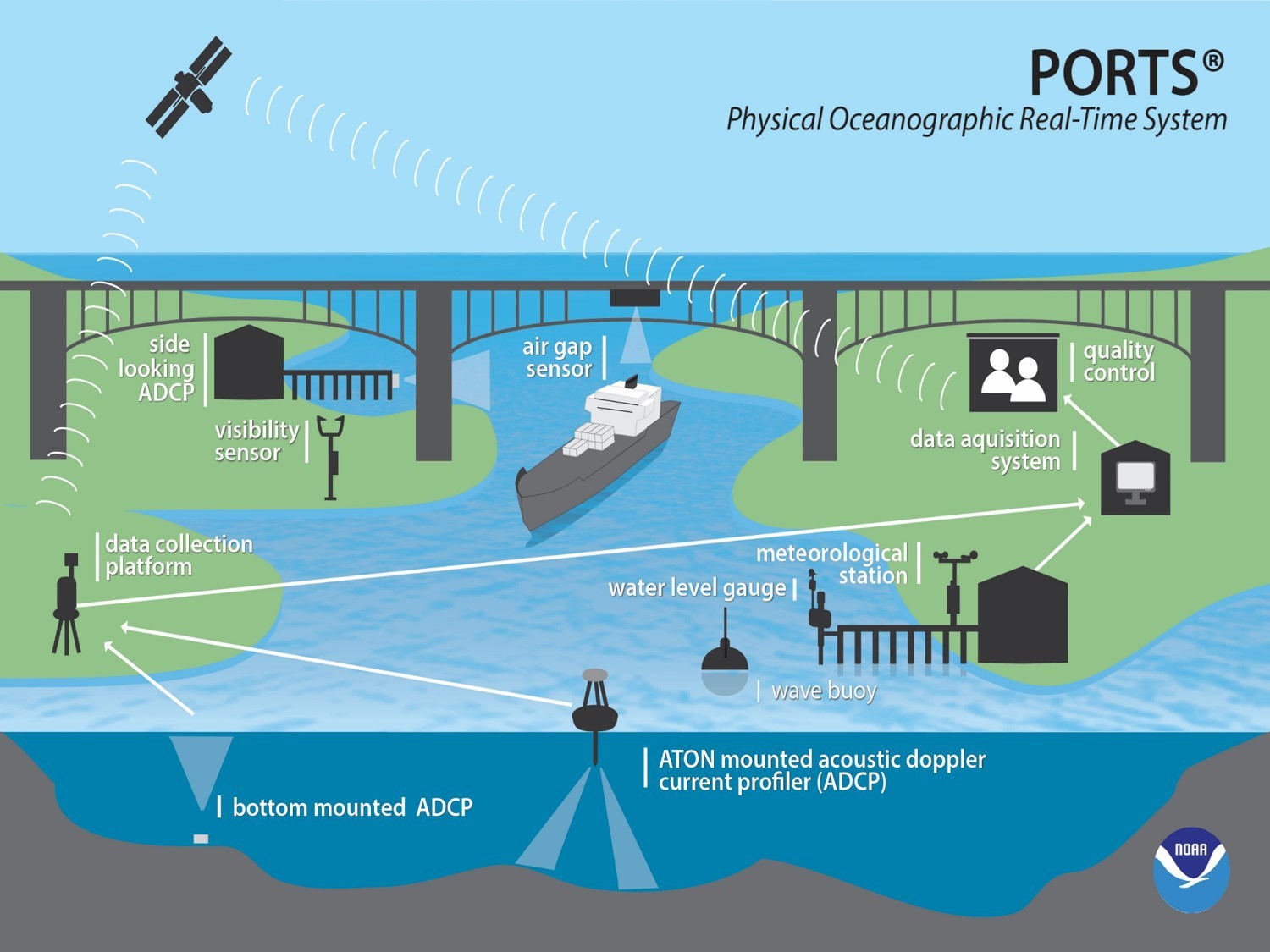
- Advocate for the continued operations and expansion of the Physical Oceanographic Real-Time System (PORTS®) and full funding from congress for this important program for safe and efficient navigation.
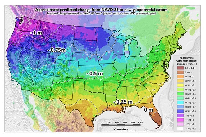
- Support for the modernization of the National Spatial Reference System (NSRS), the framework for the United States geospatial data.
- Discuss adaptive resilience to climate change, including how NOAA can make an impact in this area and the importance of the data backbone that NOS offices provide.
- Data sharing with Integrated Ocean and Coastal Mapping- and most recently with the impact of sustainable renewables with offshore wind energy.
- Defining NOAA’s role in charting and operations.
- Explore ways to enable precision marine navigation technology and highlight NOAA’s role in providing supporting data.
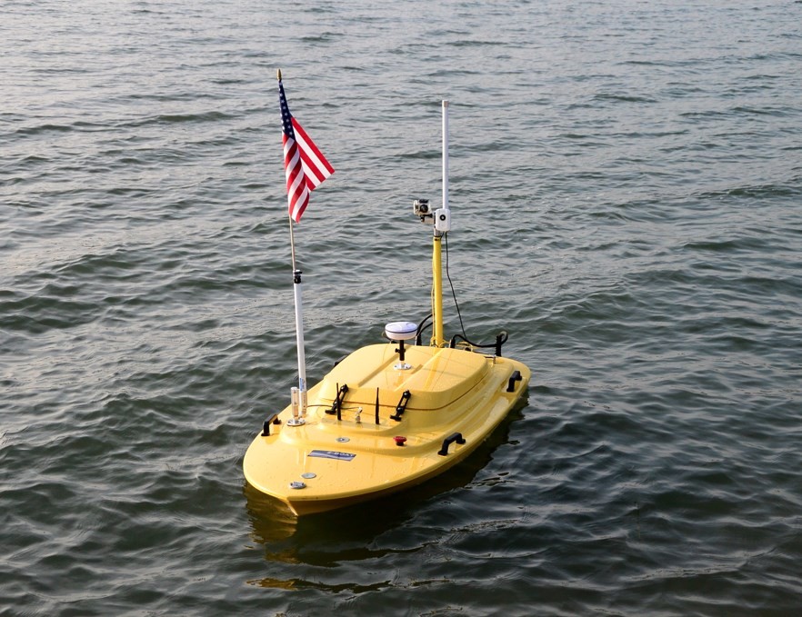
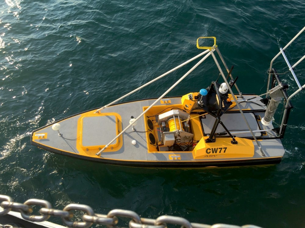
- Follow technology trends in autonomous systems for mapping the ocean floor.
Below are links and the two of the most recent and important examples of the HSRP position papers. Recommendations are provided to the NOAA Administrator sent after each public meeting. In summer and fall 2020, the HSRP wrote two position papers, one for the ACMS and the second for the NOMEC. Each paper included dozens of recommendations as summarized below. The list of HSRP recommendations and papers is at:
https://nauticalcharts.noaa.gov/hsrp/recommendations.html
1. Hydrographic Survey Review Panel (HSRP) Recommendations to NOAA on the Implementation Plan for the Alaska Coastal Mapping Strategy (ACMS)
The HSRP supported all goals and objectives of the Alaska Coastal Mapping Strategy and prepared a detailed whitepaper with recommendations for NOAA’s Implementation Plan for mapping the intertidal zone. The paper was authored by HSRP members with expertise in coastal mapping and was discussed and approved at the HSRP public meeting on September 23-24, 2020..
2. Hydrographic Survey Research Panel (HSRP) Recommendations to NOAA on the Implementation Plan for the National Strategy for Ocean Mapping, Exploring, and Characterizing the U.S. Exclusive Economic Zone HSRP NOMEC position paper FINAL https://nauticalcharts.noaa.gov/hsrp/meetings/webinar-september-2020/letter/hsrp-nomec-position-paper-final-with-public-comments.pdf
This position paper provides the HSRP recommendations to the National Oceanic Atmospheric Administration Administrator (NOAA) on the development of the implementation plan for the National Strategy for Ocean Mapping, Exploring and Characterizing the U.S. Exclusive Economic Zone (NOMEC). The HSRP members have considered the whole document and focused recommendations in areas appropriate to their experience and expertise. This is primarily related to Goal 2: Map the United States Exclusive Economic Zone (EEZ), with other comments and recommendations about other goals and objectives that relate to the mapping, including the coordination of efforts of Goal 1, the use of new technologies of Goal 3 and the building of public and private partnerships of Goal 5. This paper was discussed at the HSRP public meeting on September 23-24, 2020, along with public comments received regarding the implementation plans for NOMEC and the Alaska Coastal Mapping Strategy. Appendix A has the public comments and additional oral comments and can be found in the meeting report and transcripts posted at: https://www.nauticalcharts.noaa.gov/hsrp/meeting-webinar-september-2020.html.
7. FUTURE CHALLENGES
How NOAA keeps up with the rapidly changing climate conditions and technologies related to ocean and coastal mapping and weather modeling are among the most pressing challenges to NOAA goals in general and an area in particular where the HSRP can advise. HSRP membership should constantly evolve to include members who are involved in this changing environment and can address novel approaches.
The HSRP is tracking more than a dozen big blue economy, data, climate, resilience and ocean initiatives of NOAA and the U.S. government with a priorities matrix which includes a broad view of hydrographic services (https://www.nauticalcharts.noaa.gov/hsrp/meetings/webinar-march-april-2021/other/HSRP_PRIORITIES_MATRIX%204.10.2021.pdf.) It includes topics relating to all the navigation, observations and positioning services in OCS, CO-OPS and NGS. There are interests and emphasis in the development of the Standard Ocean Mapping Protocol, the implementation of the Alaska Coastal Mapping Strategy, Seabed 2030, updates and changes to the U.S. National Spatial Reference System (NSRS), maritime Arctic priorities, Precision Marine Navigation, replacement of the outdated NOAA hydrographic survey vessel fleet, surveying and charting technology advances, public private partnerships as well as Federal partnerships, Integrated Ocean and Coastal Mapping, coastal resilience and data, recreational boating and changes to tools such as Electronic Navigational Charts (ENC’s), Federal partnerships, autonomous navigation in restricted visibility and fog, the chart of the future, relative sea level rise and high tide flooding and full Federal funding for the PORTS® program amongst the list.
8. CONCLUSION
The HSRP members directly provide their recommendations and prioritization of programs, data, services, projects, and direction to the NOAA Administrator. Indirectly their advice may provide support and advocacy for increased budgets. HSRP provides outreach where members have contacts and connections within the U.S. navigation, observation and positioning community at large. The HRSP has been providing constructive and value-added comments, feedback, observations and suggestions to the strategic directions of NOAA. The HSRP is important to better liaise between the stakeholder needs and requirements and the products, data and services from NOS’s navigation, positioning and observations programs.
HSRP welcomes the participation of anyone interested in learning about NOAA’s navigation, observations and positioning activities and the HSRP’s role and goals, and especially those interested in contributing comments to the public meetings. The easiest way to start such involvement is to attend an HSRP public meeting or to learn about NOS’s products through its newsletters and blogs. To be added to the email announcements for HSRP meetings, send an email to the main author, Ms. Lynne Mersfelder-Lewis at lynne.mersfelder@noaa.gov . To be added to NOS blogs, you can sign up by filling in your email in the box at: NOAA Office of Coast Survey’s blog: https:// nauticalcharts.noaa.gov/updates/. You can find a sample of some of NOS’s blogs and sign up: https://oceanservice.noaa.gov/blogs.html.
9. REFERENCES & RELEVANT LINKS
HSRP has a series of recommendations and issue papers with a deeper dive on specific topics and additional recommendations to the NOAA Administrator. When requested, the HSRP also reviews NOAA white papers or other priority papers. The HSRP’s letters to the Administrator and responses are in the documentation for each meeting: https://www.nauticalcharts.noaa.gov/hsrp/meetings.html
The most recent HSRP recommendations and issue papers from the HSRP to NOAA are listed below: https://nauticalcharts.noaa.gov/hsrp/recommendations.html
HSRP Position Papers – September 2020:
Click below to download the HSRP issue papers with recommendations:
HSRP ACMS Paper FINAL https://nauticalcharts.noaa.gov/hsrp/meetings/webinar-september-2020/letter/hsrp-acms-paper-final-with-public-comments.pdf
HSRP NOMEC position paper FINAL https://nauticalcharts.noaa.gov/hsrp/meetings/webinar-september-2020/letter/hsrp-nomec- position-paper-final-with-public-comments.pdf
HSRP Issue Papers – added May 2020:
Click below to download the HSRP issue papers with recommendations:
Automation and Artificial Intelligence in NOAA’s Post-disaster Products and Services May2020 https://nauticalcharts.noaa.gov/hsrp/meetings/webinar-2020/emergency-response-ai-hsrp-final-may2020.pdf
HSRP Issue Papers – added Sept 2019:
Click below to download the HSRP issue papers with recommendations:
HSRP Sea Level Rise Issue Paper 8 October 2019 https://nauticalcharts.noaa.gov/hsrp/meetings/new-orleans-2019/committee-letter/slr-ip-hsrp-sept201-v8oct2019-final.pdf
HSRP Arctic Issue Paper 8 October 2019 https://nauticalcharts.noaa.gov/hsrp/meetings/new-orleans-2019/committee-letter/arctic-ip- hsrp-sept201-v8oct2019-final.pdf
HSRP Issue Papers – updated for May 2018:
Click below to download the HSRP issue papers with recommendations:
HSRP MGDI Blue Economy 2 May 2018 https://nauticalcharts.noaa.gov/hsrp/recommendations/2018/HSRP-MGDI-Blue-Economy-2May2018.pdf
HSRP NOAA fleet 9 May 2018 https://nauticalcharts.noaa.gov/hsrp/recommendations/2018/HSRP-NOAA-fleet-9May2018.pdf
HSRP Precision Navigation 10 May 2018 https://nauticalcharts.noaa.gov/hsrp/recommendations/2018/HSRP-Precision-Navigation-10May2018%20.pdf
HSRP Issue Papers – updated for Feb 2018:
Click below to download the HSRP issue papers with recommendations:
HSRP Charting Maritime Arctic 28 February 2018 https://nauticalcharts.noaa.gov/hsrp/recommendations/2018/HSRP-Charting-Maritime-Arctic-28feb2018.pdf
HSRP Hampton Roads Regional Pilot Project 28 Feb 2018 https://nauticalcharts.noaa.gov/hsrp/recommendations/2018/HSRP-Hampton-Roads-Regional-Pilot-Project-28feb2018.pdf
HSRP Hydrography A Core NOAA Mandate 28 Feb 2018 https://nauticalcharts.noaa.gov/hsrp/recommendations/2018/HSRP-Hydrography-A-Core-NOAA-Mandate-28feb2018.pdf
HSRP Improving Access 28 Feb 2018 https://nauticalcharts.noaa.gov/hsrp/recommendations/2018/HSRP-Hydrography-A-Core-NOAA-Mandate-28feb2018.pdf
HSRP PORTS Critical Data for Critical Decisions 28 Feb 2018 https://nauticalcharts.noaa.gov/hsrp/recommendations/2018/HSRP-Hydrography-A-Core-NOAA-Mandate-28feb2018.pdf
HSRP Rec Boating 28 Feb 2018 https://nauticalcharts.noaa.gov/hsrp/recommendations/2018/HSRP-Rec-Boating-28feb2018.pdf
HSRP Research Development 28 Feb 2018 https://nauticalcharts.noaa.gov/hsrp/recommendations/2018/HSRP-Rec-Boating-28feb2018.pdf
HSRP Surveying Charting 28 Feb 18 https://nauticalcharts.noaa.gov/hsrp/recommendations/2018/HSRP-Surveying-Charting-28feb18.pdf
HSRP US Latitudes Longitudes Elevations to Change 28 Feb 2018 https://nauticalcharts.noaa.gov/hsrp/recommendations/2018/HSRP-Surveying-Charting-28feb18.pdf
Links to the HSRP charter, legal statutes, and by-laws:
https://www.nauticalcharts.noaa.gov/hsrp/charter-bylaws-hsia-statute.html
https://www.nauticalcharts.noaa.gov/hsrp/charter/hsrp-charter-signed-8-28-19.pdf