
The area of the Colombian Caribbean Sea has historically been a privileged place for natural events, since there have been few storms, hurricanes or other meteorological phenomena from the Atlantic Ocean that have entered this sector with force. The protection provided by the chain of western Caribbean islands, the Guajira peninsula and the Sierra Nevada de Santa Marta, contribute to the weakening of these systems, which on many occasions favored these phenomena to change their trajectory by initiating a displacement. towards the northwest of the Caribbean without generating direct impacts on Colombia national territory.
During the month of November 2020, the storms “ETA” and “IOTA” erupted with the threat of affecting the islands of the Archipelago of San Andrés, Providencia and Santa Catalina. Faced with imminent arrival and destructive passage, the General Maritime Directorate (DIMAR) ordered the Oceanographic and Hydrographic Research Center of Caribbean (CIOH), Maritime Signaling Office, Harbor Master Offices and oceanographic vessels to begin preparations to face these disasters.
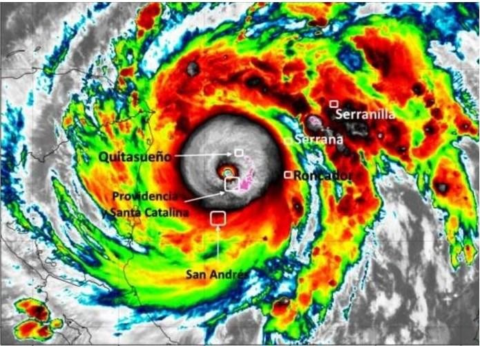
The CIOH, from the Operational Oceanography Area, carried out minute by minute meteorological monitoring and, with the Institute of Hydrology, Meteorology and Environmental Studies (IDEAM), advised the National Unit for Disaster Risk Management (UNGRD) of the high government on required actions. Thus, before the passage of ETA (Nov 5, 2020) and IOTA (Nov 15, 2020) the population was alerted to take protective measures and reduce possible human losses. These early actions prevented a dire loss of human life. Of the more than 5,000 people who inhabit Providencia Island, the most affected, only two people died.
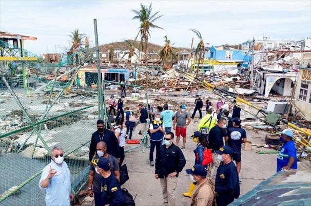
Once the devastating passage IOTA ended, the Port Authority of Providencia Island reported loss of Aids to Navigation, destruction of constructions on the coastline and almost total destruction of houses and buildings on the Island.
Almost simultaneously, the Hydrographic Service issued the required messages through NAVAREA and METAREA to inform sailors in the Caribbean Sea of the current status.
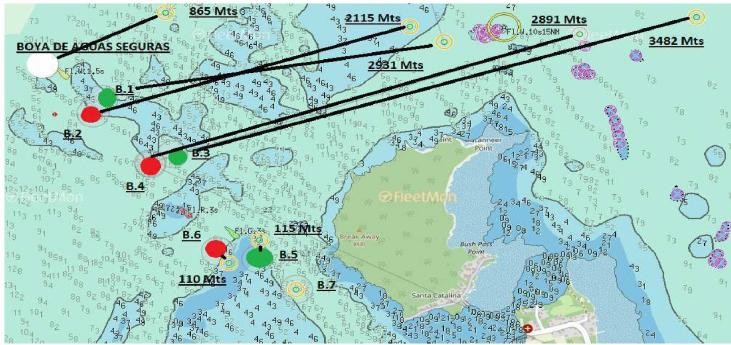
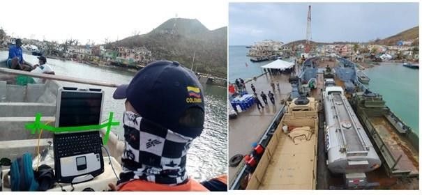
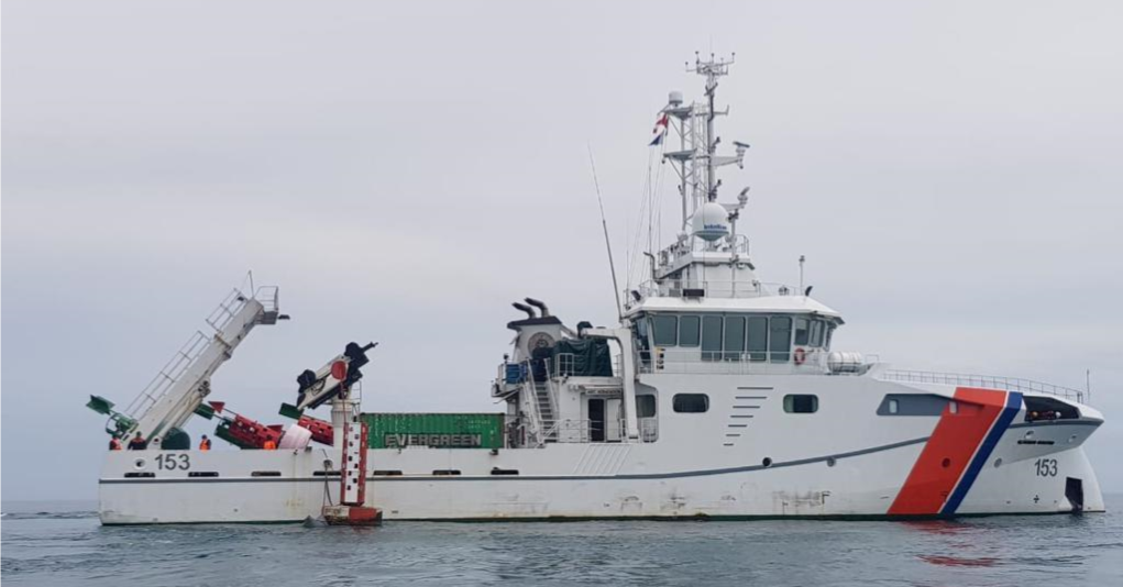
Once the storm was forecast to move towards the Island of Providencia, the human resources of the Hydrographic Service, Maritime Signaling and the “ARC Roncador” Hydrographic vessel prepared for the recovery of all the likely damages that its passage would generate, preparing the replacement buoys for the archipelago’s access channels, the hydrographic survey plan and the transport of the main humanitarian aid for the disaster site.
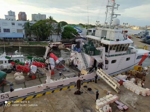
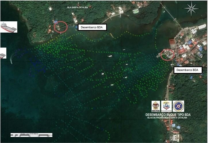
Once the hydrographic vessel “ARC Roncador” arrived in the area, surveys of the entrance to the channel of the island of Providencia were carried out. Based on this data and in accordance with the hydrographic project design, the buoy safe water and buoys N°1 and N° 2 were installed. Subsequently, with a single beam system, a survey was raised near the island to identify the safe route for units of the National Navy could enter the coast to disembark all the aid brought from the mainland.
At this point, a hydrographic survey of the Providencia canal sector started. With this information, the vessel ARC Roncador proceeded to install the recovered buoy safe water and the 6 lateral buoys.
In the following days, more hydrographic surveys were carried out according to the requirements of the coordinating authorities (National Navy and UNGRD). With this information, a route was traced for the dewatering of a grounded motor vessel and an area for new government piers was evaluated.
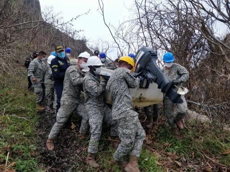
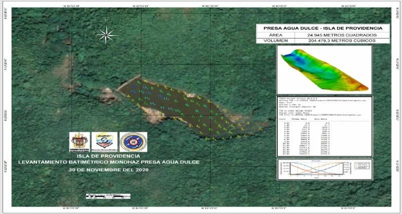
The Island of Providencia has a freshwater dam in its mountains, and in response to a request to measure its depth and condition, it was necessary for the hydrographic survey team, using their professionalism and experience, to raise the boat to about 200 meters above sea level to carry out the hydrographic survey.
Simultaneously, according to Resolution 1/2005 of the International Hydrographic Organization IHO, “Response to disasters, the national hydrographic service,” the chairs of the MACHC and SEPRHC hydrographic commissions were contacted, through videoconferences, reporting Colombia remained self-sufficient in the hydrographic tasks to face the disaster. The good intention of the United States in offering its hydrographic support if required was appreciated.
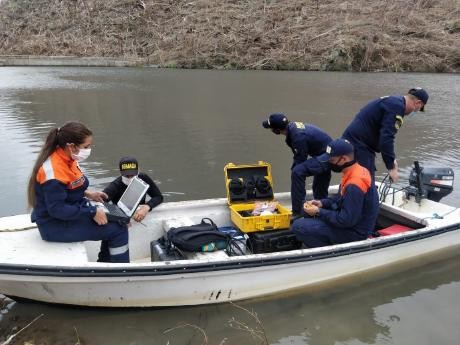
During 10 days, the hydrographic team carried out: six single-beam hydrographic surveys, one multibeam survey, and the repositoning of seven buoys o guarantee the access seaway to the island of Providencia.
In conclusion, the General Maritime Directorate through the National Hydrogaphi Service of Colombia, ARC Roncador, Maritime Signaling and Harbor Master Offices is pleased with the contribution to the country of bathymetric information, advice and actions in situ, in less than 15 days. These proved to be useful tools for correct response in times of post-natural disasters.
Some of the actions taken by the central government based on the information collected included: immediate dredging of the Providencia canal in view of the fact that its depth decreased after the passage of the storm; ensuring the continuity of the use of the freshwater dam for the island community; and the invitation to the whole world to visit these paradisiacal islands with the full assurance that Colombia will be be constantly vigilant and responsive to events such as these storms.