
1 Introduction
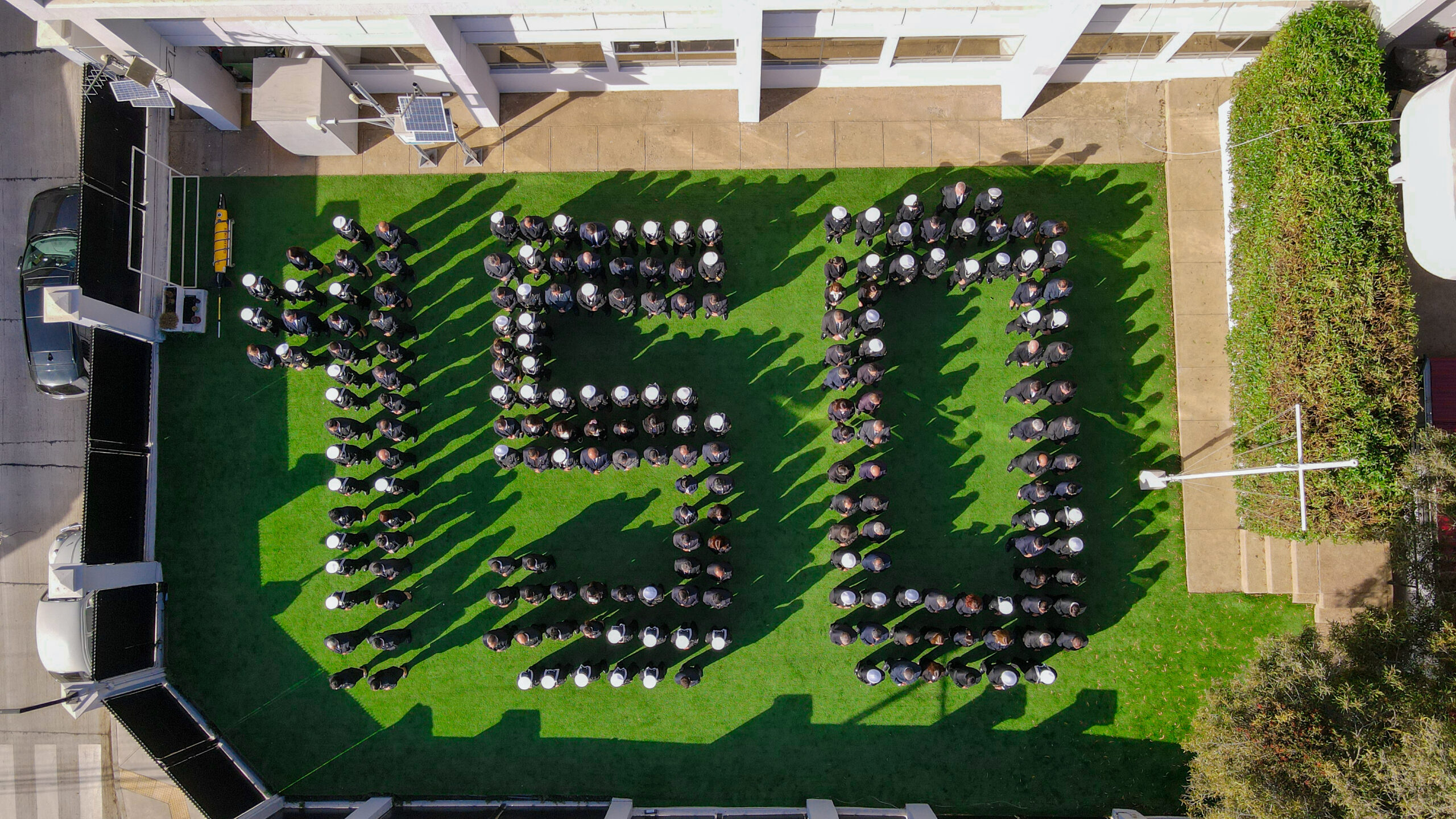
On May 1, the Hydrographic and Oceanographic Service of the Chilean Navy (SHOA; Fig. 1), formerly the Hydrographic Institute of the Navy (IHA), celebrated 150 years since its foundation. To illustrate to the reader the significance that Hydrography has had in the history of Chile, it is necessary to highlight the steps taken from its discovery until the eighteenth century; and then go on to recount the transcendent events that have occurred up to the present day. This work would not be complete without the inclusion of the challenging prospect that will have to be faced in the immediate future.

2 Origin of hydrography in Chile
Chile was discovered from the sea. In fact, on November 1, 1520, Ferdinand Magellan, an eminent Portuguese navigator in the service and under the protection of Charles 1 – King of Spain and Emperor of Germany as Charles V – sailed, in command of the caravels Victoria, Concepción and Trinidad, the navigable passage between the North Sea and the South Sea, calling it “Strait of All Saints”, which today bears its name, Strait of Magellan.
In addition to Magellan’s expedition, there are many others that contributed to the hydrographic and geographical knowledge of the extensive and rugged coastline of Chile. In 1615 the Dutchman Jacobo Le Maire, in search of a less dangerous passage than the Strait of Magellan to reach the Moluccas, discovered, further south, the strait that bears his name and, later, the great passage that joins the two largest oceans on earth, the Atlantic with the Pacific, today the Drake Passage. Also, other navigators and scientists ventured these coasts, making new contributions to their knowledge, among others, Bartolomé García de Nodal and Gonzalo Nodal (1619) and Jacobo L’Hermite (1624).
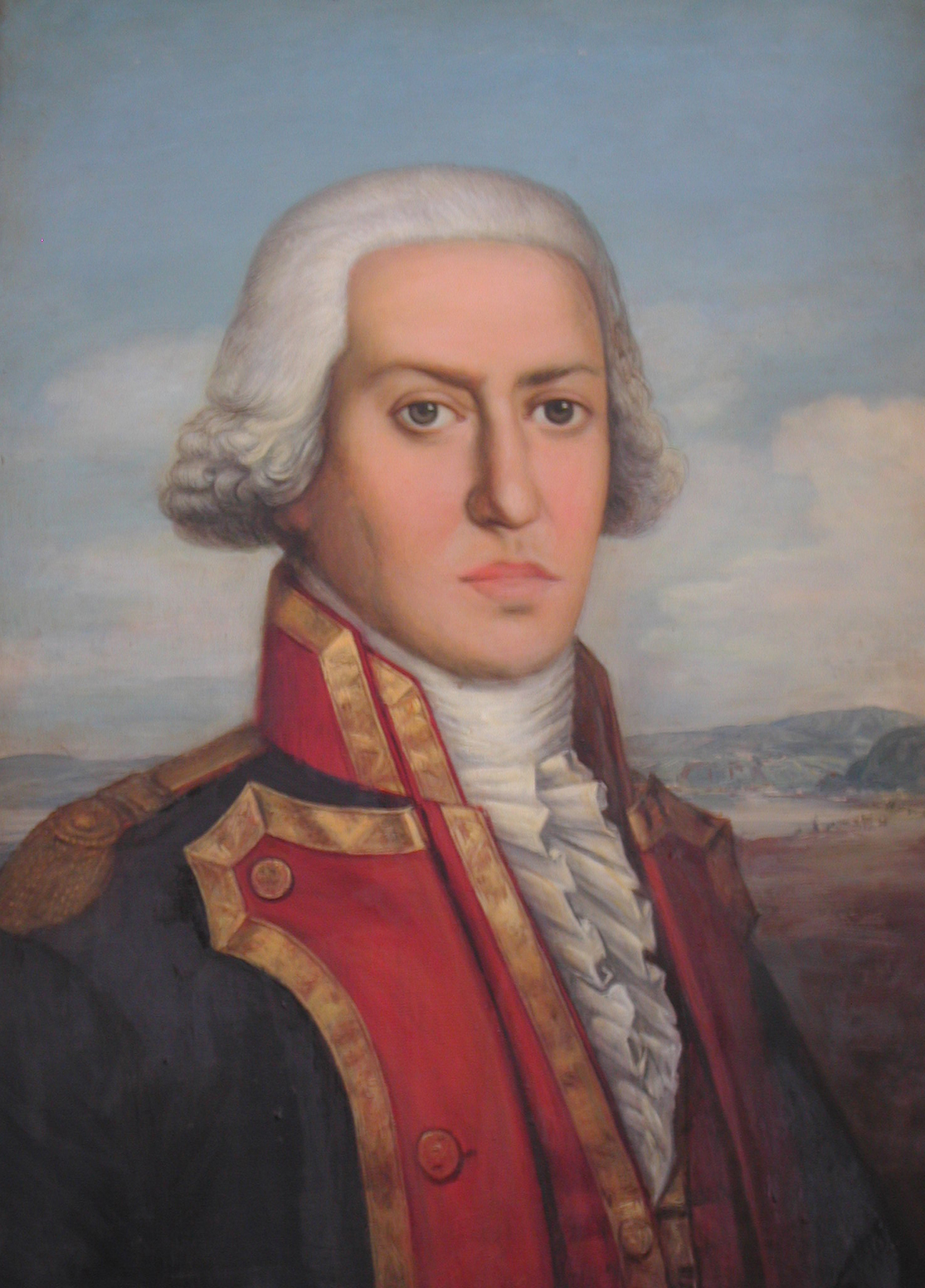
The scientific spirit and intellectual thrust of the eighteenth century also reached the expeditions. Among them, we can mention: Commodore John Byron (1764), James Cook (1768 and 1774), José de Moraleda y Montero (1787 and 1796; Fig. 2) and Alejandro Malaspina (1789 and 1794). Undoubtedly, until the end of the eighteenth century, the work carried out by the Spaniard Moraleda y Montero was the greatest hydrographic-scientific contributions, especially in the area of Chiloé and the Chonos archipelago.
3 The transcendent nineteenth century
Four episodes occurred during the nineteenth century, which have become true milestones in the history of national hydrography.
The expeditions of the Englishman Phillip Parker King between 1826 and 1830 and the continuation of these by Robert Fitz Roy between 1831 and 1836, the latter accompanied by the legendary Charles Darwin. The information generated was the first on which the documentation on the coasts and sea of Chile began to be structured.
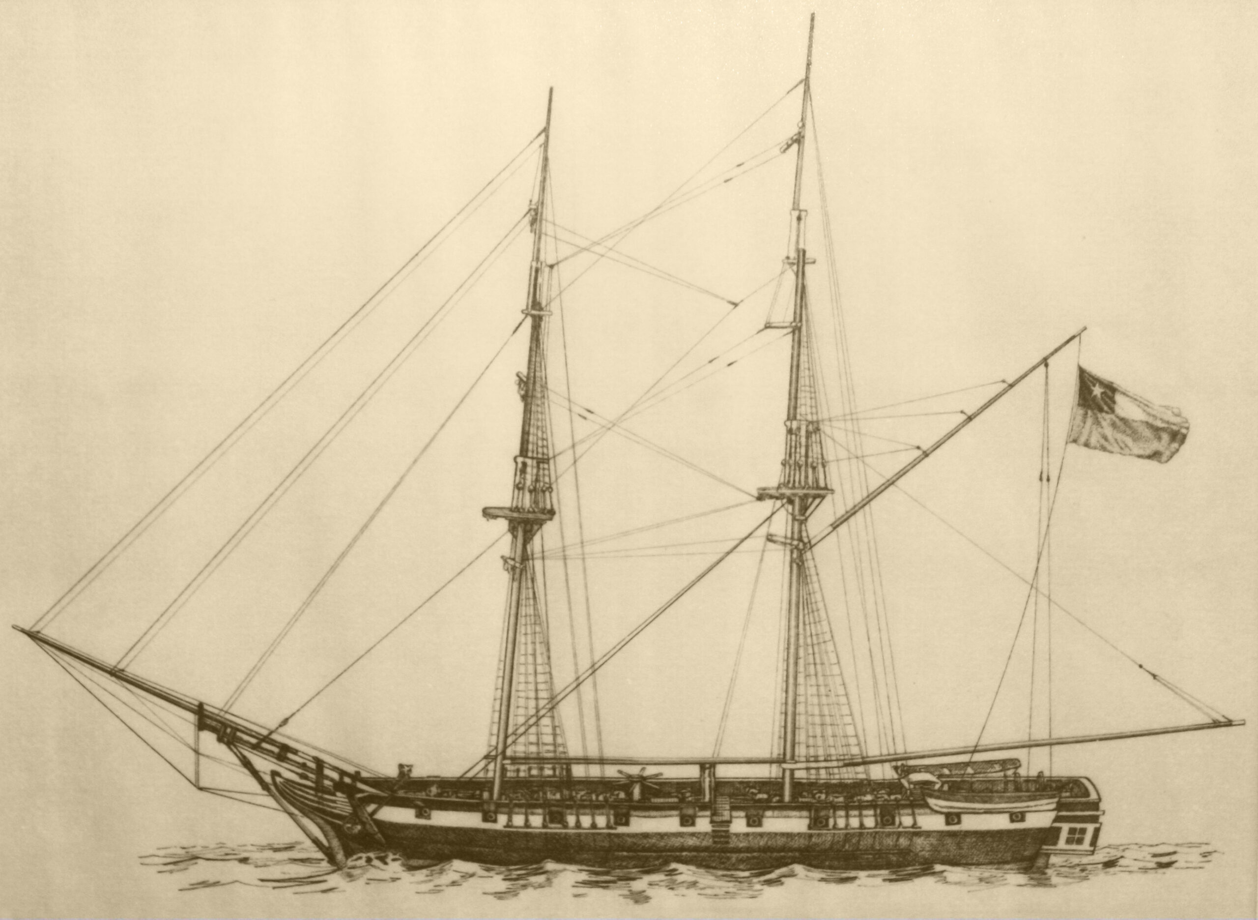
The beginning of national marine scientific activity (1834–1874): In December 1834, the war brig Aquiles (Fig. 3), which under the command of Frigate Captain Don Roberto Simpson surveyed the cove and mouth of Rio Bueno in the province of Valdivia; an event considered the birth and beginning of the national marine scientific activity, while Admiral Simpson, who later became Commander in Chief of the Navy, is recognized as the first Chilean hydrographer.
For 40 years, hydrographic and oceanographic activities on the extensive Chilean coastline and island gradually increased. This effort was joined by foreign explorers, navigators and scientists, among them: Jules Cesar Dumont D’Urville (1837) and James Clark Ross (1842). This is the end of the foreign contribution that, with its feverish scientific, intellectual, commercial and military spirit, gives way to a consolidated and thriving Chile.
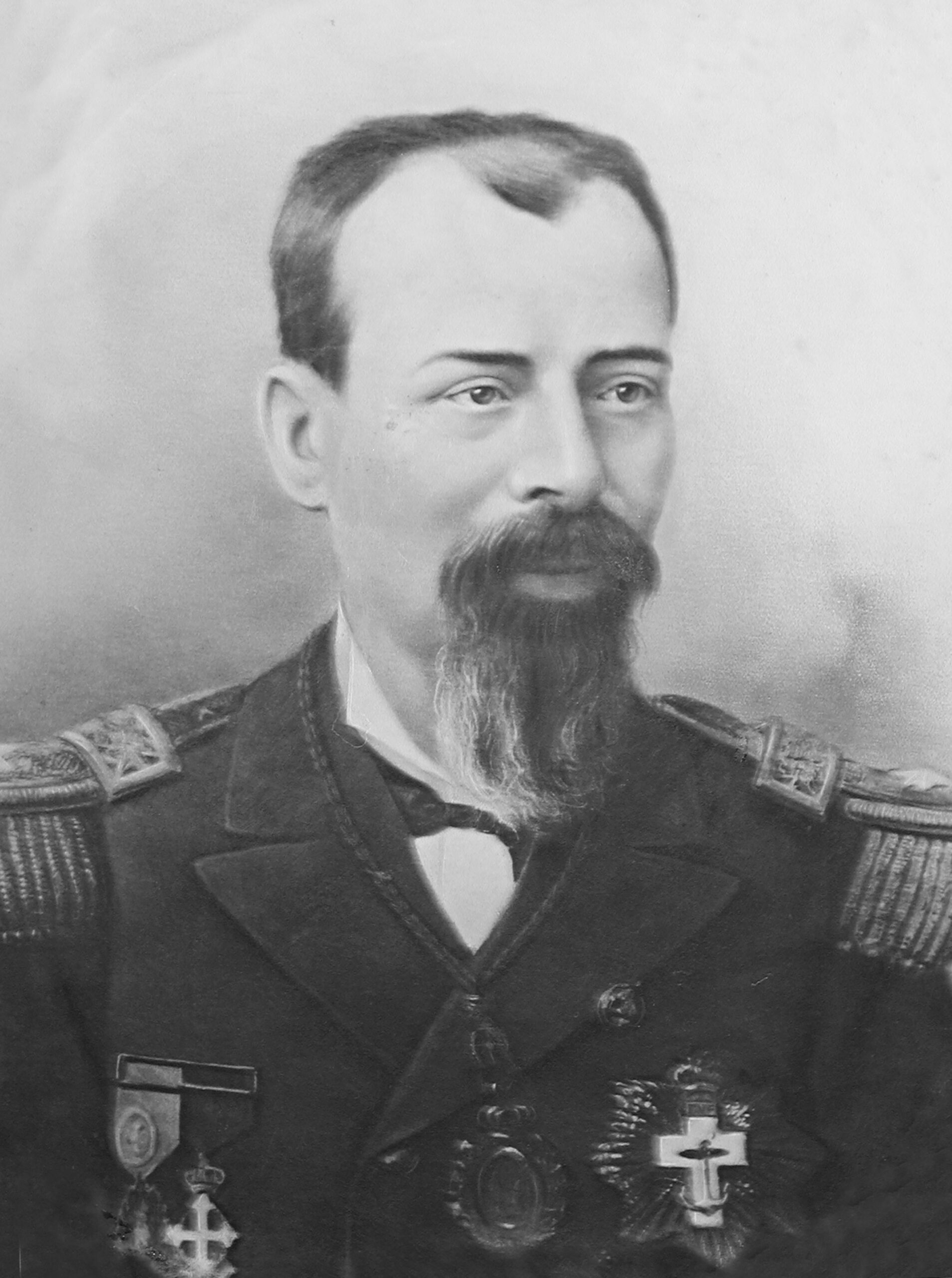
The Establishment of the National Navy’s Hydrographic Office: On May 1, 1874, the Government issued the Supreme Decree that created the “Hydrographic Office of the National Navy”. Commander Francisco Vidal Gormaz (Fig. 4) was appointed as its first Director, as a recognition for his efforts that made its creation possible, and in line with his extensive dedication and relevant qualities as a distinguished hydrographer, geographer, astronomer and prolific writer.
The Hydrographic Office was the first national cartographic body, the first created in Latin America and the 12th in the world.
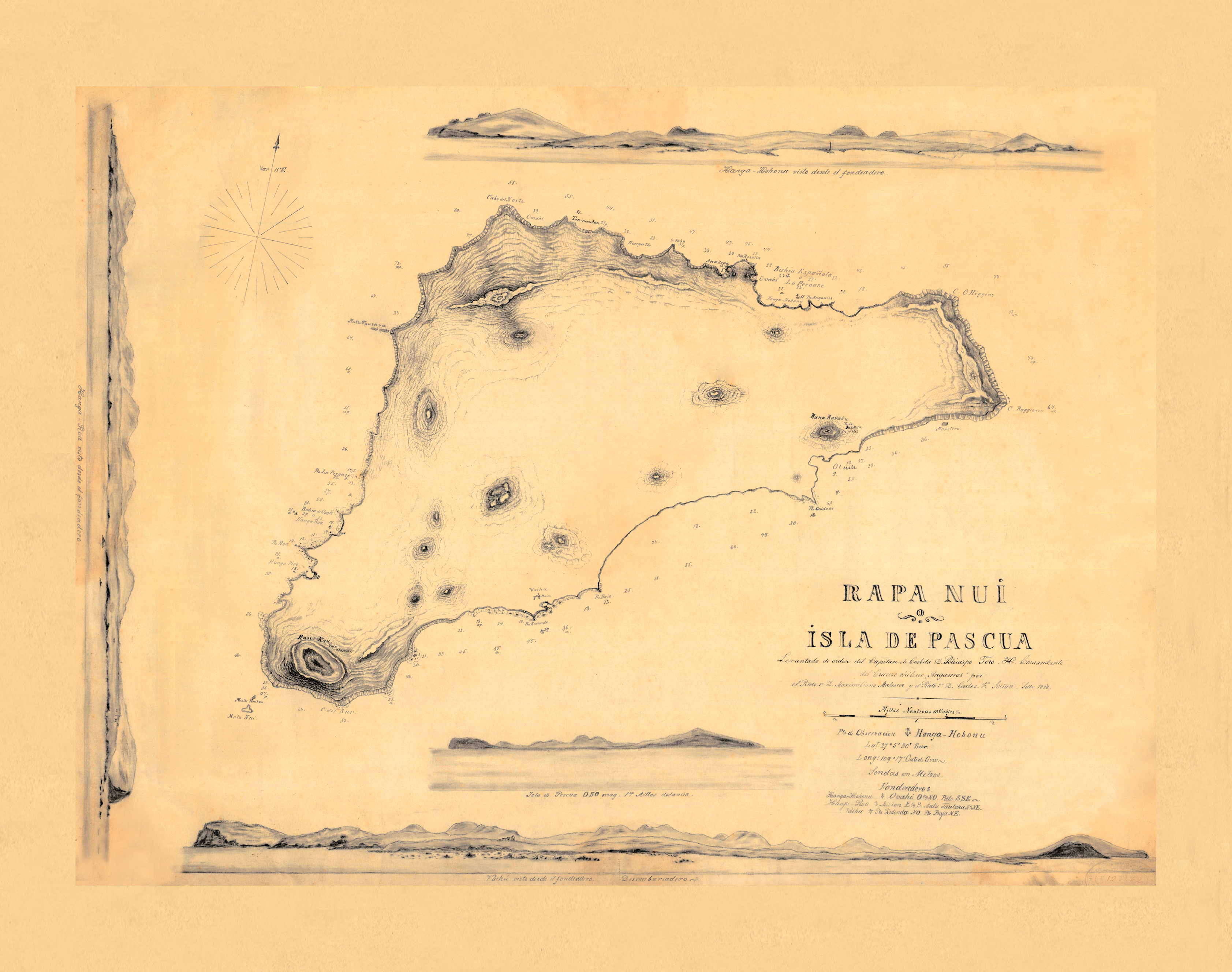
The Hydrographic survey of Easter Island (Rapa Nui): The nineteenth century, in terms of hydrographic events of transcendence, closed with the preparation of the Easter Island chart (Fig. 5), ordered to be drawn up by Lieutenant Commander Don Policarpo Toro, commander of the cruiser Angamos, in September 1888, with which he reaffirmed the incorporation of said possession into the Republic of Chile, attaching it as an illustrative document to the act that he signed together with the Chiefs of said island. testifying to its full, complete and unreserved cession.
4 The twentieth century and the development of hydrographic capabilities
During this period, the structure for carrying out hydrographic and oceanographic activity was strengthened with the different legal provisions that set the responsibilities of the then Hydrographic Institute of the Navy (IHA). This allows us to better face the continuous, intense and sustained study of our extensive coast and its vast oceanic territory.
Milestones within the first half of the century are the creation in 1914 of the School of Navigation and Hydrography for officers that to this day has graduated 273 officers specializing in these disciplines, including officers from other countries; the participation in 1921 of the foundation of the International Hydrographic Bureau (IHB), in the Principality of Monaco, together with 17 other foreign hydrographic services and the beginning in 1941 of the systematic and uninterrupted observation of tides, publishing from 1947, the corresponding Tide Tables of the Coast of Chile.
In accordance with Chile’s proposal, in 1957 the IHB Directing Committee worked on the text of a draft declaration or agreement by which the Member States would recognize the legal personality of the Bureau. But also of great relevance was the celebration of the International Geophysical Year (1957/1958), with the SHOA assuming the representation of Chile in the area of physical oceanography, with singular success in terms of participation. In 1959, Chile joined the Seismic Sea-Wave Warning System in the Pacific, putting its own national system into service on July 30, 1964; both instances were made official by Supreme Decree No. 26 of January 1966.
In 1960, the first oceanographic operation of great importance called MARCHILE began, an initiative of joint efforts between the IHA, universities, government entities and the Technical Assistance Program, which constituted a great contribution to the national oceanographic community, incipient at that time. During the eighteen cruises carried out until 1984, in transects that covered areas between Arica and Chiloé, the oceanic island and the Drake Passage, physical and chemical parameters of seawater, bathythermography, bathymetry, plankton collection, bentology, geological samples and meteorology were measured.
On 3 May 1967, the final text of the IHB Convention (and annexed Regulations) was deposited with the Government of Monaco and opened for signature by Member States. On that day, 17 countries signed it, including Chile.
In 1968, Law No. 16,771 was enacted, which establishes the functions of the IHA and its character as an official, technical and permanent service of the State, in everything related to Hydrography, Nautical Cartography, preparation and publication of navigation charts of national waters, Oceanography, among others. It is defined as a functionally decentralized service and its financing sources were identified and established. The National Oceanographic Data Center is also created; today the National Center for Hydrographic and Oceanographic Data (CENDHOC).
In 1969 and based on the aforementioned law, the IHA’s Organic Regulations were proposed and approved, explaining its mission and functions and at the same time, establishing within its responsibilities to constitute itself as the official, technical and permanent service of the State before the International Hydrographic Organization (IHO); before the Intergovernmental Oceanographic Commission (IOC), founded in 1960; to the Scientific Committee on Oceanic Research (SCOR)) and to the International Association of Physical Sciences of the Ocean (IAPSO), and other similar organizations, both foreign and international, such as representation before the “International Bureau of Time” (Fig. 6). It is also provided that the IHA will become the official representative of Chile to the International Pacific Tsunami Warning System, with responsibility for taking charge within the country of the general coordination of this system, operating the National Tsunami Warning System and controlling, on behalf of the State, marine scientific and technological research carried out by foreign vessels in national waters.
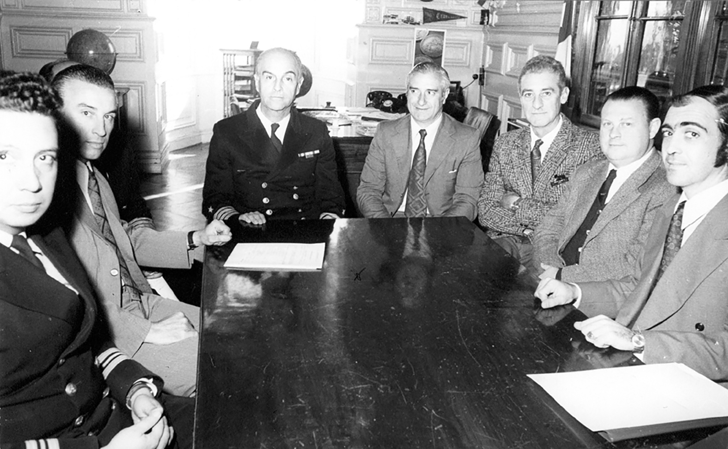
In 1971, the National Oceanographic Committee (CONA) was created, with headquarters at the IHA (Fig. 7). The Committee has the responsibility of advising the Director of the IHA – who chairs it – in his role of coordination and control of marine scientific and technological research in jurisdictional waters.
Between 1975 and 1980, the IHA, with the support of the AGS “Yelcho”, collaborated with the international oceanographic research project in the Southern Ocean, called “International Southern Ocean Studies (ISOS)”, covering the Southeast Pacific, Drake Passage and the Scotia Sea. The initiative was sponsored by the Office of the International Decade for Ocean Exploration (IDOE), an entity dependent on the National Science Foundation (NSF) of the United States and its objective in general terms was to expand the description and variability of the oceanographic characteristics of the Southern Ocean and the circulation of the Antarctic circumpolar current. This intense study gave rise to a large number of publications that substantially improved the knowledge of a marine area whose characteristics and variability exert an important influence on climate and planetary health.
In 1979 the IHA began the systematic study of waves, thanks to the acquisition of a Waverider directional buoy, which marked a milestone by being the first instrument acquired in Chile for the direct measurement of waves, allowing the determination of safety patterns to be applied in navigation, naval construction, determination of coastal erosion and in numerous other civil and naval applications.
In 1980, the then Hydrographic Institute of the Navy (IHA) became a member of the Executive Committee of the International Association of Maritime Signalling Authorities and taught the first course for Specialist Officers in Maritime Signalling, and also the first course for Oceanography for Officers.
In 1984, the three-year pilot project called “Tsunami Hazard Reduction through the Use of Systems Technology (THRUST)” was initiated under the agreement signed between the IHA and the National Oceanic and Atmospheric Administration (NOAA) of the United States, which was implemented in the National Tsunami Warning System.
In 1985, Chile, through the IHA, began its participation in the Tropical Ocean and Atmosphere Observation Program (TOGA), through a collaboration agreement signed with the National Oceanic and Atmospheric Administration (NOAA) of the United States.
In 1986, the first sample of dispersed/dissolved hydrocarbons was taken in the bay of Valparaíso and the mouth of the Aconcagua River as part of the Environmental Pollution Program. Currently, the Chemical Oceanography Laboratory of the SHOA issues an average of 43 technical reports per year, which help to establish the corresponding responsibilities and legal actions.
It should be noted that during the XIII International Hydrographic Conference (1987), Chile was nominated “Coordinator of the International Cartographic Scheme”, for area C2.
In 1989 and within the framework of participation in the “International Decade for the Reduction of the Effects of Natural Disasters”, convened by the UN, the SHOA, with the collaboration of other national agencies, materialized the EDUTSU project that culminated in the preparation and delivery in 1994 of textbooks for pre-basic, basic and secondary education on earthquakes and tsunamis, which were later translated into several languages.
In order to reflect more accurately the remarkable development achieved during the last 50 years by oceanographic science in the country and to better represent the mission and functions of the IHA, in 1990 the name of “Hydrographic and Oceanographic Service of the Navy” (SHOA) was established.
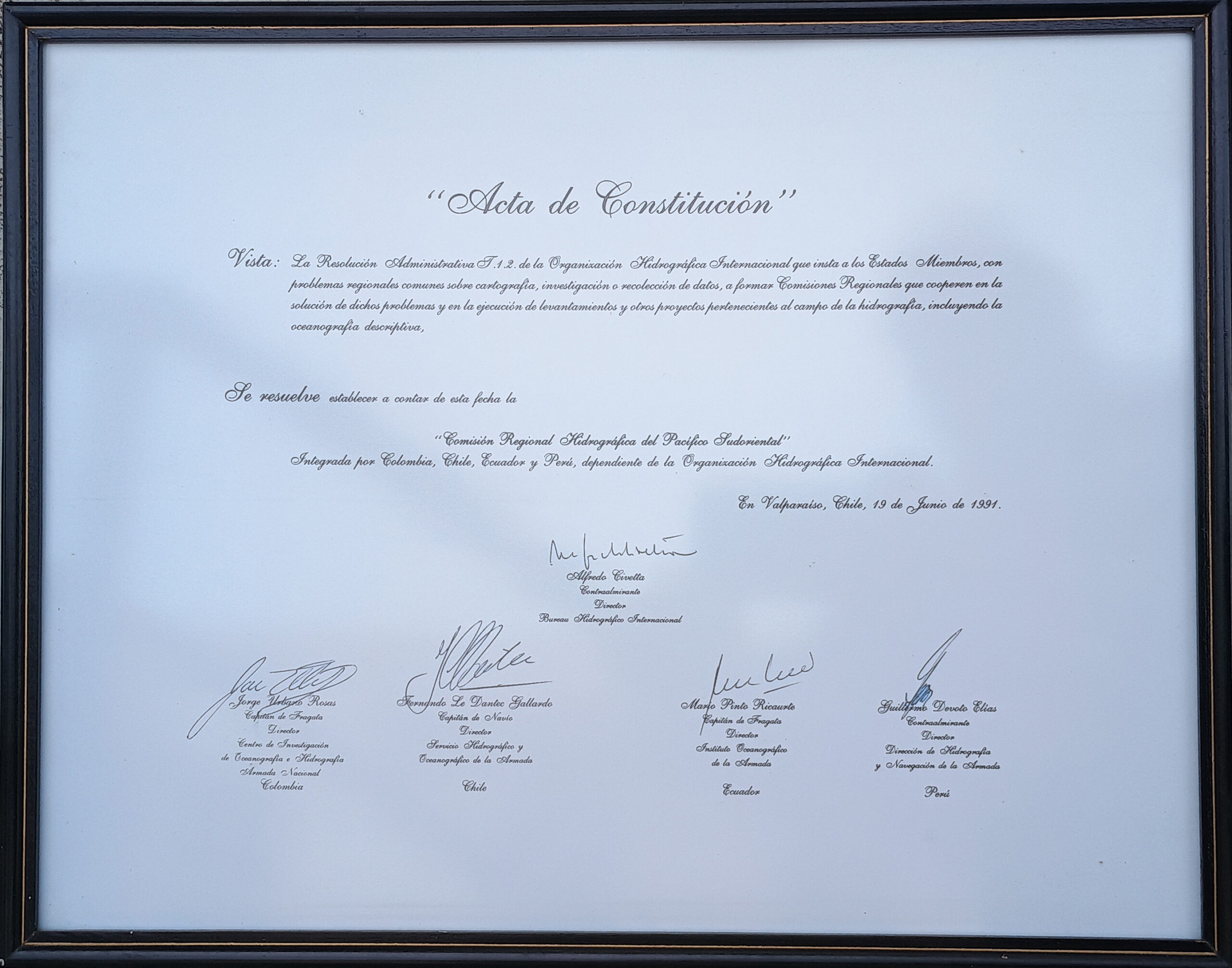
In 1991 two events took place that need to be highlight. In the first place, the SHOA obtains from the International Advisory Board on Standards of Competence for Hydrographers and Nautical Cartographers, the international homologation in category “A” of the Hydrographic Engineering course with academic recognition in the specialties of nautical cartography and coastal surveys, being empowered to provide such a course. Also, at the initiative of the SHOA, the Directors of the Hydrographic Services of Colombia, Ecuador and Peru are invited to establish the South-East Pacific Regional Hydrographic Commission (SEPRHC, whose charter was signed in Valparaíso, Chile, on June 19, 1991 (Fig. 8).
During this decade, several other relevant events took place, including:
- The “Autochart” system entered in operation – an automated cartography system – which allowed the processes of compilation, drawing, production and maintenance of nautical cartography to be optimised and accelerated. (1992).
- In 1992, the AGOR 60 “Vidal Gormaz” was incorporated into the Navy, a unit whose role was to carry out oceanographic research, in the physical, chemical, geological and biological areas as it was equipped with adequate instruments and equipment. It was in operation until August 2010. One of its transcendental activities was the participation in the international WOCE (World Ocean Circulation Experiment) program, through cruises (SR-1 and PR-14) that collected oceanographic data that allowed the development and validation of models to predict climate change at a global level. The last campaign carried out was SR-1, which covered the area between Cape Horn and the South Shetland Islands in 1998.
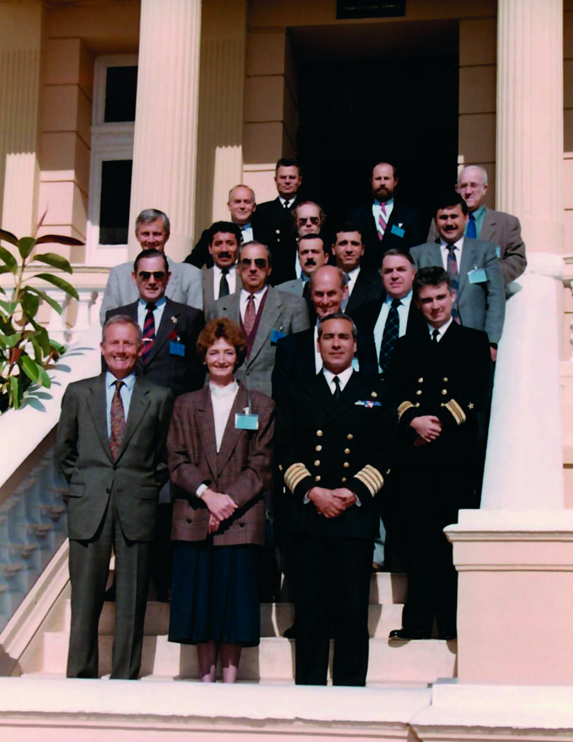
- Chile hosted the first meeting of the IHO Permanent Working Group on Cooperation in Antarctica (now the Antarctic Hydrographic Commission) held at the SHOA, Valparaíso in 1993 (Fig. 9).
- In 1994, the SHOA published an “Oceanographic Atlas for Education”, thus taking another step forward in what has traditionally been the concern of this Service: to contribute to education and awareness of the sea and its development possibilities.
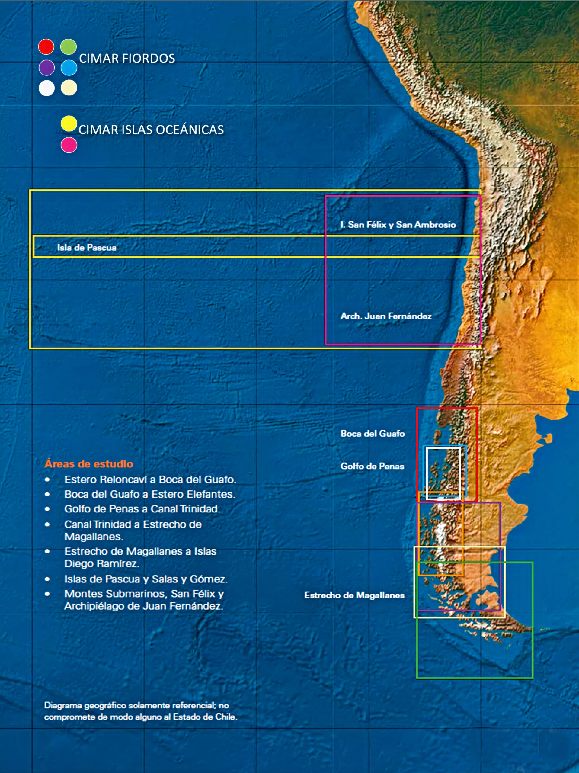
- In 1995 and derived from the interest in increasing the knowledge of the ocean and its ecosystems, the National Oceanographic Committee (CONA) worked on a research program with the aim of studying in a multidisciplinary way the oceanographic, meteorological, marine biodiversity and underwater morphology aspects in remote geographical areas, in view of which the SHOA required extraordinary funding to start the so-called CIMAR Cruises (Marine Research Cruises in Remote Areas, Fig. 10). The first of them was carried out between October 18 and November 11 of that year, in the area between Puerto Montt and Laguna San Rafael. To date, 28 cruises with the broad participation of the entire marine scientific community of Marine Sciences at the national level, which were carried out on board the AGOR 60 “Vidal Gormaz” until 2011 and from 2012 to date on the AGS 61 “Cape Horn”.
- In 1995, also following the scientific line, the SISMOMAR project was presented, which aimed to obtain the magnitude and location of all the sensitive seismic events that affect the national territory, in a period of no more than 20 minutes after they occurred, with the purpose of discriminating in the shortest possible time, those coastal seismic events capable of generating a tsunami. This initiative began in 1996 through the implementation of the TREMORS system (Tsunami Risk Evaluation trough seismic moment from a Real-time System), whose seismic sensors and transmission device were installed on the summit of Cerro El Roble in the commune of Olmué, which was operational until 2014.
- During 1996, work was done on the development of the computational modeling methodology for the implementation of the Project “Tsunami Flood Letters (CITSU)”, which aimed to simulate floods in the main coastal cities of the country, in an initial period of five years, which was implemented from 1997, the year in which the CITSU of Arica, Iquique and Antofagasta were published.
- Chile was a member of the Working Group on Strategic Planning established in 1997 to consider and approve a new IHO Strategic Plan and its associated Work Programme.
- Within the framework of the International Year of the Ocean, in 1998, the first Regional Oceanographic Cruise was held, which consisted of joint and simultaneous campaigns of the member countries of the Permanent Commission of the South Pacific (CPPS), with Chile represented by SHOA and IFOP. Likewise, another milestone in the context of this global initiative was the execution of the Valparaíso-Easter Island Oceanographic Cruise of the “Integrated Oceanopolitical Program (POI)”, with the aim of increasing the knowledge of the areas covered and the economic development of the country.
- Since 1998, the State of Chile, represented by the SHOA, has held the position of Associate Director of the International Tsunami Information Center (ITIC), an entity created in 1965 and staffed by personnel from the United States and our country.
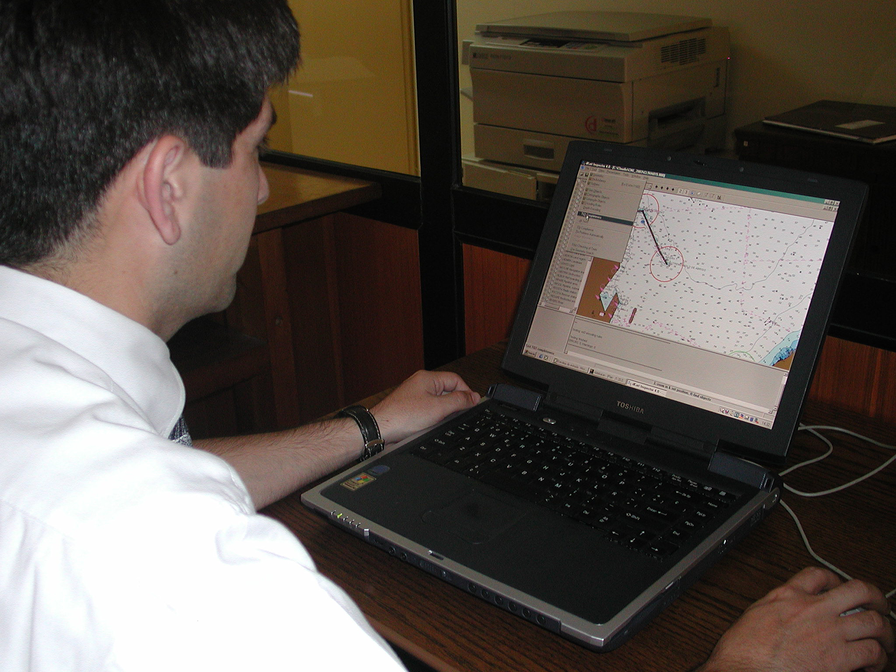
- In 1999 the SHOA produced the last nautical chart using manual procedures for separating colours in plastic and the process began entirely with digital methods and the use of the WGS-84 datum. The first electronic nautical chart (ENC) is published (Fig. 11).
It should be noted that before the beginning of the 21st century, the SHOA had an important global technological development and the details of some of them are presented below:
Automation of the nautical chart correction process: Based on low-cost elements – digitizer and plotter under the control of a microcomputer and graphic design program – an important level of automation was achieved for the correction of nautical charts, affected by the notice to mariners issued from their printing, before being provided to users.
Improvement of the National Tsunami Warning System: The system called “TREMORS”, of French technology, was incorporated, whose main characteristic was to drastically reduce the warning times in the event of a tsunami, as well as to allow the epicenter of the phenomenon and its magnitude to be determined with great precision.
Professional training: The Navy formalized the creation of the hydrography specialism for officers and enlisted personnel, in order for them to work in the areas of hydrography and oceanography.
Modernization of aero-photogrammetric equipment: This initiative was based on the need to streamline the digital production of topographic information, arriving in a format suitable for acceptance by the processes of computer-aided cartography and that required by electronic cartography.
Capacity development to produce electronic charts: The SHOA, considering that the IHO was in the final stage of developing technical specifications for the production of Electronic Cartography, began the development of its own capacity for the production of official ENCs, significantly optimizing the safety conditions for navigation on the routes and access to the main ports. For validation, distribution, and commercialization instances, SHOA partnered with IC-ENC.
Improvement of the National Tidal Network: During 1999 and in response to the permanent concern and a sustained desire for the technology used, the SHOA carried out the replacement of the METERCRAFT tide gauges with automatic data collector platforms and satellite transmission. Along the same lines and in order to improve the technical capabilities of the SHOA, the Department of Oceanography acquired two of the first acoustic profilers (Acoustic Doppler Current Profiler) used in Chile, to make measurements of current speed and direction throughout the water column, thus replacing the work of mechanical currentmeters.
The SHOA thus culminates the twentieth century with a technological level that would allow it to face the challenges of the twenty-first century. Chile and its extensive participation in the main themes of IHO and IOC, contributed with strong ideas based on the experience that, as a developing Service, it was experiencing in the transition from analogue to digital. On the other hand, the benefit obtained by knowing in detail and in advance the experiences achieved by more developed countries allowed informed decisions to be made to incorporate the necessary technological advance safely and at a reasonable cost.
5 Evolution of the SHOA from 2000 to date
This part of the document briefly details the evolution of the SHOA from 2000 to date. It includes technological development and participation in the international arena.
On May 1, 2000, the SHOA made available to the national and international maritime community its first Electronic Nautical Charts (ENC) of the main shipping routes.
In 2001 the SHOA incorporated multibeam technology and the nautical charts produced include the multibeam soundings. The first meeting of the recently established Working Group on the Hydrography Manual (MoHWG) is also held, on which occasion the Table of Contents and the program for its development were defined. Chile was nominated its President.
The Sixteenth IHO Conference (2002) was very important for Chile, due to its participation in the revision studies of the IHO Convention and also due to the fact that the Conference elected a new Steering Committee composed of the VA Maratos (Greece); CA Barbor (USA) and CN Gorziglia (Chile). With this, Chile became the first IHO Member State to provide a Spanish-speaking Director and the fourth from South America to reach the IHO Directorate.
During the second half of 2002, the First Geophysical Research Cruise was carried out on board the AGOR 60 “Vidal Gormaz”, an initiative organized by the Pontificia Universidad Católica de Valparaíso (PUCV), the University of Chile and the SHOA and which, in later stages, had the collaboration of other entities such as SERNAGEOMIN, SIPETROL and ENAP, as well as foreign universities from Germany. Canada, Denmark, Norway and the United States. The specific objective of this project was to develop a scientific and technological framework for the exploration of methane from gas hydrates. its main result being the knowledge of the distribution and volumes of hydrates and underlying free gas of the most promising areas to be exploited.
On the occasion of the centenary of the “General Bathymetric Chart of the Oceans” (GEBCO) project in 2003, a joint project of IHO and the Intergovernmental Oceanographic Commission (IOC) of UNESCO, all those who had contributed to GEBCO were recognized, including our country, Chile. Another important event that linked Chile to IHO in 2003 was the establishment of the Capacity Building Committee (CBSC) and subsequently the implementation of the Capacity Building Fund, initiatives promoted by the recently elected Director of IHO from Chile.
During the XVII General Assembly of IODE (Committee on International Oceanographic Data and Information Exchange) held at UNESCO Paris headquarters in 2003, the representative of Chile was elected as Vice-President of IODE for the period 2003–2005 and later re-elected for an additional term (2005–2007).
The most important contribution that Chile made to IHO in 2004 was the work carried out within the Working Group on Strategic Planning, which drafted proposals to amend the IHO Convention and other related documents that would be examined in 2005, on the occasion of the 3rd Extraordinary Hydrographic Conference that would be convened for that purpose.
Within the framework of the SHOA’s Five-Year Plan 2001–2005, in 2003 the first DART (Deep-ocean Assessment and Reporting of Tsunami) system was acquired, which was transported by the R/V ship “Roger Revelle” and installed off the coast of Pisagua by the team of the Woods Hole Oceanographic Institution (WHOI) of the United States with the participation of SHOA specialists. Other wind, temperature, current, and wave sensors were also installed in order to obtain high-quality information in real time and thus support academic and institutional research. The installation of an AANDERAA satellite tide gauge in Covadonga, Antarctica and the deployment off the coast of Valparaíso, of 02 APEX (Autonomous Profiler Expert) buoys are part of this effort.
SHOA was a member of the Working Group that prepared and revised the content of the 1st edition of the IHO Hydrography Manual (2005). Once the English version was finished, several Spanish-speaking countries took on the task of bringing it into Spanish and once this was accomplished, it was up to the SHOA to edit the publication, which was printed and distributed by the SHOA to the international Spanish-speaking hydrographic community.
In the years 2005–2009, SHOA was actively involved in the International Tsunami Warning System Group (ICG/ITSU) and the Joint WMO/IOC Technical Commission for Oceanography and Marine Meteorology (JCOMM).
In 2006, the first DART II system was anchored in Chile and South America, which represented an important effort for mitigation against tsunamigenic events in contribution to the coastal communities of our country as well as the Pacific basin and to the International Tsunami Warning System, through real-time transmission with the Iridium satellite system.
In 2007, the National Committee of SCOR (CN-SCOR) was created, under the coordination of CONA, with the aim of promoting and regulating activities related to SCOR International in our country, whose representation has fallen to the SHOA since 1968.
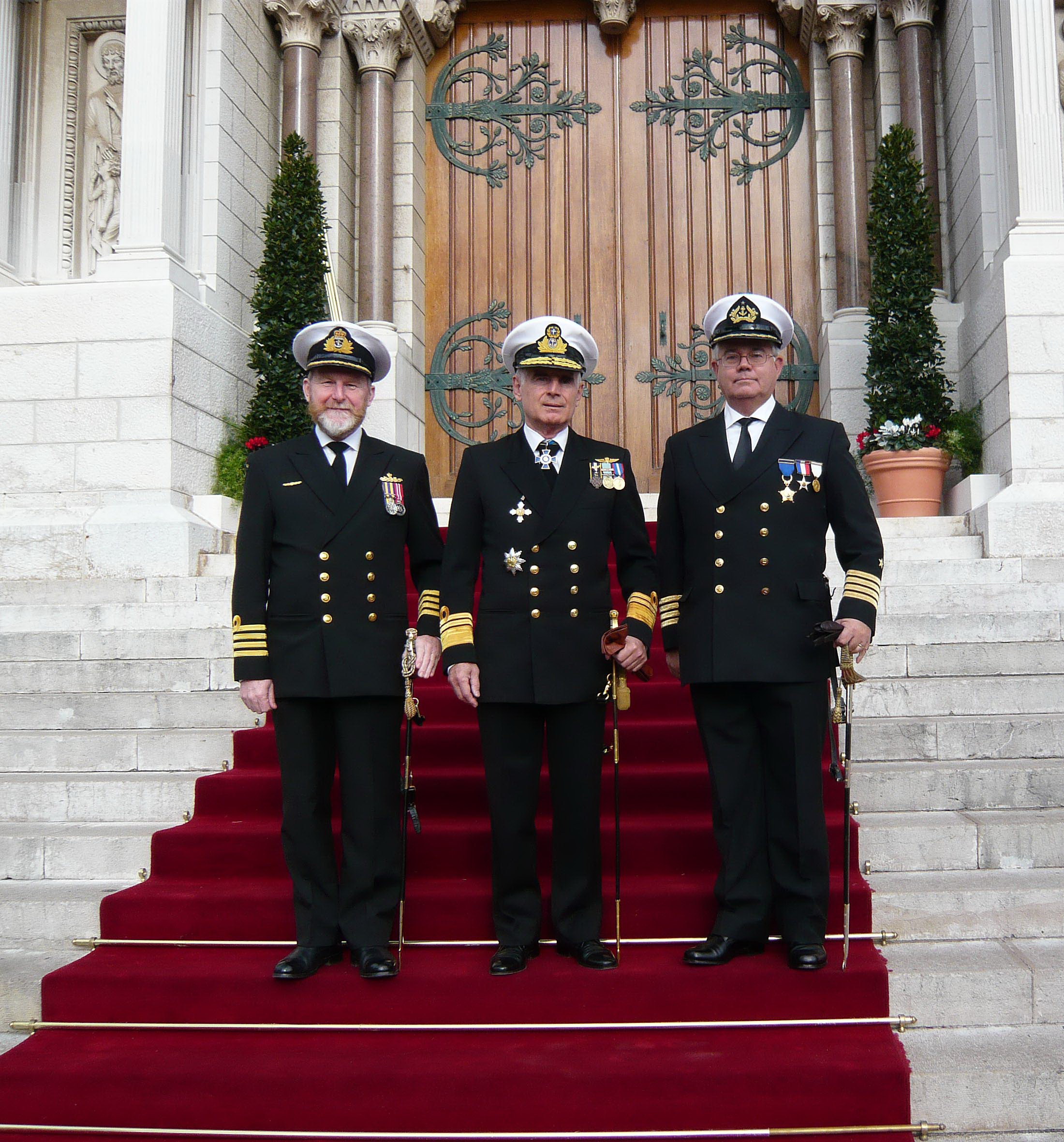
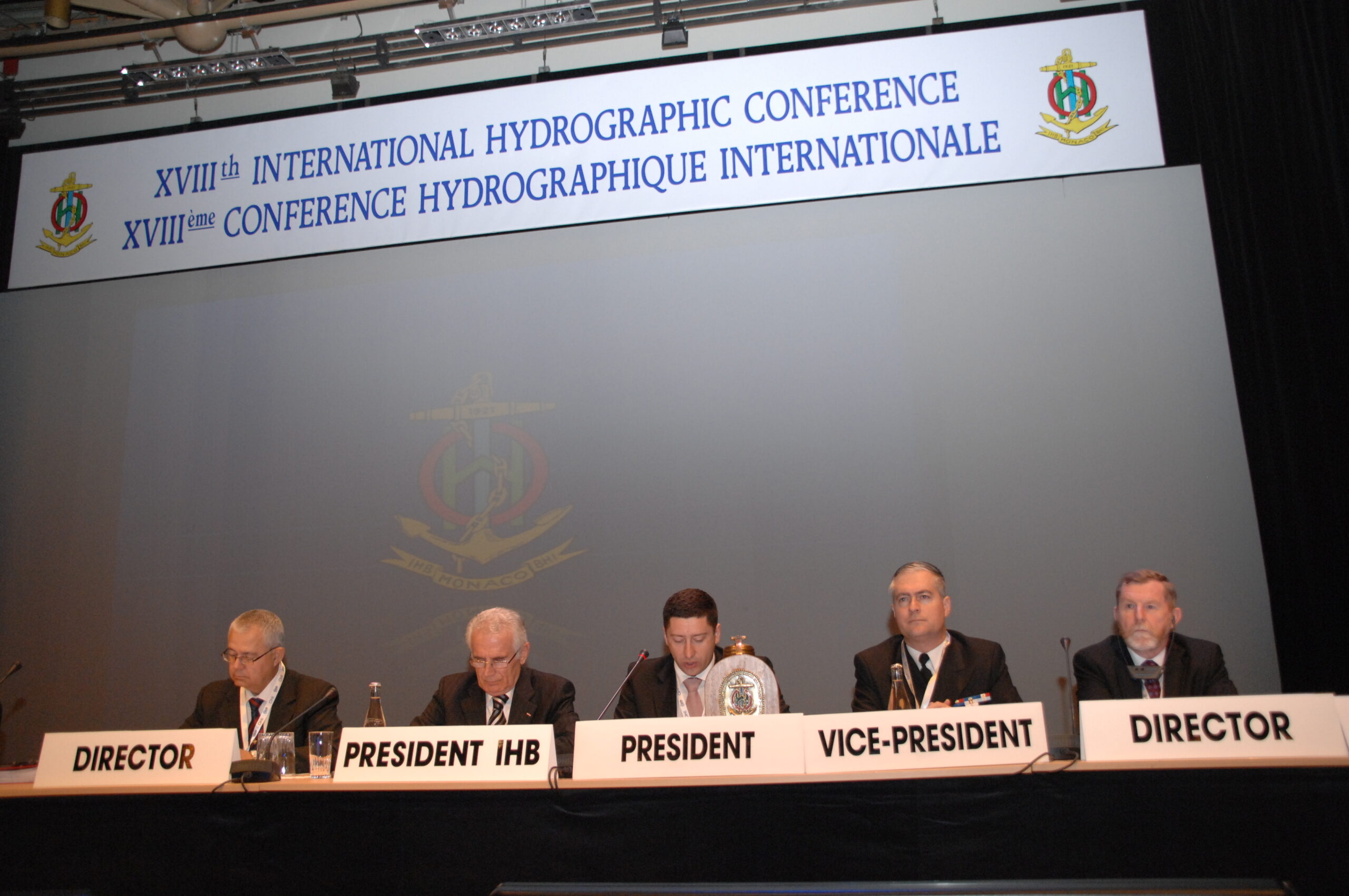
The XVII International Hydrographic Conference (2007) elected a new Directing Committee for the period 2007–2012, which was made up of VA Maratos (Greece) and CN Gorziglia (Chile) who were re-elected and CN Ward (Australia). With this re-election, Chile maintains a relevant position within the IHO (Fig. 12).
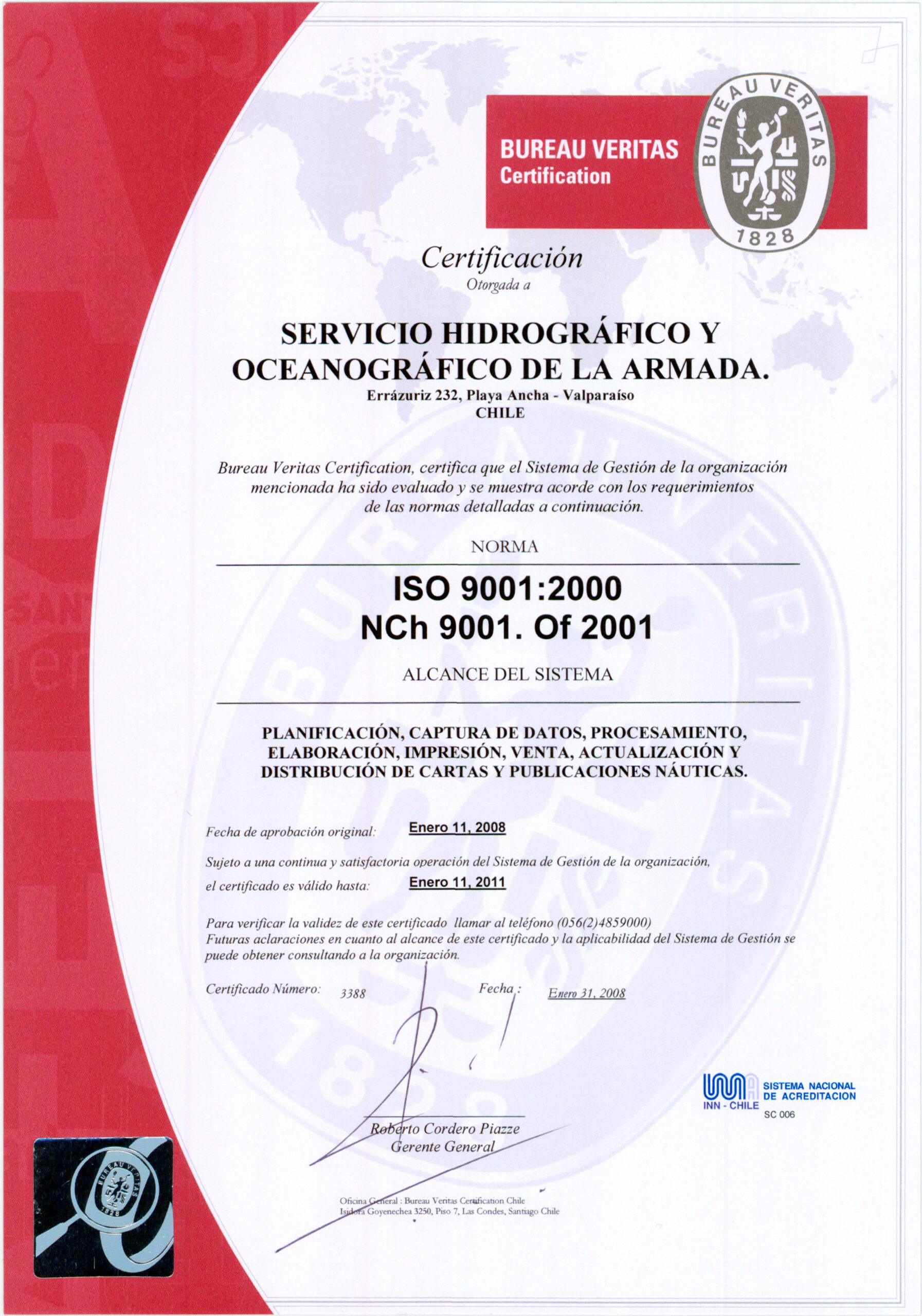
Following the growing international trend, Chile decided to go for ISO certification with respect to cartographic processes (Fig. 13). This effort was a great challenge for the SHOA, which concluded with this certification in 2008.
In May 2008, the SHOA hosted the International Course called “ComMIT/MOST Workshop (Community Modelling Tsunami Interface/Method of Splitting Tsunami)”, which was aimed at professionals from the Tsunami Warning Centers of the countries that make up the then called Regional Tsunami Warning Group of the Southeast Pacific Ocean, made up of Chile, Colombia, Ecuador and Peru. The instruction was in charge of NOAA’s Pacific Marine Environmental Laboratory (PMEL).
Chile’s permanent and active contribution to the objectives of IHO was recognized by the cordial invitation extended to it to participate as a guest at the III Conference of the Southwest Atlantic Hydrographic Commission, held in Uruguay in 2009. On the occasion, Chile shared with its peers the experiences obtained in the implementation of the new Print on Demand procedures. We also participated in the 1st meeting of the recently structured IHO Working Group on Water and Tidal Levels (TWLWG) and in the VII meeting of the Sub-Committee on Capacity Building where the existing demands in Chile and those of the other three CHRPSE countries, on their behalf, were presented.
The earthquake and tsunami that occurred in the country in February 2010, made it necessary to readjust Chile’s participation in the international tribune of the IHO, limiting participation only to the meetings of the two Regional Hydrographic Commissions that make up Chile; the HCA and the SEPRHC.
Based on capitalizing on the experiences obtained in this event, the SHOA developed, among other activities, the preparation of the “Five-Year Sustainability Plan for the Continuity of Development 2011–2015”; which included, among others, the development of the hydrographic campaigns of the “Extended Continental Shelf” Project; renewing the National Nautical Cartography and strengthening the National Tsunami Warning System (SNAM).
In his role as President of the Regional Hydrographic Commission of the Southeast Pacific, Chile hosted the 10th Meeting of the Commission held in April 2011 in Valparaíso. The participants (Colombia, Ecuador and Peru), led by Chile, analyzed and decided on the capacity demands and updated the 2013–2017 regional capacity building program.
In recognition of the experience gained and the continuous progress made in the National Tsunami Warning System (NAS), SHOA was elected Vice-Chair of the Intergovernmental Coordination Group of the Pacific Tsunami Warning and Mitigation System for the period 2011–2013, a position he held for a second term when he was re-elected at the next biannual meeting in 2013.
In 2012, Chile attended the XVIII IHO Conference, on which occasion the national representative Captain Patricio CARRASCO was elected Vice-President of the Conference, a distinction granted to Chile for its active participation in the IHO rostrum. It is the result of teamwork guided by a clear objective of serving the safety of navigation and contributing to national, regional and global development. The Conference elected a new Steering Committee and in September the term in which Chile held the position of Director of IHO, 2002–2007 and 2007–2012, came to an end.
In 2012, the first version of the Diploma course called “Tsunami on the Pacific Coast of South America: Scientific Bases, Threat and Vulnerability” was given, organized by the Pontificia Universidad Católica de Valparaíso (PUCV) and the United Nations Educational, Scientific and Cultural Organization (UNESCO) and with the collaboration of SHOA and the SATREPS Program (Science and Technology Research Partnership for Sustainable Development). This training program has been carried out in various modalities to this day for the benefit of countries such as Chile, Colombia, Ecuador, Peru and some other nations in the region and the Caribbean.
In 2013, the appointment of the Director of SHOA as one of the five representatives of the IHO to the Steering Committee of the GEBCO Project (General Bathymetric Charts of the Oceans) stands out, adding this designation to the one made to participate in SCUFN. This recognizes the degree of commitment that Chile has had in GEBCO and with the knowledge of the bathymetric characteristics of the oceans.
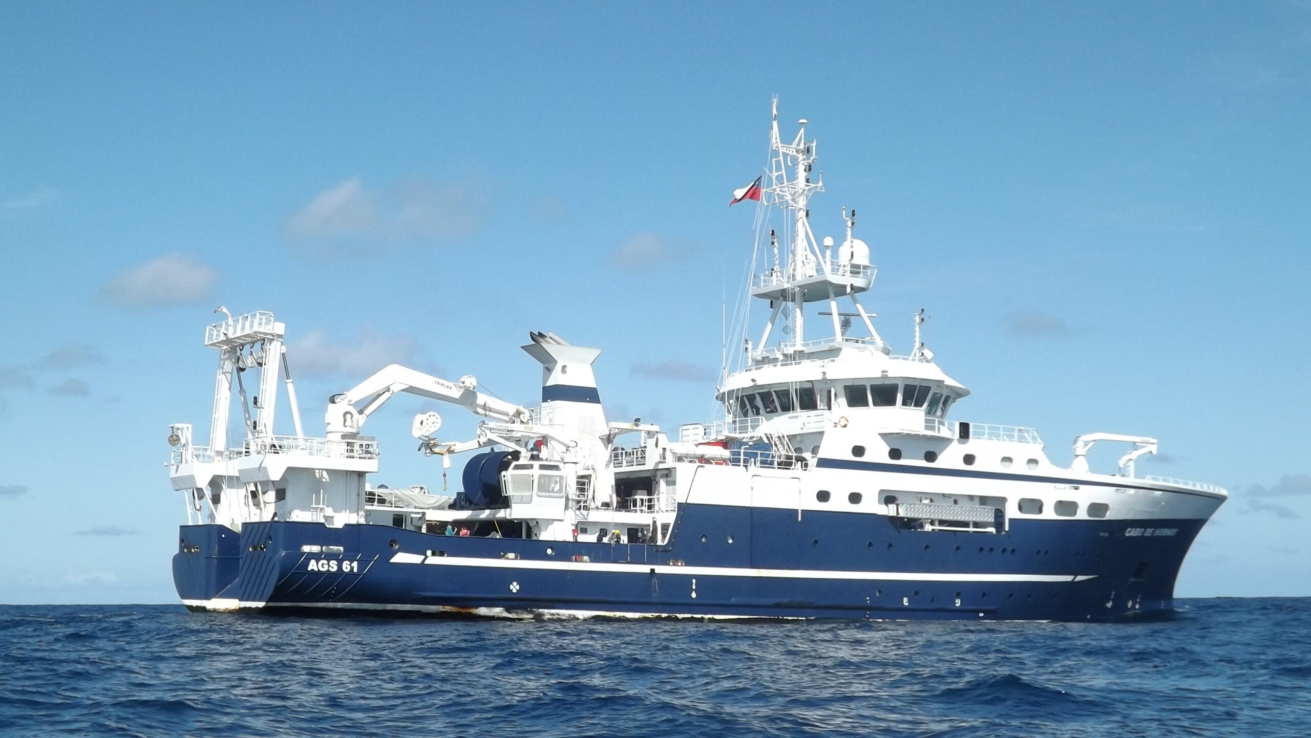
One of the great milestones that marked the year 2013 was the delivery of the new research vessel AGS 61 “Cabo de Hornos” to the Chilean Navy (Fig. 14). The inaugural cruise was the CIMAR 19 Fjords, which took place between July 1 and 20 of that year. The Navy has established that the CONA will be the entity that receives, assesses and coordinates the research requirements of the national and international scientific community, and must always take into consideration the requests for research that are linked to the National Oceanographic Plan and the CIMAR Five-Year Plan.
The year 2014 ended with Chile as the host of the 6th HSSC Meeting (November) that took place in Viña del Mar. On the occasion, an exhaustive review was made of the degree of compliance with the IHO Work Program, an opportunity in which the experience of Chile was shared in order to develop realistic plans in accordance with the human and financial resources available.
At the end of September 2015, with the participation of SHOA professionals and technicians from the National Oceanic and Atmospheric Administration (NOAA) of the United States, the funding of two prototypes of the 4G DART System provided by NOAA was carried out within the framework of a Memorandum of Understanding signed between SHOA and this entity. This technology provides an essential source of data so that alert centers, and especially the SNAM, can detect, predict and warn of these events.
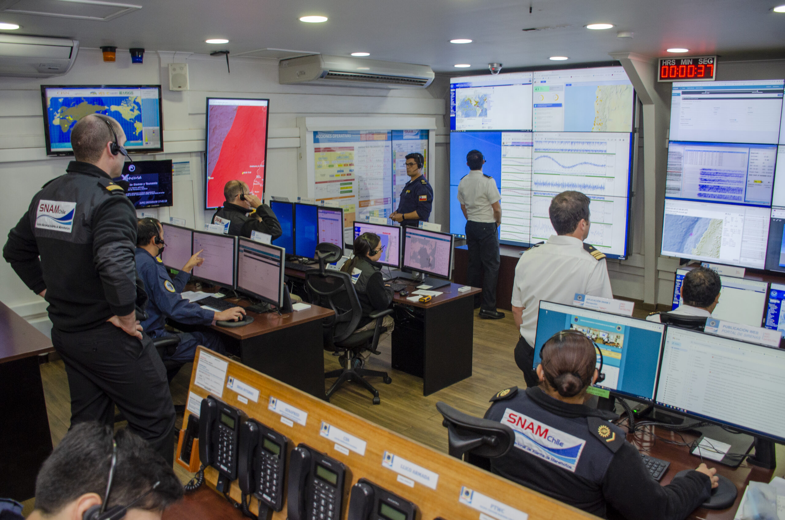
One of the most relevant milestones this year was the inauguration of the new facilities of the Operations Room of the National Tsunami Warning System (SNAM; Fig. 15). This Warning Center has been recognized as a benchmark for the region and one of the most important in the world. Its design allows a panoramic view of the events that are unfolding, which is in direct support of those in charge of decision-making, thus optimizing the quality of information and response times.
The last IHO event of 2015 in which Chile actively participated was the 7th meeting of the Subcommittee on the World Marine Advisory Service, which was held in Monaco in August. NAVAREA coordinators, including Chile, benefited from the information provided by the IMO Secretariat on the modernization of the Global Maritime Distress and Safety System (GMDSS) and on the GMDSS Master Plan. In the process of establishing the drafting of standard messages in the event of tsunamis, Chile had a significant participation.
In 2016, the “Integrated Tsunami Prediction and Warning System (SIPAT)” was officially launched, as part of the SNAM Decision Support System. This tool consists of a database of pre-modeled events using high-performance computational modeling that allows the prediction of tsunamis on the Chilean coast and thus sectorize tsunami threat levels.
The oceanographic vessel AGS 61 “Cabo de Hornos” carried out the CIMAR 22 “Oceanic Islands” Cruise, the first of this type of campaigns whose scientific research contemplated the protected area of the Nazca-Desventuradas Marine Park, which exceeds three hundred thousand square kilometers of ocean surface, making it the largest in the Southeast Pacific. The objective of the cruise was to study the bio-oceanographic and meteorological characteristics between the American continent and the islands of San Felix, San Ambrosio and the archipelago of Juan Fernandez.
Finally, one of the most relevant contributions of the SHOA in recent years and which is directly linked to its Mission of providing safety to navigation, was the preparation and edition of the first version of the SHOA Publication No. 3015 “Tidal Current Tables of the Coast of Chile” year 2017, which contemplated the inclusion of fifteen locations and a spatial coverage from the Chaco Channel to the Beagle Channel. To date, this product includes 21 sectors with daily current forecasts.
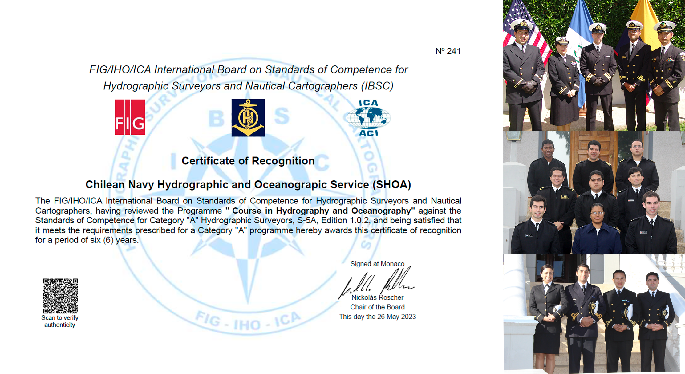
Although the Cat “A” Hydrography Course taught by Chile, through the SHOA, had its adequate international recognition, recent modifications adopted by the International Council on the Standards of Competence of Hydrographers and Nautical Cartographers, demanded the SHOA to work on a new presentation that had the support of the Naval Polytechnic Academy and external advisors of the University of Playa Ancha. achieving the recognition of the program for a period of six years. This took place in New Zealand, in March 2017. Given the success of the presentation, SHOA was asked to prepare an article for the International Hydrographic Review sharing the experience gained in the preparation of the Programme. This has been the level of cooperation with which Chile has worked within the IHO, for the benefit of its Member States.
In April 2018, the 19th meeting of the Authorities of the Asia-Pacific Maritime Safety Agencies was held in Chile. On the occasion, IHO asked the Director of SHOA, in his capacity as Hydrographer of Chile, to represent the organization to highlight the role that hydrography plays for the economic development of maritime states.
In August 2018, the International Tsunami Training Program (ITP 2018) was carried out at SHOA facilities, which since it was implemented in the seventies had been carried out only in Hawaii, United States, this being the first time it was taught in another country. The choice of Chile to develop this training was a reflection of the trust placed in it by the International Tsunami Information Centre (ITIC) and the Intergovernmental Oceanographic Commission (IOC) of UNESCO, as well as the recognition of the level achieved by the country as an example of an Integrated Tsunami Warning and Mitigation System thanks to the experience acquired in these events by the SNAM.
During this same year (2018), the capacity of the Service was substantially increased through the acquisition of a new instrument, the SeaExplorer underwater glider (Glider), which corresponds to an autonomous detection platform designed to collect physical, chemical, biological and/or acoustic data profiles, depending on the sensors installed.
In 2019 and for the first time, Chile participates as a member of the Working Group on the Maintenance of Electronic Nautical Chart Standards. It also participated in the 16th Meeting of the Hydrographic Commission on Antarctic, an opportunity in which, in addition to discussing the progress made by the Commission, a Seminar was organized and dictated, at the proposal of Chile, for the Members of the Antarctic Treaty Consultative Meeting on the importance of Hydrography. This Seminar had the active participation as a speaker, the Director of the SHOA.
At the beginning of 2020, the second backup unit of the National Tsunami Alarm System, called SNAM Alternativo II, was inaugurated, located on the grounds of the Naval Polytechnic Academy in the city of Viña del Mar. This structure, like the one put into operation in 2015 adjacent to the main Operations Room, has all the necessary equipment to execute the necessary actions by the team on duty when facing an emergency.
In 2020 all meetings of the Committees, Working Groups and even the scheduled 2nd IHO Assembly had to be rescheduled in response to the global Covid19 pandemic. Notwithstanding this, an important issue resolved was the decision to establish the Working Group on Hydrographic Surveys (HSWG), a proposal that was originally submitted by Chile in 2014.
One of the themes highlighted by IHO was to highlight the need to incorporate women in hydrography. On this subject, Chile notes that women have worked as cartographic draftsmen; oceanographers, data processors; digitizers; and lately hydrographs, without any limitation or restriction. Chile’s experience was shared through an article in the International Hydrographic Review.
The work of the Service and the Navy in many aspects had to adapt to the health crisis caused by the pandemic, in view of which several activities and commitments had to be carried out remotely, such as the first training for Tsunami Field Observers, carried out by SHOA specialists via videoconference.
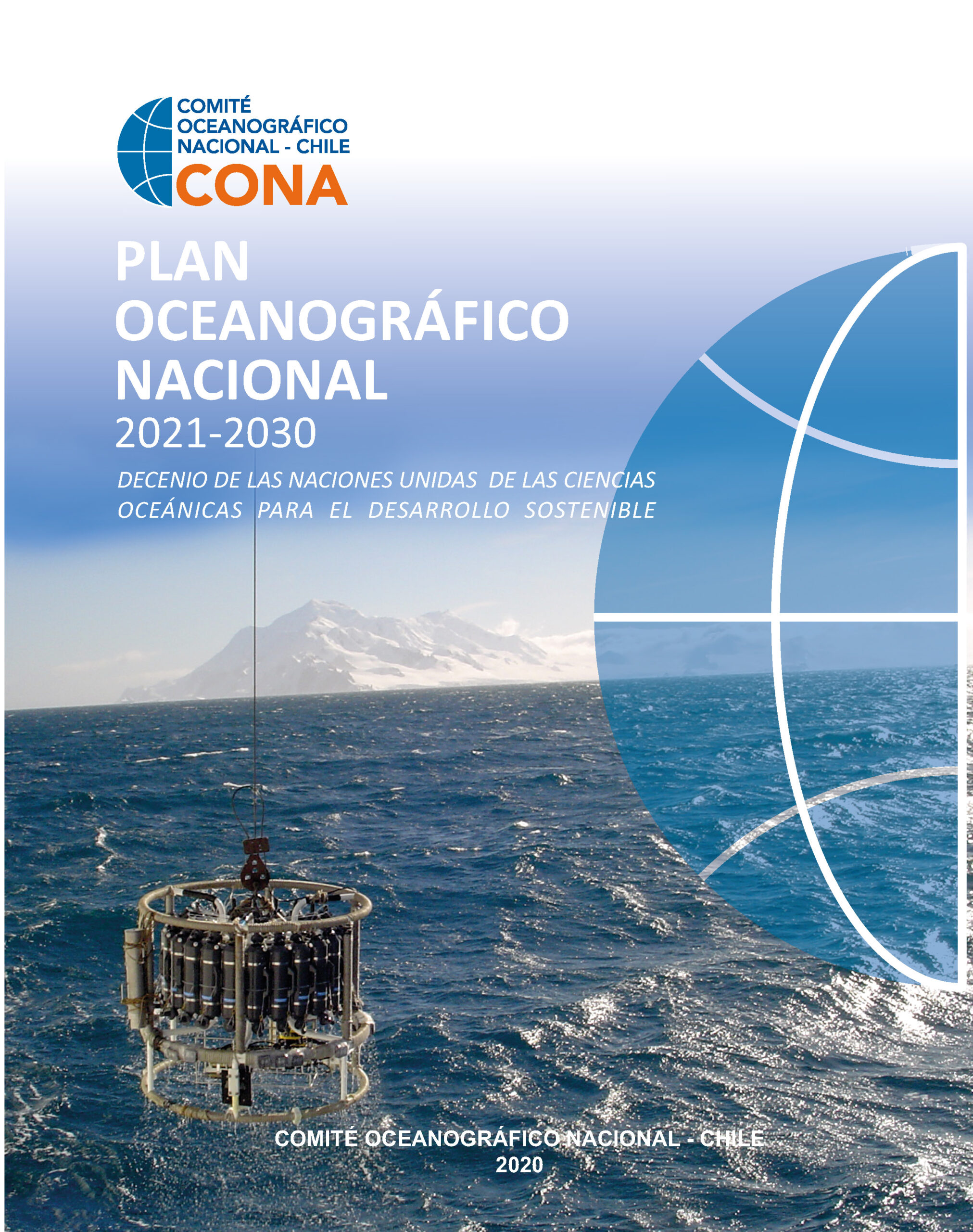
As the First Centenary of IHO is commemorated in 2021, Chile confirms the importance for the development of national maritime interests of maintaining since its inception in 1921, an active and forceful participation in the activities of the Organization, always seeking to contribute to the fulfillment of its objectives. Also this year was the 50th anniversary of the National Oceanographic Committee (CONA), an organization that coordinates marine scientific activity in our country and that honored this new anniversary with the publication of the National Oceanographic Plan for the period 2021–2030 as a response to the United Nations 2030 Agenda, also assuming the role of national focal point for the Decade of Ocean Science for Sustainable Development (Fig. 17).
Since the mission of the SHOA is to provide safety to navigation through the official nautical cartography of the State of Chile, it is important to note that this final product is the result of a series of hydro-carto-oceanographic processes, which capture and generate a large amount of data and information. In this context, in 2021 the IDE-SHOA Office (Spatial Data Infrastructure) was established, with the aim of creating and maintaining a single and centralized management system that through a geospatial graphic interface will allow the administration, search and expeditious access to the information generated as a result of the work and processes of the Service’s work.
Following the experiences gained from the tsunami of January 15, 2022 generated by the eruption of the Hunga Tonga-Hunga Ha’pai volcano and within the framework of the activities of the Southeast Pacific Tsunami Warning Working Group (GT-ATPS) while Chile held the Chair, SHOA organized the workshop called “Shared access to sea level data: Tool for an effective regional response to tsunami emergencies”, aimed at representatives of the Tsunami Warning Centers of Colombia, Ecuador, Peru and Chile.
The year 2023 began with one of the most powerful El Niño events in recent years, it is for this reason that through the CONA the Universidad Católica del Norte (UCN) and the Universidad de Concepción (UdeC) were invited to carry out the First “CIMAR Glider” Cruise together with the SHOA. This initiative contemplated the simultaneous use of the autonomous vehicles that each institution has, in transects off the coasts of Coquimbo, Taltal and Iquique, in order to collect oceanographic information relevant to the monitoring of this warm phase of the ENSO climate phenomenon.
In this same line of research and support for the scientific community, the Plenary Assembly approved the formation of two new Working Groups of the National Oceanographic Committee: Ocean Culture (GT-COCEAN) and Integrated Management of Coastal Areas (GT-GIAC). The first of them arose as a need to take action with respect to what is set forth in the National Ocean Policy enacted in 2018, which in its chapter dedicated to the Sectoral Area “Scientific Development”, establishes as a main axis of action for the development of science and technology that of “Marine Education of Society”; while the second aims to promote knowledge, models and methodologies that promote sustainable development in the face of adaptation to climate change and coastal resilience.
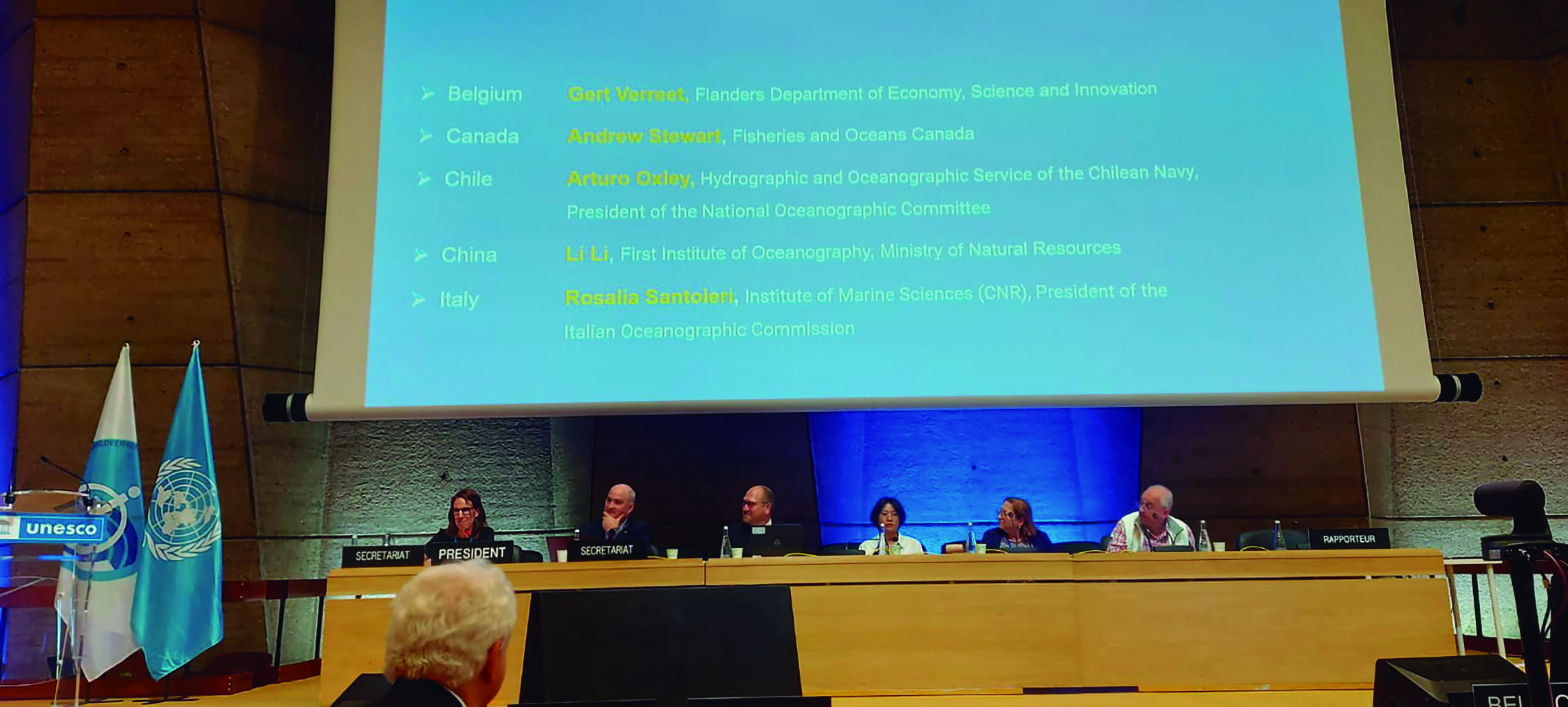
During the 32nd Assembly of the Intergovernmental Oceanographic Commission (IOC) of UNESCO, held in June 2023, Chile was elected for the first time as a member of the Steering Committee of the Global Ocean Observing System (GOOS) as a Regional Expert by Electoral Group III of which our country is a member, for the period 2023–2025.
6 Current participation of the SHOA in the international tribune
It is impossible for SHOA to be represented in all committees, working groups, task teams and others, established by the IHO and the IOC either to deal with technical or administrative issues.
Chile is constantly analyzing the advisability of integrating existing and new groups that are formed, which is subject to this being in line with the objectives of the SHOA and in accordance with the human and economic capacity to sustain the commitment to integrate such groups.
All in all, it is estimated that Chile, through the SHOA, is a member of the main decision-making groups and at all times willing to contribute to the mission of the IHO, as it has been doing since the establishment of the Organization on June 21, 1921, and of the IOC since its establishment in 1960.
The SHOA currently participates actively in the International Hydrographic Organization (IHO) having responsibilities in the following instances:
- Assembly
- Council
- Finance Committee (FC)
- Hydrographic Services and Standards Committee (HSSC)
o ENC Standards Maintenance Working Group (ENCWG)
o Tide, Water Levels and Currents Working Group (TWCWG)
o Working Group on Hydrographic Surveys (HSWG)
o Working Group on the S-100 (S-100 WG) - Inter-Regional Coordination Committee (IRCC)
o Southeast Pacific Regional Hydrographic Commission (CHRPSE)
o Hydrographic Commission on Antarctica (HCA)
o Sub Committee of the Global Navigation Safety System
o Sub-Committee on Capacity Building
o FIG-IHO-ICA International Committee on Standards of Competence for Hydrographers and Nautical Cartographers (IBSC)
o Coordinator of the international cartographic scheme area C2
For its part, it also has extensive participation in the Intergovernmental Oceanographic Commission (IOC), within which it is a member of the Executive Council and directly or through the National Oceanographic Committee, it is mainly represented in the following global programmes:
- GOOS Steering Committee (Group III)
- Associate Director of the International Tsunami Information Centre (ITIC)
- Research and monitoring of marine pollution.
- International Oceanographic Data and Information Exchange (IODE)
- Global Sea Level Observation System (GLOSS)
- Advisory Council of Experts on the Law of the Sea (ABE-LOS)
- Joint Committee on Marine Oceanography and Meteorology (JCOMM)
- IOC International Panel on Harmful Algal Blooms (IP-HAB)
- The Seabed 2030 Project
- Ocean literacy
Also in regional programs, under the auspices of the Permanent Commission of the South Pacific (CPPS), among which we can highlight:
- Scientific Committee of the Program of the Regional Study of the “El Niño” Phenomenon in the Southeast Pacific (ERFEN).
- Committee of the Global Ocean Observing System Alliance for the Southeast Pacific (GRASP)
- Southeast Pacific Tsunami Warning Working Group (GT-ATPS)
Finally, we can highlight that the SHOA is also related to other international organizations, among which we can mention:
- Pan American Institute of Geography and History (PAIGH)
- International Federation of Geometers (FIG)
- Permanent Commission for the South Pacific (CPPS)
- Scientific Committee on Antarctic Research (SCAR)
7 SHOA’s challenges
At any time, whatever the technologies and procedures, SHOA must be a service of excellence. The challenges are many, but we could mention:
- Keep the National Nautical Cartographic Coverage updated, completing all charts in DATUM WGS-84 reference, to allow the coverage of the Electronic Nautical Chart to be completed.
- Successfully face the next “up-grade” or update to the new standard for Electronic Cartography, called S-101 and which replaces the current S-57.
- Complete the publication of the new Tsunami flood charts, with new modelling and complete coverage of populated coastal areas.
- To satisfy the demands of the State and the private sector that contribute to national development.
- Ensure the availability of the technological capacity to meet the objectives and meet the requirements in emergency situations.
- Maintain and increase the availability of human resources that are trained, committed and proud to serve Chile and the Navy from the deck of the SHOA.