Abstract
This article covers the safety of navigation in Africa and considers the significant limitations both in the hydrographic surveys of several coastal countries, and the production and updating of nautical charting. This responsibility is internationally assumed by other members of the International Hydrographic Organization (IHO). In the case of the maritime spaces of the Portuguese-speaking African countries (Cape Verde, Guinea-Bissau, São Tomé and Príncipe, Angola and Mozambique) it has been the responsibility of Portugal, through the Hydrographic Institute (IHPT). IHPT ensures the production of their nautical mapping, which includes a structured and regular collection of hydrographic data, carried out under bilateral cooperation agreements. This responsibility is usually designated to a Primary Charting Authority (PCA).
Over the last 20 years, IHPT has taken advantage of a number of opportunities to support Portuguese-speaking African countries. This has ensured considerable steps have been taken to improve hydrographic surveys, the production of new nautical cartography and supporting the development of capabilities in marine sciences and techniques. This is currently one of the IHPTs most relevant programs involving a notable effort; the purpose of this article is its dissemination.
1. The Hydrographic Institute
Established in 1960, Instituto Hidrográfico (IHPT) is both an organization within the Portuguese Navy and a national marine research laboratory. It is the national hydrographic service, provides environmental support to naval operations and carries out research and development (R&D) activities in physical and chemical oceanography, marine geology, hydrography, safety of navigation and marine data management.
IHPT is focused on ocean observation, mapping its several scientific dimensions and predicting its behavior in the short, medium and long term. It is committed to open data policies and sharing its capabilities with society for shorter R&D cycles and faster elicitation of knowledge of the ocean.
The main objectives of IHPT activities are the safety of navigation, environmental monitoring and the protection of the marine environment. It is involved in several R&D projects, which ultimately contribute to climate change analysis and the development of the blue economy.
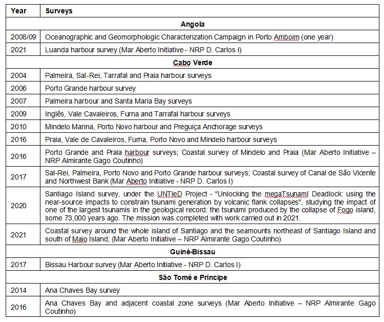
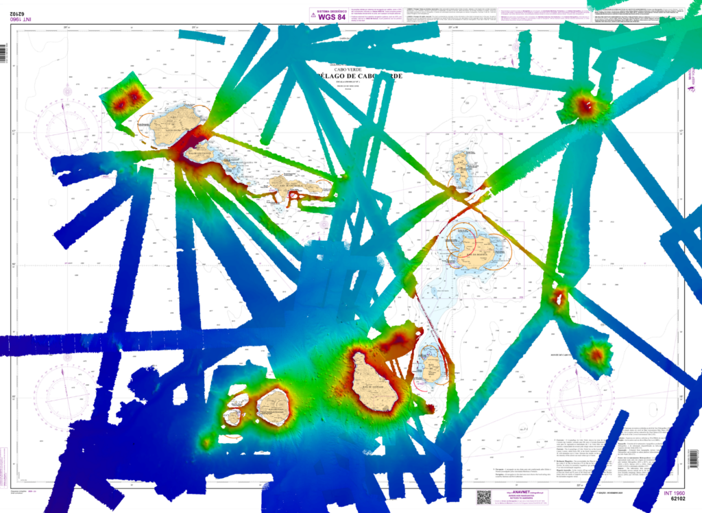
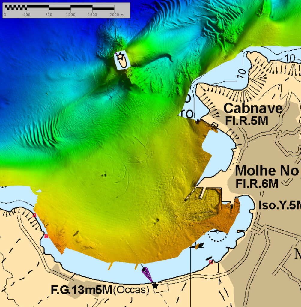
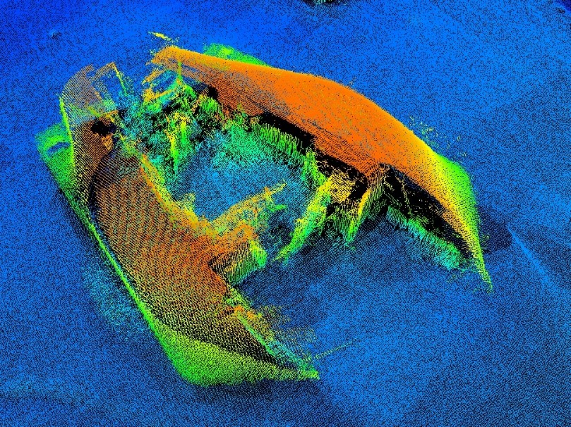
2. Surveys in Africa
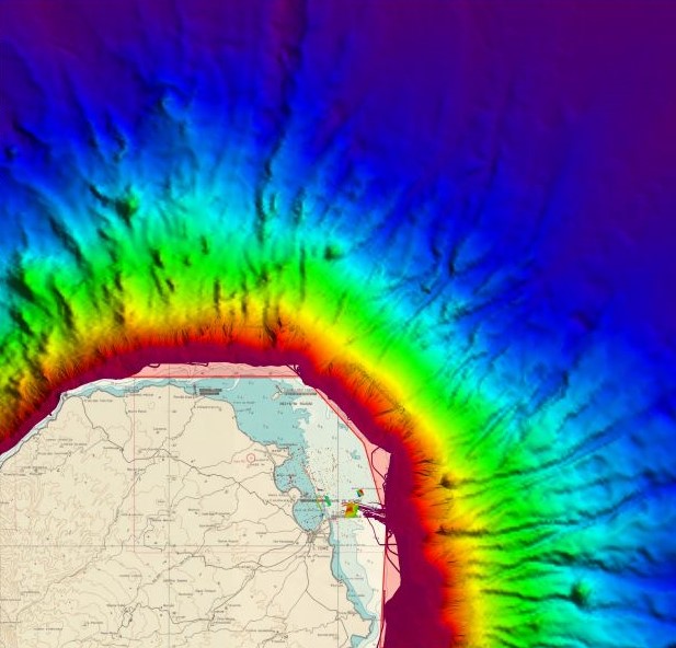
It is only possible to publish new nautical cartography, and thus increase the safety of navigation, if hydrographic surveys are carried out and up-to-date data is obtained.
The logistics of planning and executing surveys in Africa constitutes one of the main challenges of executing hydrographic surveys, but it is an essential factor for its success.
Until 2016, in all the surveys completed by IHPT in Africa, it was necessary to ship a large amount of material and equipment (hundreds of kgs in freight) and then install and calibrate on vessels of opportunity.
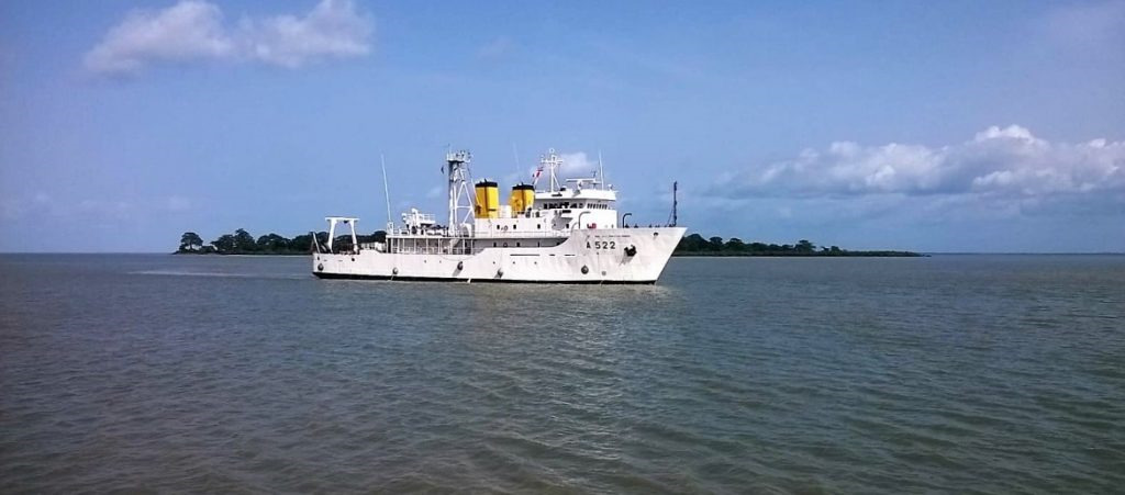
From 2016, Portugal began to engage hydrographic vessels on missions related to the Portuguese Ministry of Defense’s MAR ABERTO Initiative. MAR ABERTO aims to contribute to maritime security in the Gulf of Guinea and to the implementation of the pilot project of the European Union (EU) Coordinated Maritime Presences tool, focusing on strengthening European participation in the stabilization efforts in this region. Primarily, the missions carried out by hydrographic vessels under this Initiative contribute to Portugal’s Defense Cooperation with African countries, as well as to the implementation of the EU Maritime Security Strategy. This enables closer relationships, hydrographic surveys and, consequently, the publication of new nautical charts, which is a vital contribution to the safety of navigation and, therefore, to a range of other areas of activity related to the sea and its use.
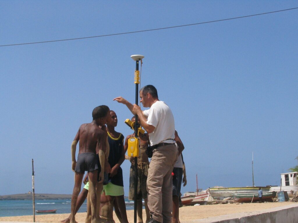
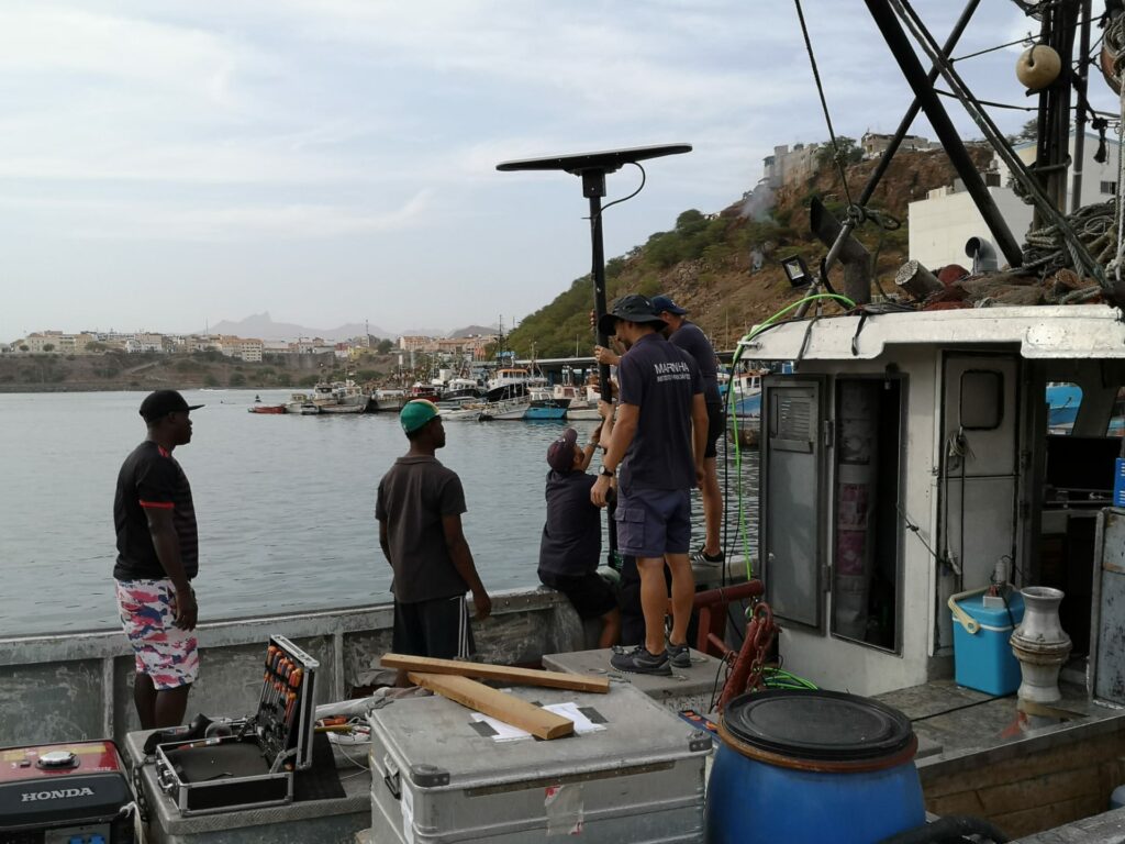
The campaigns undertaken by the IHPT focused on geodesic work to up-to-date the geographical coordinates of vertices in the current coordinate system and the establishment of local geodesic networks to support the remaining work to be completed. IHPT installed tide gauges and leveling bench marks, coordinated aids to navigation for cartographic representation, port structures and topography and executed hydrographic surveys. The diversity of vessels used required a high adaptative capacity from IHPT teams.
The use of hydrographic vessels in the MAR ABERTO Initiative has proven to be a wide-ranging asset in the scope of bilateral cooperation with several countries. The multitude of skills associated with the deployment of a hydrographic vessel has provided diverse cooperation with military organizations, public institutions and universities related to maritime affairs. This has been an enabler to carrying out hydrographic work within Portuguese-speaking African countries and, consequently, has led to the updating of nautical cartography, promoting the safety of navigation. This has proven also to be an excellent opportunity to develop capacity building activities, as discussed next.
It is also worthy to note the high level of cooperation from local institutions that have always supported the work carried out by the IHPT. Certainly, one cannot forget the importance of language, a decisive factor of communication and articulation, and the communion witnessed between IHPT teams and local populations.
3. New Way of Capacity Building
The efforts of Portugal in Capacity Building (CB) in Hydrography for Portuguese-speaking African countries are based on:
- Keep and strengthen the cooperation and collaboration;
- Continued involvement of the target Coastal States by the development of their hydro-graphic services in order to meet their SOLAS obligations;
- Recognition that IHO’s CB funding is not sufficient to meet the needs;
- Technical visits/Seminars do not fully meet the CB practical needs;
- IHO member States should share their education and training programs, focusing on on-the-job training (e.g. on-board hydrographic survey training, in-office chart production training, etc.)
- IHO member states should coordinate the IHO CB initiatives with national initiatives, providing coastal states with on-the-job training which adds real value to the coastal states.
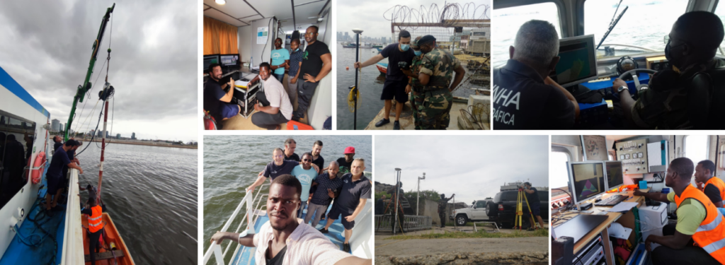
For this approach to be successful, it is essential to have technical personnel embedded in local teams to provide training, enabling a real capacity for that country to evolve. Some examples in recent years include:
- Attendance of CAT A and CAT B courses at the IHPT Hydrography and Oceanography School since 1977. This has included students from the following Portuguese-speaking African countries: 24 from Angola, 24 from Mozambique, 7 from Guinea-Bissau, 4 from São Tomé and Príncipe and 3 from Cape Verde;
- Training and education of personnel during hydrographic surveys carried out by IHPT in Portuguese-speaking African countries. This has enabled local teams to take advantage of the engagement with the IHPT’s work to gain practice in hydrography;
- Multibeam installation and data acquisition (Angola in 2021, and Mozambique in 2016 and 2018);
- Mozambique co-production of nautical cartography with dedicated technical support. This has included several technical visits with on-the-job training provided in Lisbon and Maputo, with the particular purpose of each action concluding with the co-production of a new nautical chart.
4. Final Considerations
Portugal supports the IHO Capacity Building working plan with Technical Visits and several training actions. Despite, the efforts made by Portugal, under bilateral agreements in technical cooperation, institutional capacity building and training of technical staff of other coastal states being internationally recognized; they are not listed and reported in the IHO CB activities.
In fact, there are many contributions given by IHO Members directly linked to the IHO Mission and its objectives that go unrecognized. Particularly, those related to safety of navigation, capacity building and cooperation on hydrographic activities among states on a regional basis.
IHPT will keep its efforts to maintain close ties with its international partners, an essential factor for the success of capacity building. A good example of this was the successful organization of the 1st Conference on Hydrography of the Community of Portuguese Speaking Countries, held in Lisbon, at the IHPT from 5 to 7 July 2022.
From this conference came the need to increase cooperation and capacity building in Hydrography and related scientific areas. This will increase the safety of navigation and the development of national hydrographic services. It also considers the international geopolitical and strategic scenario, where reforms and commitments are expected from countries, in order to define objectives related to the sustainability of the oceans and the role they may play in the climate agenda.
5. Annex