


Preface
The International Hydrographic Organization (IHO) currently has 98 Member States (as of February 2023). The Member States are usually represented by their National Hydrographer, the head of the national hydrographic service. We have asked them all three identical questions about milestones in the history of hydrography, future developments, and the jubilee journal The International Hydrographic Review (IHR) itself. Look forward to many interesting answers and exciting insights into our global hydrographic community!
~
Question 1
What are the most important milestones or evolutions in the history of hydrography and how have they impacted hydrography in your country?
Question 2
What technological developments fundamental to your work do you expect to see in the next few years?
Question 3
Do you have a favourite IHR article and why?
~
Answers


~
Renato Arruda
Brazil
Q1: In the 19th century, Brazil received French hydrographic campaigns that conducted surveys on the Brazilian coast and helped to train the first Brazilian hydrographers. These Brazilian hydrographers led to the creation of the Brazilian Hydrographic Office in 1876. The creation of the International Hydrographic Bureau (today IHO) in 1921 reverberated on the standardization of cartographic products by the Brazilian Hydrographic Office. Subsequently, the acting of IHB/IHO and the interaction with other national Hydrographic Offices in the International Hydrographic Conferences induced the Brazilian Hydrographic Office to create the advanced course in hydrography in 1933, to adopt the First Brazilian Nautical Cartographic Plan in 1935 and to purchase two new hydrographic vessels in 1958.The adoption of the IHO standard on the specifications for hydrographic surveys (S-44) in 1968 significantly conditioned the hydrography carried out by public and private entities in Brazil, bringing important consequences for the safety of navigation, for a better knowledge of the seabed in the Brazilian jurisdictional waters and to improve the training of Brazilian hydrographers.
Q2: The automation of data collection and processing, including the automatic calibration of hydrographic systems. Additionally, the implementation of new nautical products based on S-100 standard will be of fundamental importance for safer and more integrated navigation.
Q3: Article “Multibeam Processing for Nautical Charts”, issued in the November 2009 edition of IHR. It was developed a reliable and efficient semi-autonomous workflow for processing multibeam data that supported the charting production.
Geneviève Béchard
Canada
Q1: The fundamentals of the science of hydrography (to measure and describe the physical features of those parts of the globe covered by water) and the reasons to do so (for safety of navigation), have remained largely unchanged since the first edition of the IHR, while we have benefitted from significant technological advances to revolutionize how we work. For Canada, with its vast water area, this has meant that technologies such as multibeam echosounders and GPS have facilitated the surveying of great swaths of that area. Further, databases and highspeed data communications has enabled the processing and management of the massive amount of data collected.
Separately, the grounding and oil spill of the Exxon Valdez in 1989 provoked substantial investment in Canada in the infrastructures to prevent similar disasters and accelerated the development of ‘smart’ electronic charts (e.g., ENCs) and the systems that can use them. For CHS, this meant developing and implementing production environments capable of generating products, and now services, for these systems. By June 1997 Canada released its first official S-57 ENC, and now has an ENC portfolio of 1,269 ENCs.
Q2: While the coverage and quality of data in CA has improved considerably, substantial challenges, particularly in northern waters, remain. Here, we know that developing technologies will play a key role. Uncrewed survey vessels (USVs) can act as force multipliers and operate in areas where the risk to traditional assets, like humans and icebreakers, is very high. USVs can also reduce the carbon footprint and environmental impacts compared to most current hydrographic survey operations. Remote sensing and satellite-derived bathymetry are becoming essential
tools in the kits of hydrographers and planners. Underlying all new technologies and capabilities is the technical backbone that enables the secure and rapid transmission of data and information from collection to hydrographic offices then on toend users. Marine spatial data infrastructures will continue to develop as a framework for providing findable, accessible, interoperable, and reusable information. Lastly, the development of applications capable of exploiting S-xxx data will further
drive the demand for data from hydrographic offices and other data providers.
Q3: Since its inception, the IHR has documented evolutions, indeed revolutions, in technology and in society which have changed the face of hydrography and how it is used. I have particularly enjoyed the earlier publications which we can now peruse since they have been scanned and digitized.
Arturo Oxley Lizana
Chile
Q1: We believe that the most important evolution in the history of hydrography is the massive gathering of bathymetric data that nowadays we are able to collect when conducting hydrographic surveys. The exponential growth of the volume of data collected from the single “leadline” to the existing arrays of “multibeam echosounders” and other modern systems, surely have impacted hydrography in Chile. Such impact has had an effect on the need to improve the professional preparation of the personnel and the development of new procedures, methods and software to manage these data and transform it in usable information.
Q2: We think that it is a fundamental issue to ensure that data, information and services provided by Hydrographic Offices reach end users, not corrupted. We believe that advancing on technological development that could minimize this concern would help and ensure a more reliable accomplishment of the work Hydrographic Offices are entitled and responsible for. Furthermore, we are of the opinion that in the next few years, our office should be provided new trusted navigational services, considering that more users will be demanding new hydrographic products like the S-100 “IHO Universal Hydrographic Data Model¨ specifications layers, this development will start with the implementation of the S-101 product specifications for our national electronical nautical chart.
Q3: We are of the opinion that each article has its merits on its own and therefore we think that it is not fair to intent to identify a favourite IHR article. Historical articles as well as recent articles elaborating on the new technologies and their application are fantastic records of the “a live” spirit that is strongly embedded in the behaviour of hydrographic surveyors worldwide.
Elikkos Elia
Cyprus
Q1: We distinguish various milestones in the development of hydrography. However, Cyprus as a state with short history in hydrography, has not been affected significantly by them. Since the establishment of the National Hydrographic Committee in 2007, the systematic evolvement of hydrography in Cyprus began. Cyprus has been investing in the knowledge of maritime space by making use of cutting-edge technologies such as: LiDAR, MBES, GIS, etc. It is obvious that the development of the S-100 standard and the concept of Digital Twin, introduces us to a new era.
Q2: Although we are not yet users of Artificial Intelligence (AI) technologies, it is obvious that the use of AI is increasing. We have already witnessed the use of AI in Unmanned Surface Vehicles, in the development of algorithms for the data collection and data processing, and many other fields. The development and use of AI will be the next technological revolution that will affect, not only hydrography, but also our lives in general.
Q3: The International Hydrographic Review is a useful tool in our work as it is a pool of the latest findings, trends and ideas in the science of hydrography. IHR articles contribute to advancing our knowledge in hydrography. In this context, it is difficult to distinguish a specific article.
Pia Dahl Højgaard
Denmark

Q1: The invention of the sonar represented a revolution in the determination of the ocean depths. Using acoustic waves, even the measurement of the deepest parts of the ocean takes only a few seconds. Sonar-based bathymetry has hugely improved our knowledge of the seafloor.
Since the first launch in the 70s, Global Navigation Satellite Systems (GNSS) have been continuously improved to the point that it is now difficult to imagine surveying without satellite positioning. The Danish Navy has been among the first performers of ellipsoidally referenced surveys.
The development of ECDIS has played a central role in the digital transition of the hydrographic community. The advent of digital nautical cartography has triggered huge innovations in how Denmark was managing and publishing geospatial data.
Finally, the S-100 family of standards is setting the path for a new generation of navigation services, which will ultimately replace the current traditional products. S-100 represents a great opportunity for a paradigm shift on how we support safety of navigation. S-100 will also support optimized ship-routing and, thus, the reduction of the environmental footprint of global shipping.
Q2: Although shipborne acoustic sensors will maintain a fundamental role for the coming years, a variety of other measurement technologies and platforms will be increasingly used.
Remote sensing will play an important role in this context. Specifically, spectrally derived bathymetry (SDB) has evolved considerably, and machine learning will likely play an important role in developing effective depth predictors.
Trusted Crowd-Sourced Bathymetry (TCSB) is ready for becoming operational, benefiting from the implementation of the VDES (AIS 2.0) technology for data transfer prioritization and scalability. The installation of a network of smart devices aboard designated partners’ vessels has potential for becoming one of the primary sources of hydrospatial information.
The use of autonomous surface vehicles (ASVs) will also gain momentum in the next few years. However, to fully embrace autonomous surveying smarter sensors, system interfaces and algorithms still need to be developed. Nevertheless, we foresee ASVs becoming the primary platform to conduct systematic hydrographic surveys in the long term.
Q3: This is a very difficult question. There are so many great technical articles that have been published in the 100 years of IHR activity. Naming one about a specific technology or innovation would be somehow unfair for the many great ones not mentioned. As such, I prefer to mention a recently published article that is a bit different from the ones usually published on the IHR: “The Empowering Women in Hydrography Project” (https://doi.org/10.58440/ihr-28-n09). I feel the relevance of this project to finally overcome any unconscious bias and discrimination. If we do not support and cultivate the talents, skills, and creativity of women in Hydrography and hydrospatial disciplines, we will not succeed in our own mission to provide data and services for the benefit of society.
Jervis Marvin Robinson
Fiji
Q1: The most important evolution is the global move to digital methods of navigation.
The move from conventional hydrographic and cartographic means is outstanding and is a strong indication of the interest in the subject globally. The intention to move to S-100 is strong willed and will see a lot of advancements in the near future.
Q2: The move from paper to electronic charts. The move to autonomous survey techniques.
Q3: No, not any.
Laurent Kerléguer
France

Q1: Of course, considering technology, one would immediately think of acoustic sounding and multibeam echosounders as key milestones and indeed they are!
But sticking to the 100th anniversary, acoustic sounding is anterior. For me the game changer is the satellite positioning which has really and universally revolutionized the way we conduct surveys and their accuracy. It has been for the better, although there is still a taste of nostalgia when you think of field work that was required in the age of optical positioning with signals on shore.
The accuracy we have reached on moving vessels is just amazing. Autonomous navigation that develops would not be possible without Global Navigation Satellite System that seems so easy and natural to anyone nowadays.
More generally, hydrographers are meteorologists, accuracy is a second nature for them. One has to admit that from ping to chart we have made significant progress on so many parameters that can spoil the result if you do not master them: speed of sound in the water, attitude of the platform, tide, data processing…
Q2: Massive data, how we get it and what we do with it.
The next biggest challenge for our community will be to bring quicker and more accurate answers to users.
We are still a long way from knowing our ocean from a holistic prospective, encompassing physical, chemical and biological parameters from shore to abyss.
The high resolution in the deep that we need to survey ecosystems, will require a disruptive approach.
The technology is there, already dramatically accelerating our capacity to collect data at sea thanks to unmanned vehicles. Still we have to be able to deploy these systems in number, and the economic model to do this cannot be based on profit because there is not “deep sea B” and if we spoil it for exploitation it will probably be forever.
Another issue is our capacity to process massive data to deliver smart products.
The ultimate smart product might be the digital twin of the ocean that will model the ocean in all its complexity and interfaces so that we can anticipate, at the laboratory, the consequences of our actions. That is ambitious and exciting challenge where Hydrographers have a major role to play.
Q3: Actually, all the articles are interesting for hydrographers. The editorial line is a good balance between articles on the evolution of methods, articles on future challenges and articles on experiences. It is also a good balance between writers from institutional organizations and industry.
I was particularly interested in the article Portugal’s cartographic responsibility in Africa as it is a good example of a positive approach to capacity building. Capacity building is essential for the IHO to progress as a collective organization as our standards and techniques are constantly evolving. The Portuguese experience described in this article has strong resonance for the Shom, which is engaged in similar processes. In particular, long-term support is an essential key to success. Congratulations to Portugal for what they are doing and for letting us know about it in this very nice article.
Thomas Dehling
Germany

Q1: I would name three milestones: The invention of the echosounder, the digitalization in hydrography and the widening scope of users and uses of hydrographic data. All three led to revolution or at least drastic changes and developments far beyond the technological changes.
Q2: On the surveying part, I foresee a regular combination of acoustic and optical sensors on all kinds of platforms from the subsea to space.
On the processing part, I see a major development in the use of artificial intelligence.
On the product part, there might be a disaggregation of ENC-data from a flat screen to diverse and tailored applications on-board and onshore. This will make use of the S-100 family of product specifications and will serve the broad range of automation in shipping and all other uses of hydrographic information.
Q3: Not really. I think it usually is the latest issue of IHR (currently 28) and at least a few of the articles. I will not name just one of them.
Dimitrios Efstathiou
Greece
Q1:
1905 – Institution of the Hellenic Hydrographic Office under the Hellenic Navy General Staff
1908 – First Hellenic nautical paper chart
1919 – Greece cofounding member state of IHO
2004 – First edition of Hellenic ENCs
Q2: We expect HNHS products to be delivered in S-100 standards and an acquisition of a new hydrographic/oceanographic vessel.
Q3: IHR it of our most interest with its variety and importance of its articles.
Masayuki Fujita
Japan
Q1: Japan has conducted numerous hydrographic surveys within the vast national water. In 1960s, we started to use the LORAN-C system to determine the position of a survey vessel, whose value, however, generally included the error within a few hundred meters. After the GNSS service became available for public, not only positioning errors in the sea have been drastically improved, but also Japan has adopted the WGS84 instead of the Japanese local system, as GNSS services connected Japan, an isolated island country, to the rest of the world from the coordinate perspective. We established DGPS stations in 1997 along the coast of Japan, and successfully reduced the positioning error to approximately 1 meter.
This success was doubly helpful for safety of navigation, that is, providing ships with their more precise locations and enabling creation of even more precise nautical charts than before. Moreover, we developed new technology using GNSS services for detecting seafloor movement in centimeters. This technology is essential for understanding the occurrence of earthquakes and is acclaimed in terms of contribution both to disaster prevention and mitigation, and to earth science.
Q2: Artificial Intelligence (AI) technology has been evolved rapidly and been utilized in various fields in recent years. I wish to see the introduction of the AI technology into hydrography, such as action control of autonomous survey vehicles, automatic compiling of nautical charts and processing huge LiDAR and/or MBES data, in the next few years
Q3: None.
Toine Barten
Netherlands
Q1: Some of the most important evolutions in the history of hydrography for the Netherlands are the addition of the multibeam-echosounder and the implementation of GNSS on board of our hydrographic survey vessels. For a seafaring nation such as the Netherlands, that is so reliant on the ocean, being able to map the ocean detailed and accurately gives a huge boost to safety at sea. Our adoption of these systems has helped the Netherlands hydrographic service become a reliable and respected partner and a valuable addition to our national infrastructural management.
Q2: The advent of new technological advances in hydrography has the potential to change the way hydrographers will work in the future. Some of the most influential changes I expect to see in our own fleet are the use of drones, remote surveying, AI, and the implementation of S-100 standard. As a naval hydrographer, hydrography is split into two categories for me; military hydrography and civilian hydrography and therefore I will look at the future of both.
Military hydrography: One of our main military tasks is conducting rapid environmental assessments in, or close to, hostile territories. The improvement and further implementation of autonomous vehicles will make it easier and safer to operate in these environments. Especially the development of high-tech and reliable UUV’s that can travel further away from the operator has the potential to be very important for military hydrography. Being able to operate closer to shore without being seen, as well as not risking any personnel means that it will be easier to use specialized hydrographic knowledge without the hydrographers themselves becoming a liability. Thus making both our work as well as the work of the forces we support easier and safer. Further developments in this area will create an increasing demand for the use of hydrography in the frontlines of any amphibious operation.
Another important development is the use of drones and deep learning/AI object detection in seabed warfare. Subsea cables and pipelines are vital infrastructure that has often been neglected in maritime warfare. However, the recent incident with the Nord Stream pipeline proves how vulnerable our subsea infrastructure really is. The implementation of autonomous drones with automated object detection would give us the ability to protect our cables and pipelines
Civilian hydrography: The use of autonomous vehicles, AI and the introduction of the S-100 standard will not only change hydrography, but will change shipping in general. The use of these autonomous systems will potentially accelerate the shift to online-hydrography thus changing the way hydrography has traditionally been carried out. Furthermore, these developments can facilitate an increase in survey speeds as well as the production of even more reliable data. This could prove vital for the advancement of autonomous shipping, which comes even closer with the
new S-100 standard. When looking at it from a larger scope, these developments have the potential to reduce shipping costs and increasing efficiency – having an impact on the global economy.
Q3: While it is always difficult to pick a favorite, a very important article for us is: “Survey Plan Improvement by Detecting Sea Floor Dynamics in Archived Echo Sounder Surveys” by L. L. Dorst in the Vol. 5(2) released in August 2004. One of the main tasks of the Netherlands hydrographic service is charting the North Sea and Dorst’s research gave us a better understanding of what is necessary to achieve this goal, on which other research projects have built further. It also gives us an understanding of why we approach surveying the way we do in the Netherlands and creates a solid foundation for our current operating procedures.
Chukwuemeka
Ebenezer Okafor
Nigeria
Q1: The most important milestones or evolutions in the history of hydrography are evolutions from “Hand Lead line and Three Point Sextant” to “Wire Drag Survey in 1904”, “Use of Single-Beam Echo Sounders in the 1930s” and finally the evolution of 2Side Scan and Multi-Beam Sonar Technologies in the 1950, 1960, and 1970s”. The sonar technologies offered hydrographic surveyors the opportunity of obtaining seafloor images, thereby improving the ability to identify submerged wrecks and obstructions, with quantitative100 percent depth information of the sea bottom. These evolutions in the history of hydrography greatly increased the survey operations in Nigeria, and also offered a more accurate information, as well as redundant data that are relevant in other applications other than charting for safety of Navigation.
Q2: In the next few years, I expect to see more technological developments in the use of unmanned platforms for deployment of modern hydrographic survey equipment and the use of satellite for hydrographic data acquisition. These would not only increase coverage of Nigerian waters but will also ensure that some areas that have access difficulties could be easily surveyed.
Q3: Yes, The Article on “Variance in the Accuracy of Tidal Levels with Increasing Data Length” by D. R. Metters is my favorite because Nigeria will soon embark on a systematic installation of permanent tide gauges along its coast to commence systematic water level observation and measurement with a view to determining various National water levels for Nigeria. Therefore, this article further educated me on the confidence to be placed on levels obtained at varying time frame.
João Paulo
Ramalho Marreiros
Portugal
Q1: The most important milestones in hydrography are the ones that allowed the improvement of data acquisition and processing, with better resolution and accuracy, making it available for nautical chart production and other applications. It is remarkable the evolution in hydrography with the invention of the single beam echosounder and the positioning of soundings by electronic systems. More recently, the availability of GPS and multibeam. With the development of computer systems, the processing of hydrographic data is becoming more efficient and evolve to the creation of the Electronic Nautical Charts.
All the above-mentioned improvements had impact in Portugal that has a strong tradition in nautical cartography. The establishment of the Portuguese Hydrographic Institute, in 1960, was a significant milestone. Since then, the practice of hydrography, keep evolving in pace with modern technologies, multibeam surveying and electronic nautical chart production, in the 1990’s. The recognition of education and training in hydrography, IHO CAT, in 1983, was a relevant milestone, as well as the acquisition of two oceanic type hydrographic ships in the 1990’s, the D. Carlos I class
Q2: The transition to autonomous systems is a promising development. The advantages of such systems are immense. The process towards increased use of these new technologies seems unstoppable, however some hurdles still need to be overcome. Autonomous marine operations is not yet a mature technology requires improved regulation and training of specialized personnel.
Nautical cartography will evolve with less demanding for the traditional paper chart. The new Hydrographic Geospatial Standard for Marine Data and Information, known as S-100, together with its supporting geospatial information infrastructure, that is under development and implementation by the IHO will have transformative impact in maritime navigation and in the support of the marine environment and costal infrastructures with significant economic, commercial, technical, risk avoidance and environmental benefits.
With the ever-increasing and affordable capacity computing power to process and store data, the emergence of artificial intelligence in hydrography and ocean sciences is full of challenges and opportunities. This is an exciting and important developing field to follow by the hydrographic community.
Q3: The first article I remember to read at the IHR, was devoted to a new survey vessel built by the Portuguese Navy, published in 1989, LXV (l), “New survey vessels for the Portuguese Navy”, by P. Fiadeiro and A. Silva Ribeiro. It was the first ship where I served as a midshipman, the same year when it was published.
Also the article published just after the creation of the Portuguese Hydrographic Institute, in 1962: Vol. XXXIX (I) “The Portuguese Hydrographic Office” and, in the same volume, I should refer the article “Prince Henry of Portugal and the Progress of Nautical Cartography” by Teixeira da Mota, because of its historical relevance.
The IHR is well known by the Portuguese hydrographic community for publishing the latest technical developments in hydrography. Among them, just to mention two articles: one published in 1976: Vol. LIII (I), “Satellite Navigation in Hydrography”, by Eaton, R. M., Wells, D. E. and Stuifbergen. More recently the article published in May 2017 “Navigation Sonar: More Than Underwater Radar — Realizing the full potential of navigation and obstacle avoidance sonar” by Ian Russel and R. Glenn Wright.
Gustavo Adolfo
Gómez-Pimpollo Crespo
Spain
Q1: Hydrography, being a science, has evolved hand in hand with technological developments mainly occurring in the last few decades. On this regard, the following milestones should be highlighted.
GPS positioning: It meant an improvement in logistical and operational planning of hydrographic cruises, resulting in greater efficiency in survey performance as well as greater accuracy in data captured.
Introduction of the multi-beam echo sounder: It meant a notable leap forward in quality compared to the single-beam echo sounder, by attaining total coverage of the seafloor, which made it possible to identify potential dangers to navigation not detected with the previous technology, and to improve data used to produce nautical charts, increasing the safety of navigation.
The use of unmanned vehicles, not as a part in the history of hydrography, but due to their current and future relevance, they will have a great impact in the development of hydrographic surveys.
Q2: The main technological development in the hydrography field will be using Artificial Intelligence (AI) in the cartographic production line (such as using AI to edit bathymetric data) regularly.
Indeed, there are already companies that have developed AI algorithms to edit acquired bathymetric data, but these algorithms are the first steps of research, considering that much more advanced algorithms will be achieved for use in the field of hydrography, oceanography and geodesy, both in machine learning and especially in deep learning.
The employment of AI will allow the collection of a large amount of bathymetric data obtained by a large number of vessels sailing with multi-beam echo sounders around the world. All this information will be stored in clouds for processing and integration into their companies or hydrographic services.
This is another great challenge for humankind, to have better knowledge of the seafloor because we have already mapped about a quarter of our seas and oceans, especially in deep waters. That is to say, we are still far from knowing what we have underwater, and the resolution of our global map is lower than that of the Mars surface.
Q3: It is complicated to choose only one because there are many interesting articles. However, there is one that I want to highlight, the article “Review of active and passive optical methods in Hydrography” written by Dr. Gottfried Mandlburger. I liked this article quite a lot because it is very complete. It is very complicated to explain clearly in one article the different employed optical methods (active and passive), their use on board platforms (satellites, crewed or unmanned aerial vehicles and remotely operated vehicles), the available different acquired data processing techniques, as well as indicating the great variety of applications these methods have.
Roshan Ranaweera
Sri Lanka
Q1: The National Hydrographic Office (NHO) of the National Aquatic Resources Research and Development Agency (NARA) was established in 1984 and is accredited by the International Hydrographic Organization (IHO) as the focal point for Hydrography in Sri Lanka. The project “Strengthening of the National Hydrographic Office of the National Aquatic Resources Research and Development Agency of Sri Lanka” was initiated in 1984–1986 and commenced in 1988 as a technical cooperation project between Sri Lanka and the Federal Republic of Germany. The project’s objective was to enable the NHO to provide better and more comprehensive hydrographic information to users, thus contributing to the overall goal for a better and improved management of aquatic resources of the country’s exclusive economic zone. The Project was successfully concluded, and NHO was vested in its legal power in 1996. Since 1988, the NHO has been surveying Sri Lankan waters to ensure their safe, sustainable, and navigable use.
Q2: Sri Lanka has been making efforts to position itself as a maritime hub in the Indian Ocean region. The island nation’s strategic location on major shipping routes and its modern ports make it an attractive destination for transshipment and other maritime activities. In this regard, assurance of navigational safety and efficiency for international and domestic vessels is essential, besides developing port infrastructure. Therefore, Sri Lanka plans to undertake a digital transformation initiative to fully modernize traditional products and services, deliver high-quality data and
digital services to our users, and provide data-driven services for more efficient shipping to boost our blue economy.
Q3: Research and technology articles are my preferred section – a way to advance understanding of new frontiers in ocean mapping. IHR always features cornerstones in research/technological development of the hydrography.
Bernice Mahabier
Suriname
Q1: Suriname was a colony of the Netherlands until 1975 hydrographic surveys and production of paper charts were responsibility of Netherlands.
Various missions of experts from the Netherlands came to Suriname and, in the field of shipping, for the then Shipping Service, with the support of various departments of the Dutch Ministry of Traffic and Public Works, a program for rehabilitation was drafted. This emergency plan that was proposed in 1989 was called project ‘Improvement Accessibility Surinamese Ports’ and its final goal was an independent Maritime Authority Suriname (MAS). The MAS was cable of conducting their own surveys and the chart production was still done by the Netherlands. In 2005 the MAS renewed it membership at the IHO and with that, the training and partnership opportunities were endless. The MAS trained the personnel to not only advanced their capabilities in survey, but produce paper charts, ENCs and aids to navigation. Partnerships were established with neighboring countries France, Brazil and other service supporting organizations UKHO and IC-ENC.
Q2: The transition to autonomous shipping, whereas hydrographic offices like Suriname must facilitate this development with the new S-100 and S-200 standards.
The transition to a full digital service means transition of the Hydrographic service to meet the obligations and standards. The processes, human resources, digital infrastructures need to be adjusted to meet the development
Q3: The article of TCarta , using Satellite-Derived Bathymetry in areas with high turbidity.
Magnus Wallhagen
Sweden
Q1: During the past century the technical development in hydrography has been tremendous, but I would like to highlight three important milestones. First the establishment of IHO 1921 as the competent organization to standardize hydrographic information. Sweden was one of the founding Member States of the IHO and Sweden was also founding Member State of the first Regional Hydrographic Commission (RHC), the Nordic Hydrographic Commission. The establishment of RHCs to implement the standards and measures taken within IHO is the second important milestone I would like to mention. Last but not least the implementation of the first global standard for electronic geographic information, namely the S-57 standard for ENCs, was a remarkable success for the IHO. Already during the 1990-ies, many years before Google Maps was invented, IHO had a standard ready for usage internationally in navigational systems, which we today call ECDIS. This has established IHO as the reliable International Governmental Organization for standardization of existing and future products and services for the e-navigation era.
Q2: The development of the new generation of standards for hydrographic products and services, S-100, is critical to take the next step in the usage of hydrographic information. The existing ENCs, in the S-57 format, is more or less an electronic version of the paper chart. From an HO perspective and also from IHO we know that we and other stakeholders have much more data which could be useful for navigation and also usage beyond navigation. S-100 is needed to standardize these data and to make it possible to combine different datasets in a structured way. This will contribute to not only safer navigation, but also to more efficient navigation when you could optimize your route and optimize the loading of your ship. Optimized routes and optimized loading will also contribute to less environmental impact from the shipping industry. S-100 will also be an important step towards more automated navigation, with machine readable datasets.
Q3: The 12th edition of the IHR, which was issued in November 2014 was a special edition with articles and notes submitted by members of the Baltic Sea Hydrographic Commission (BSHC). The Editor of that time, Ian W Halls, states in the Editorial that “this edition provides an excellent example for how other regional hydrographic commissions can learn from one another and cooperate”. I have always considered the cooperation within the BSHC to be very unique, which has contributed to a well-established political commitment for a re-surveying plan for the Baltic Sea and cooperation projects with substantial EU-funding. This special IHR BSHC edition gives an insight of the level of cooperation within this RHC.
Rhett Hatcher
United Kingdom
Q1: There are so many landmark moments to highlight from the history of hydrography, and we are all aware that today’s innovations are built on the achievements of our predecessors.
Hydrography is a discipline that has always benefited from tremendous international cooperation, which has spurred much of our progress. This goes back to when zero-degree longitude was agreed by the main chart producing nations in 1884. We should also point to the work of the United States Coast and Geodetic Survey’s Nicholas H. Heck in developing and perfecting wire-drag surveys between 1906 and 1916, as well as the discovery of the ‘echo sounding’ technique by the German physicist Alexander Behm, following the Titanic disaster.
From a UK perspective, we can point to the use of constant radar ranges to assist the surveyors of HMS Seagull in 1947, and the first sidescan sonar that was undertaken by HMS Bulldog in 1987 of Mounts Bay in Cornwall.
We then saw a rapid series of advances from the advent of the systems that enabled full bathymetric coverage of the seabed in the 1980s and 1990s, including the ECDIS trials undertaken in the North Sea in 1988. In 1994 Global Positioning System (GPS) become fully operational for navigation systems and in 1997, the UKHO produced its first ENC, foreshadowing the digital era that is now well and truly upon us.
I also believe that we will look back on the Nippon Foundation’s GEBCO Seabed 2030 Project as a very significant initiative in the history of hydrography, bringing together global expertise from a wide array of partners, including the UKHO, as it strives to achieve the complete mapping of the world’s oceans by 2030.
Q2: It is hard to look beyond the S-100 standard when it comes to the technological innovations that will define the next decade for digitally-focussed hydrography. This new standard will underpin the next generation of marine data products, including gridded data, high-density bathymetry, dynamic ECDIS, under-keel clearance management, web-based services and more.
By equipping them with far more granular bathymetric data, seafarers will enjoy significantly enhanced situational awareness, helping them to make better navigation decisions. More than this, S-100 will also play an important role in helping shipping to meet the new challenges and goals of our era, including decarbonisation and autonomy, by enabling safer and more efficient voyage planning, passage execution and traffic management.
We also see great promise in the potential of Artificial Intelligence and Machine Learning as technologies that can significantly speed up and automate our work. We have seen already through our Generalise Addictive Model (GAM) Service that machine learning can make an important contribution in tackling the increasing levels of bathymetric data cleansing and verification tasks that we face, delivering the same levels of certainty and accuracy but at unprecedented speed.
From a UK perspective, we are also excited about the possibilities for the new UK Centre for Seabed Mapping (UK CSM). The shared vision of the UK CSM members is for it to become the key focal point for the UK’s seabed mapping community. The UK CSM has over 20 members and will play a vital role in co-ordinating the collection, management and sharing of seabed mapping data through collaboration, as well as championing the importance of marine geospatial data in the UK.
Q3: It’s hard to choose! Perhaps because it reflects so much of our thinking at the UKHO, I thought the article in Volume 27 of IHR on NOAA’s decision to retire its paper chart portfolio and transition to ENCs was a very significant article and also a compelling explanation of the reasoning behind the decision (https://doi.org/10.58440/ihr-27-n03). The authors set out a very clear rationale for NOAA’s decision to focus exclusively on ENC production, highlighting the considerable benefits to the mariner, as well as the rapid decline in demand for paper charts. As the article rightly concluded, NOAA may have been the first hydrographic office to take this step, but it will not be the last. The UKHO has since followed suit, setting out our own plans to withdraw from the production of paper charts and increase our focus on digital navigation products and services, for the same reasons that were so well outlined in this article.
José Pedro
Domínguez Viloria
Uruguay
Q1: We have had many milestones, among which stand out the beginnings of the surveys in the Río de la Plata at the beginning of the last century, in the Uruguay River, these being our bordering rivers with the Argentine Republic, the Merín Lagoon, which is the border with the Federative Republic of Brazil, from which we actively participated in the different Boundary Treaties of those geographical spaces that are so important to our countries. Another very important challenge recently was being in charge of the survey to establish the Outer Limit of the Continental Shelf in
accordance with Article 76 of UNCLOS. And without a doubt at present the development and maintenance of the official Electronic Nautical Cartography according to the S-57 standard of the IHO. Boundary Treaties signed with our neighboring countries give Uruguay legal strength in matters of maritime space ordering, in the different uses of natural resources and their conservation, some even shared as it is related to fishing in the front with the Argentine Republic, or the Uruguay-Brazil Waterway in Laguna Merin project.
Q2: We hope that in the short term the hydrographic acquisition systems will be more accessible in terms of cost, which are often difficult for developing countries to achieve and thus be able to access them to achieve more effective surveys of our jurisdictional waters in the process of develop new products according to the IHOS-100 standard.
Q3: Not specifically.
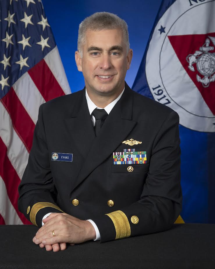
Benjamin K. Evans
United States of America
Q1: Selecting a single milestone in hydrography with its long history of innovation is nearly impossible. However, a major step forward which revolutionized the full arc of the hydrographic workflow, including field surveying, nautical cartography, and the use of our data by mariners was the advent of full bottom coverage survey techniques. The ability to fully ensonify the seafloor to produce a high resolution model of the bathymetry and seafloor features completely changed hydrographers approach in the field. While these systems undoubtedly made hydrography more accurate and efficient, they ushered in a new set of requirements for supporting technologies. These dense datasets and the uncertainty estimates possible from multiple measurements of the seafloor in each location gave rise to a whole new class of surface-based products for navigation, modeling, and resource management. The promise of this is realized with the advent of high resolution bathymetric overlays using the S-102 standard. These new products, made possible by full bottom coverage survey methods, are allowing mariners to increase safety, optimize use of available water, and reduce congestion in the world’s seaports.
Q2: Increases in our capacity and efficiency of hydrographic data acquisition, and more importantly, our ability to convey data to stakeholders in fit for purpose format in a timely fashion. In the field, we see the value of uncrewed systems to amplify the effectiveness of traditional platforms. UxS will capitalize on advances in bandwidth, low-latency connections between platforms and shore, quickening data ingestion and product creation. Ashore, AI will aid in analyzing data from a wider range of sources for ingestion into authoritative, current seafloor models like NOAA’s NBS.
Marine modeling, guided by high-res bathy and other data, will improve our forecasting of water levels, currents, and other marine phenomena. Automation will increase efficiency of transforming data streams into products for users needing authoritative geospatial data for our oceans and coasts. Advances in data models plus next-gen ECDIS and other chart displays, will allow mariners unprecedented use of data to meet their needs, like customized depth curves derived from S-102 overlays. The S-100 model displays these products in a unified operational picture, increasing safety, and efficiency of navigation.
Q3: The Navigation Surface: A New Database Approach to Creating Multiple Products from High-density surveys by then-LT Shepard Smith, NOAA, Dr. Lee Alexander, and CAPT Andy Armstrong, NOAA (ret.). This article from 2002 set the vision which has guided much of our work over the course of my career. The navigation surface concept was a major shift in hydrography and charting, transitioning from individual depth soundings to a gridded model of the seafloor in which depth estimates and uncertainties went hand-in-hand. This opened the door to the “chart of the future”, in which bathymetry, water levels, currents and other data could be combined into a unified picture for the mariner. We’ve been working toward this vision since this article was published, and our Precision Marine Navigation program and the S-100 framework put us on the cusp of achieving it. Link to article: https://journals.lib.unb.ca/index.php/ihr/article/view/20584/23746.
John Nyberg
United States of America
Q1: There have been incredible changes to the way we collect and present our information throughout hydrographic history, but there have also been massive changes to the way we manage our workforces, data, and products. NOAA found its origins in coastal exploration during a time when it needed to acquire modern scientific tools from across the Atlantic. In my opinion, the recognition of the importance of hydrographic and geospatial science, from a national perspective, to support marine navigation is the most important milestone in US hydrographic history.
This commitment to science and exploration has lasted for over 200 years and we recognize it as foundational to our program and work. The transition to a digital world encompasses a large number of significant independent milestones – lead line to multibeam sonar data collection, celestial to satellite positioning, copper plate engraving to database driven chart production, paper to electronic navigation systems, and many more. These have had profound impacts on the way the US manages its hydrographic programs, the skill sets that makeup our workforces, the types of information we manage, and the tools that we use for our daily work.
Q2: Moving to S-100 based navigation is the hydrographic milestone of our era. This impactful transition will allow us to visualize a wide variety of data for mariners to use in a single system. With S-101 underpinning a wider array of high resolution bathymetry, surface currents, weather and more, we will be supporting safer, more efficient, sustainable marine transportation. The way data is managed will be fundamentally different as we progress through the transition to S-100. We will need to build partnerships within our countries, internationally, and with the private sector.
Some S-100 products will likely overlap and may be available from multiple sources. We can expect to see non-hydrographic offices as the responsible producers for information that is intended for use in an ECDIS. We will have to consider both technological and administrative measures to manage these new arrangements, including system based solutions in the ECDIS, new methods of data delivery, and increased attention to sharing data through a federated approach. I imagine a distribution system that delivers data from the producer to the user with a thin system in the middle to manage product usage and currency.
Q3: Singapore’s National Marine Spatial Data Infrastructure ‘GEOSPACE-SEA’: Enabling Hydrospatial Context and Applications in a Changing Ocean and Seascape by P. Y. Pang, P. Oei. I really enjoyed this article because it highlights the benefits of MSDI and more importantly the values of making data available and how our data is imperative for uses beyond navigation including coral reef management, coastal planning, and many more. I also really appreciated the discussion on partnerships and operational sustainability for ensuring MSDI success. Link to the article:
https://iho.int/uploads/user/pubs/ihreview_P1/IHR_November2020.pdf